Skip to content
Plan & Tour
DestinationsItinerariesTravel BlogAboutContact
0Sign inPlan a trip
Plan & TourPlan & Tour

Travel guides, destination inspiration and curated itineraries for Canada, the USA and beyond, plus a free tool to plan your own day-by-day trip.

Get travel inspiration

Explore

  • All Destinations
  • Curated Itineraries
  • Travel Blog
  • Plan a Trip

Topics

  • Hiking & Nature
  • Food & Drink
  • City Breaks
  • Budget Travel

Company

  • About Us
  • Contact
  • Privacy Policy
  • Terms of Service

© 2026 Plan & Tour. Built for travellers.

Discover the world, one trip at a time.

Ringrose Peak: Hiking the Dramatic Summit Above Lake O’Hara
  1. Home
  2. Destinations
  3. British Columbia
  4. Ringrose Peak: Hiking the Dramatic Summit Above Lake O’Hara
Mountain

Ringrose Peak: Hiking the Dramatic Summit Above Lake O’Hara

A rewarding alpine climb in Yoho National Park with sweeping views across the Canadian Rockies.

British ColumbiaUpdated 8 August 2026

Why Visit Ringrose Peak

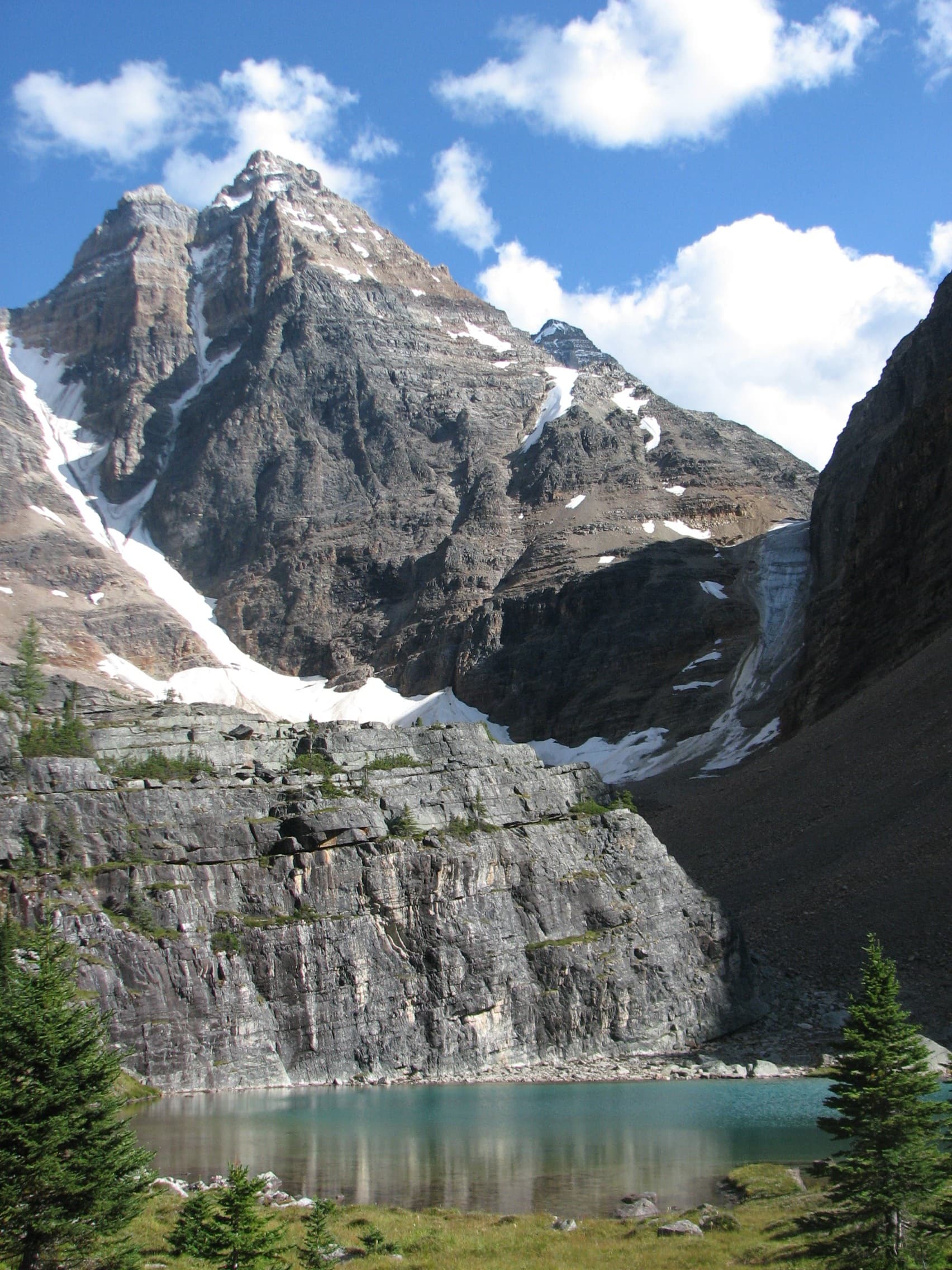
Ringrose Peak rises sharply above the turquoise waters and larch forests of the Lake O’Hara basin in Yoho National Park. Its position on the continental divide delivers 360-degree panoramas that include the glaciated peaks of the Waputik Range, the rugged ridges of Mount Biddle, and distant views into Banff National Park. The mountain rewards hikers who are comfortable with steep, rocky terrain and route-finding with an intimate encounter with high-alpine terrain that feels remote yet accessible within a day.

Getting There

Access begins at the Lake O’Hara trailhead along the Trans-Canada Highway in Yoho National Park. Most visitors reserve a spot on the Parks Canada shuttle bus that climbs the steep service road; a limited number of hiking permits allow the full 11-kilometre walk up the road on foot. Once at the lake, the approach to Ringrose follows well-marked trails across the Opabin Plateau before ascending the southeast slopes on loose scree and occasional ledges. Strong navigation skills or a GPS track are useful once above treeline.

Best Time to Visit

July through mid-September offers the most reliable snow-free conditions on the upper slopes. Early July may still hold pockets of snow in shaded gullies, while September brings cooler temperatures and fewer bugs but the chance of early-season storms. Larch season in late September paints the surrounding plateaus in gold, adding color to photographs of the peak.

What to See and Do

The standard route climbs roughly 800 metres from Lake O’Hara to the 2,925-metre summit. Highlights include the hanging valley of the Opabin Plateau, alpine meadows dotted with heather, and a narrow ridge walk near the top. Photographers prize the late-afternoon light that illuminates the glaciers on Mount Victoria across the valley. Strong hikers often combine the ascent with a traverse of the Opabin Plateau circuit for a full-day loop. Wildlife sightings may include marmots, pikas, and occasional mountain goats on the higher ledges.

Nearby Attractions

After descending, spend time exploring the shoreline trails around Lake O’Hara or continue to nearby summits such as Mount Huber or the scenic viewpoints above Lake McArthur. The region also connects to longer backpacking routes into the Cataract Brook valley and the famous Iceline Trail further north in Yoho.

Visitor tips

  • Reserve the Lake O'Hara shuttle well in advance; walk-in spots are extremely limited and the road is closed to private vehicles.
  • Carry layers for rapid weather changes, a helmet for potential rockfall on the upper slopes, and plenty of water as there are no sources above the plateau.
  • Study current trail conditions and avalanche forecasts even in summer, and consider traveling with a partner experienced in off-trail travel.

Frequently asked questions

How difficult is the hike to Ringrose Peak?+

The route involves steep, sustained climbing on loose rock and requires good fitness, route-finding ability, and comfort with exposure near the summit ridge.

Do I need a permit to hike Ringrose Peak?+

A day-use permit is required to access the Lake O'Hara area; the shuttle bus reservation includes this permit, while walk-in hikers must obtain one separately from Parks Canada.

Can beginners summit Ringrose Peak?+

The peak is best suited to experienced hikers; beginners should consider easier trails around Lake O'Hara such as the lakeshore loop before attempting this ascent.

Is there cell service near Ringrose Peak?+

Coverage is nonexistent or extremely limited once you leave the highway; download offline maps and inform someone of your plans before heading out.

What wildlife might I encounter on the way to the summit?+

Marmots, pikas, and mountain goats are commonly seen; practice proper food storage and maintain a respectful distance from all animals.

Share
Google Maps Apple Maps Directions

Image: No machine-readable author provided. Geoffl assumed (based on copyright claims). · Public domain · via Wikimedia Commons

Keep reading

Nearby & related

All stories
Wedgemount Lake: Hiking to a Turquoise Alpine Gem Near Whistler
British Columbia

Wedgemount Lake: Hiking to a Turquoise Alpine Gem Near Whistler

A rewarding backcountry trek leads to glacial waters and sweeping mountain views in British Columbia’s Coast Range.

8 August 2026
Yellowhead Lake: Turquoise Waters and Mountain Backdrops in Mount Robson Provincial Park
British Columbia

Yellowhead Lake: Turquoise Waters and Mountain Backdrops in Mount Robson Provincial Park

This serene lake in British Columbia’s Rockies delivers quiet paddling, trout fishing, and easy access to dramatic peaks…

8 August 2026
Swindle Island: Remote Wilderness on British Columbia’s Central Coast
British Columbia

Swindle Island: Remote Wilderness on British Columbia’s Central Coast

Discover pristine rainforest, marine wildlife, and quiet anchorages on this secluded island in the Inside Passage.

8 August 2026


