Skip to content
Plan & Tour
DestinationsItinerariesTravel BlogAboutContact
0Sign inPlan a trip
Plan & TourPlan & Tour

Travel guides, destination inspiration and curated itineraries for Canada, the USA and beyond, plus a free tool to plan your own day-by-day trip.

Get travel inspiration

Explore

  • All Destinations
  • Curated Itineraries
  • Travel Blog
  • Plan a Trip

Topics

  • Hiking & Nature
  • Food & Drink
  • City Breaks
  • Budget Travel

Company

  • About Us
  • Contact
  • Privacy Policy
  • Terms of Service

© 2026 Plan & Tour. Built for travellers.

Discover the world, one trip at a time.

Wedgemount Lake: Hiking to a Turquoise Alpine Gem Near Whistler
  1. Home
  2. Destinations
  3. British Columbia
  4. Wedgemount Lake: Hiking to a Turquoise Alpine Gem Near Whistler
Lake

Wedgemount Lake: Hiking to a Turquoise Alpine Gem Near Whistler

A rewarding backcountry trek leads to glacial waters and sweeping mountain views in British Columbia's Coast Range.

British ColumbiaUpdated 8 August 2026

Why Visit Wedgemount Lake

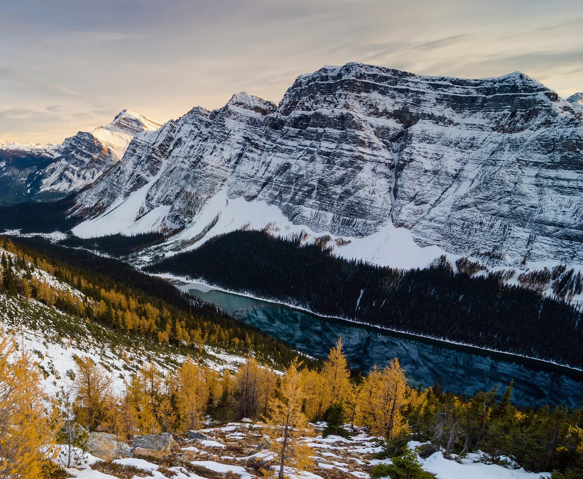
Wedgemount Lake sits high in the mountains above Whistler, fed by the Wedgemount Glacier. Its vivid turquoise water and surrounding peaks create one of the most dramatic day-hike destinations in the Sea-to-Sky corridor. The lake rewards hikers with crisp alpine scenery that feels remote yet remains reachable in a single day from the highway.

Getting There

Drive north from Whistler Village on Highway 99 for roughly 11 kilometres, then turn right onto the gravel Wedgemount Forest Service Road. The road climbs steeply for 4 kilometres to the trailhead parking area. A high-clearance vehicle helps, though most passenger cars can manage the route in dry conditions. No public transit reaches the trailhead, so arrange a ride or shuttle if needed.

The Hike

The out-and-back trail covers about 12 kilometres round-trip with 1,200 metres of elevation gain. The path begins in old-growth forest, crosses Wedgemount Creek on a sturdy bridge, then ascends steadily through switchbacks. The final kilometre is the steepest, crossing boulder fields before reaching the lake. Allow five to seven hours for the round trip, plus extra time for photos and lunch at the shore.

What to Expect at the Lake

The water remains icy year-round because of the glacier. Most visitors stop at the outlet stream or the rocky beach on the south shore. Strong hikers can continue around the lake for closer glacier views, but the route becomes rough and unmarked. The surrounding ridges offer opportunities for experienced scramblers, while casual visitors simply soak in the panorama of Wedge Mountain and the Spearhead Range.

Best Time to Visit

July through early October provides the most reliable snow-free access. Wildflowers peak in late July and early August. Early-season hikers may encounter snow patches on the upper trail, while September brings cooler temperatures and fewer bugs. Always check current avalanche and trail reports before heading out.

Nearby Options

  • Combine the trip with a visit to nearby Rainbow Lake or the Brandywine Falls viewpoint on the same day.
  • Extend your stay in Whistler to explore the Sea-to-Sky Gondola or the trails around Lost Lake.
  • Camp at the small backcountry site near the lake if you want to watch the alpenglow on the glacier at sunrise.


Visitor tips

  • Carry at least two litres of water per person; the only reliable refill is at the lake itself.
  • Wear sturdy hiking boots and bring trekking poles for the steep, rocky descent.
  • Start early in the morning to avoid afternoon thunderstorms and secure parking at the trailhead.

Frequently asked questions

How difficult is the hike to Wedgemount Lake?+

The trail is rated strenuous due to its sustained climb and elevation gain. Fit hikers with good stamina complete it in a day; beginners should consider it a full-day challenge.

Can you swim in Wedgemount Lake?+

Swimming is possible but the water stays extremely cold from glacial melt. Most visitors wade briefly rather than swim laps.

Is camping allowed at Wedgemount Lake?+

Yes, a small designated backcountry camping area exists near the lake outlet. Campers must pack out all waste and follow Leave No Trace principles.

Are dogs permitted on the trail?+

Dogs are allowed but must remain under control. The rocky upper sections can be tough on paws, so bring booties or check conditions first.

What should I bring for a day hike?+

Pack layers for changing mountain weather, sturdy footwear, plenty of water, snacks, a headlamp, and a map or GPS app. A first-aid kit and bear spray are also recommended.

Share
Google Maps Apple Maps Directions

Image: IvanAndreevich at English Wikipedia · CC BY 3.0 · via Wikimedia Commons

Keep reading

Nearby & related

All stories
Yellowhead Lake: Turquoise Waters and Mountain Backdrops in Mount Robson Provincial Park
British Columbia

Yellowhead Lake: Turquoise Waters and Mountain Backdrops in Mount Robson Provincial Park

This serene lake in British Columbia’s Rockies delivers quiet paddling, trout fishing, and easy access to dramatic peaks…

8 August 2026
Swindle Island: Remote Wilderness on British Columbia’s Central Coast
British Columbia

Swindle Island: Remote Wilderness on British Columbia’s Central Coast

Discover pristine rainforest, marine wildlife, and quiet anchorages on this secluded island in the Inside Passage.

8 August 2026
Boom Mountain: Hiking the Rugged Peaks of Yoho National Park
British Columbia

Boom Mountain: Hiking the Rugged Peaks of Yoho National Park

Experience dramatic alpine views and accessible summit hiking on Boom Mountain in British Columbia’s Canadian Rockies.

8 August 2026