Skip to content
Plan & Tour
DestinationsItinerariesTravel BlogAboutContact
0Sign inPlan a trip
Plan & TourPlan & Tour

Travel guides, destination inspiration and curated itineraries for Canada, the USA and beyond, plus a free tool to plan your own day-by-day trip.

Get travel inspiration

Explore

  • All Destinations
  • Curated Itineraries
  • Travel Blog
  • Plan a Trip

Topics

  • Hiking & Nature
  • Food & Drink
  • City Breaks
  • Budget Travel

Company

  • About Us
  • Contact
  • Privacy Policy
  • Terms of Service

© 2026 Plan & Tour. Built for travellers.

Discover the world, one trip at a time.

Mount Victoria: Hiking the Iconic Peak Above Lake Louise in Banff
  1. Home
  2. Destinations
  3. British Columbia
  4. Mount Victoria: Hiking the Iconic Peak Above Lake Louise in Banff
Mountain

Mount Victoria: Hiking the Iconic Peak Above Lake Louise in Banff

A practical guide to reaching and exploring Mount Victoria, the striking summit that towers over Lake Louise in the Canadian Rockies.

British ColumbiaUpdated 31 July 2026

Why Mount Victoria Stands Out

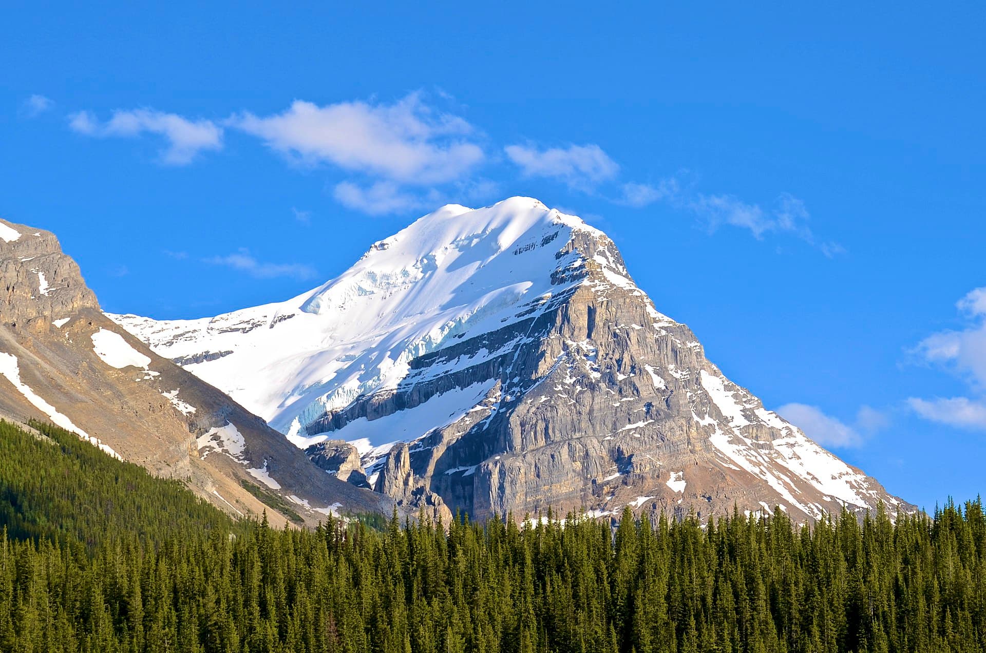
Mount Victoria rises directly above Lake Louise, creating one of the most photographed backdrops in the Canadian Rockies. Its long, serrated ridge and twin summits offer hikers a tangible sense of scale and reward strong legs with sweeping views across the Continental Divide into Yoho National Park. The mountain’s position makes it a natural extension of a Lake Louise visit, yet the trails feel remote once you leave the lakeshore crowds behind.

Getting There

Access begins at the Lake Louise parking area in Banff National Park. From the lakeshore, follow the trail that climbs behind the Chateau Lake Louise toward the Plain of Six Glaciers. The route continues past the teahouse and onto the lateral moraine before ascending the south slopes of Mount Victoria. A high-clearance vehicle is helpful for reaching the trailhead early, but the main parking lots are served by the park shuttle from Banff and Canmore during peak season. No special permits are required for day hikes, though national park entry fees apply.

Best Time to Visit

July through mid-September provides the most reliable snow-free conditions on the upper slopes. Early summer can still hold deep snow on north-facing sections, while late September brings cooler temperatures and the first autumn snow. Morning starts are essential; afternoon thunderstorms are common and the ridge offers little shelter. Wildflowers peak in late July on the lower meadows, and the larches turn golden in early October on nearby slopes.

Trails and Activities

The standard route follows the Plain of Six Glaciers trail for the first seven kilometres before branching onto steeper switchbacks that gain the saddle between the two summits. From the saddle, a short but exposed scramble leads to the south peak. The full round-trip typically takes eight to ten hours for fit hikers. Photographers prize the early-morning light on the Victoria Glacier and the reflection of the peak in Lake Louise. Mountaineers sometimes continue along the Abbot Ridge for multi-day traverses, but most visitors turn around at the summit.

Nearby Highlights

  • Lake Louise lakeshore and canoe rentals for a relaxed contrast to the hike
  • Plain of Six Glaciers Teahouse for a warm drink before the final ascent
  • Moraine Lake and the Valley of the Ten Peaks, a short drive south
  • The town of Banff, 45 minutes away, for supplies and additional trails

Wildlife sightings are frequent; grizzly bears frequent the avalanche paths, so carry bear spray and make noise on blind corners.

Visitor tips

  • Start hiking before 7 a.m. to avoid afternoon storms and secure parking at Lake Louise.
  • Carry layers, at least two litres of water, and bear spray; the upper ridge has no reliable water sources.
  • Check current trail conditions and avalanche reports at the Lake Louise visitor centre the day before your hike.

Frequently asked questions

How difficult is the hike to the summit of Mount Victoria?+

The route is strenuous with significant elevation gain and a short exposed scramble near the top; it suits experienced hikers comfortable with heights.

Do I need a guide or special equipment for Mount Victoria?+

Most summer hikers manage without a guide, but an ice axe and crampons may be needed in early season or for the north peak traverse.

Can beginners or families reach the summit?+

The full summit is not suitable for beginners or children; families can enjoy the easier Plain of Six Glaciers trail up to the teahouse.

Is there cell service on Mount Victoria?+

Coverage is spotty above treeline; download offline maps and inform someone of your plans before departing.

What should I do if weather turns bad on the ridge?+

Descend immediately via the same route; there are no bailout trails and lightning risk is high on the exposed summit area.

Share
Google Maps Apple Maps Directions

Image: Jack Borno · CC BY-SA 3.0 · via Wikimedia Commons

Keep reading

Nearby & related

All stories
Vedder River: Salmon Fishing, Paddling and Riverside Trails in British Columbia
British Columbia

Vedder River: Salmon Fishing, Paddling and Riverside Trails in British Columbia

A clear, productive river in the Fraser Valley offering consistent chinook and coho runs, easy paddling and quiet hiking…

1 August 2026
E
British Columbia

Englishman River: Waterfalls, Forests and Salmon Runs on Vancouver Island

Hike to dramatic waterfalls, swim in clear pools, and watch salmon spawn along this Vancouver Island river.

1 August 2026
B
British Columbia

Bella Coola River: Wilderness Fishing and Grizzly Viewing in British Columbia’s Great Bear Rainforest

This remote river in the Bella Coola Valley offers world-class steelhead and salmon fishing, abundant wildlife, and…

1 August 2026


