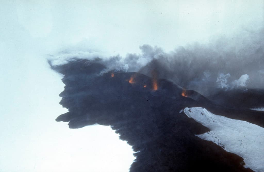
Why Mount Seguam Stands Out
Mount Seguam rises as a classic stratovolcano on the western half of Seguam Island, part of the Aleutian chain in Alaska. Its symmetrical cone and recent eruptive history create a dramatic landscape of lava flows, cinder cones, and fumaroles amid tundra and steep coastal cliffs. The island’s complete lack of permanent residents and infrastructure delivers true remoteness, attracting geologists, birders, and seasoned backcountry travelers seeking solitude unavailable on more accessible Alaskan peaks.
Reaching the Mountain
Access begins with flights to Adak or Dutch Harbor, followed by chartered boat or floatplane to Seguam Island’s rocky shores. No docks or trails exist, so visitors must land on gravel beaches and hike inland across unmarked terrain. Weather windows are narrow; multi-day expeditions require self-sufficiency in food, shelter, and navigation. Federal permits are typically needed for landing on this Alaska Maritime National Wildlife Refuge land.
Best Time to Visit
July and August offer the longest daylight and least severe storms, though fog, rain, and wind remain constant. Snow lingers into June on higher slopes, while September brings early winter conditions. Avoid shoulder seasons when boat charters become unreliable.
What to See and Do
Climb the volcano’s flanks for panoramic views of the island’s two main volcanic centers and surrounding North Pacific waters. Scan coastal cliffs for nesting seabirds including puffins and murres, and watch for sea otters and Steller sea lions in the kelp beds. Examine fresh lava fields from the 1990s eruptions and steaming vents near the summit crater. Experienced hikers can circumnavigate portions of the island, camping on sheltered beaches.
Nearby Destinations
From Seguam, boat charters commonly continue to nearby islands such as Amukta or Yunaska for additional volcanic terrain and wildlife concentrations. The larger Adak Island provides resupply options and World War II historical sites after a return trip.