Skip to content
Plan & Tour
DestinationsItinerariesTravel BlogAboutContact
0Sign inPlan a trip
Plan & TourPlan & Tour

Travel guides, destination inspiration and curated itineraries for Canada, the USA and beyond, plus a free tool to plan your own day-by-day trip.

Get travel inspiration

Explore

  • All Destinations
  • Curated Itineraries
  • Travel Blog
  • Plan a Trip

Topics

  • Hiking & Nature
  • Food & Drink
  • City Breaks
  • Budget Travel

Company

  • About Us
  • Contact
  • Privacy Policy
  • Terms of Service

© 2026 Plan & Tour. Built for travellers.

Discover the world, one trip at a time.

Mount Ratz: Hiking British Columbia’s Remote Northern Wilderness Peak
  1. Home
  2. Destinations
  3. British Columbia
  4. Mount Ratz: Hiking British Columbia’s Remote Northern Wilderness Peak
Mountain

Mount Ratz: Hiking British Columbia’s Remote Northern Wilderness Peak

Experience solitude and dramatic alpine scenery on Mount Ratz, one of the Cassiar Mountains’ highest and least-visited summits.

British ColumbiaUpdated 31 July 2026

Why Visit Mount Ratz

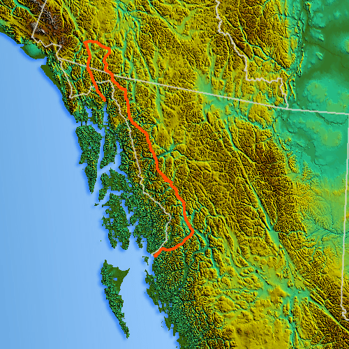
Mount Ratz rises to 3,090 metres in the Stikine Ranges of northern British Columbia, offering visitors a true wilderness experience far from roads or crowds. Its steep granite faces, hanging glaciers, and sweeping views across the Spatsizi Plateau make it a magnet for experienced mountaineers and backcountry photographers seeking untouched terrain.

Getting There

The mountain lies roughly 200 kilometres north of Smithers and west of the Stewart-Cassiar Highway. Most travellers fly into Dease Lake or Telegraph Creek, then arrange helicopter or float-plane access to trailheads near the Little Iskut River or Mt. Edziza Provincial Park boundaries. Self-supported approaches require multi-day bushwhacks across tundra and glacial streams; no maintained trails reach the summit.

Best Time to Visit

July through early September offers the longest daylight and most stable weather windows. Snow lingers on north faces into July, while August brings wildflowers and clearer skies. Winter ascents demand ski-plane or snowmobile logistics and are reserved for highly skilled parties.

What to See and Do

Classic objectives include the south ridge scramble and the east-face glacier route, both requiring ice axes, crampons, and route-finding skills. Photographers prize the 360-degree panorama that includes the Stikine River canyon and distant Coast Mountains. Nearby, the lava fields and hot springs of Mount Edziza Provincial Park provide excellent side trips for those with extra days.

Wildlife and Safety

Caribou, grizzly bears, and wolves inhabit the valleys; carry bear spray and practise Leave No Trace principles. Cell service is nonexistent, so satellite communicators and detailed topographic maps are essential.

Visitor tips

  • Secure helicopter or float-plane transport well in advance; road access ends more than 80 km from the peak.
  • Pack for rapid weather shiftsu2014carry layers, a four-season tent, and extra fuel even in summer.
  • File a detailed trip plan with Parks BC or local outfitters and carry a satellite beacon for emergencies.

Frequently asked questions

Do I need a permit to climb Mount Ratz?+

No summit permit is required, but backcountry camping in adjacent provincial parks may need registration; check current BC Parks rules before travel.

How difficult is the climb?+

Routes range from moderate scrambling to technical glacier travel; prior alpine experience and crevasse rescue skills are strongly recommended.

Can I reach Mount Ratz without flying?+

Overland approaches are possible but involve weeks of rugged hiking and river crossings; most visitors use air support for safety and logistics.

What wildlife should I watch for?+

Grizzly bears, black bears, and caribou are common; store food properly and make noise while hiking through thick brush.

Are there any nearby services or towns?+

Dease Lake, 150 km away, offers fuel, basic supplies, and charter flights; Telegraph Creek has limited lodging and is reachable by rough road.

Share
Google Maps Apple Maps Directions

Image: Skookum1 · Public domain · via Wikimedia Commons

Keep reading

Nearby & related

All stories
Wedgemount Lake: Hiking to a Turquoise Alpine Gem Near Whistler
British Columbia

Wedgemount Lake: Hiking to a Turquoise Alpine Gem Near Whistler

A rewarding backcountry trek leads to glacial waters and sweeping mountain views in British Columbia’s Coast Range.

8 August 2026
Yellowhead Lake: Turquoise Waters and Mountain Backdrops in Mount Robson Provincial Park
British Columbia

Yellowhead Lake: Turquoise Waters and Mountain Backdrops in Mount Robson Provincial Park

This serene lake in British Columbia’s Rockies delivers quiet paddling, trout fishing, and easy access to dramatic peaks…

8 August 2026
Swindle Island: Remote Wilderness on British Columbia’s Central Coast
British Columbia

Swindle Island: Remote Wilderness on British Columbia’s Central Coast

Discover pristine rainforest, marine wildlife, and quiet anchorages on this secluded island in the Inside Passage.

8 August 2026


