Stikine River: Wilderness Rafting and Remote Adventure in Northern British Columbia
This powerful northern river carves through dramatic canyons and vast wilderness, offering serious paddlers and anglers access to one of Canada’s last truly wild waterways.
The Stikine River’s Wild Character
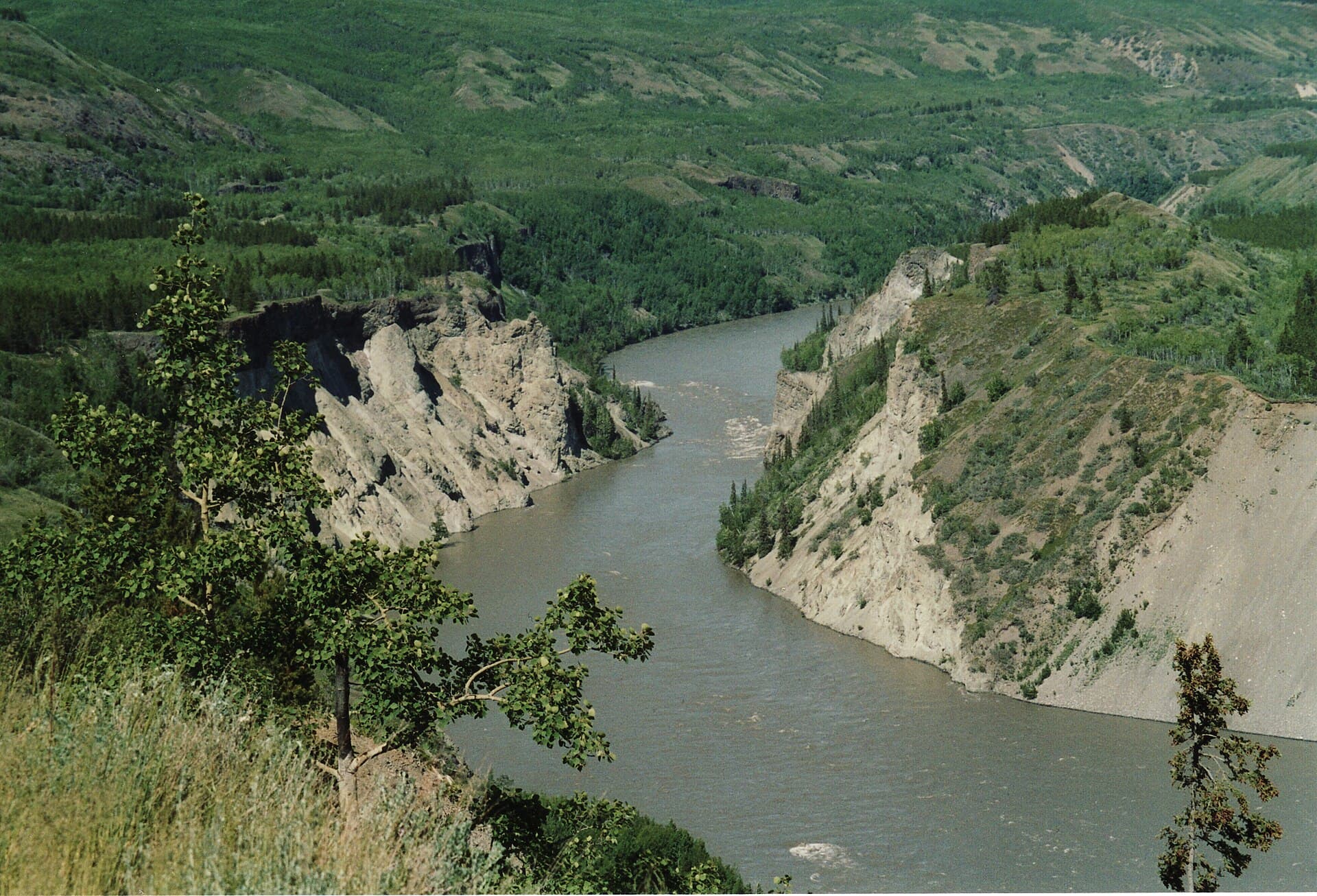
Flowing northwest from the Spatsizi Plateau through British Columbia’s remote interior, the Stikine River drops more than 1,000 metres over its course, creating one of the continent’s deepest river canyons outside the Rockies. Its upper reaches remain roadless for long stretches, preserving intact wildlife corridors and old-growth forests that draw only the most self-reliant travellers.
What to See and Do
Paddling the Grand Canyon
The 70-kilometre Grand Canyon section features continuous Class IV–V rapids flanked by sheer basalt walls. Multi-day raft or kayak trips typically begin at the confluence with the Pitman River and end near Telegraph Creek. Only experienced teams or guided parties should attempt this stretch; many choose to fly in and out by floatplane to avoid the most technical water.
Fishing and Wildlife
Below the canyon the river widens into productive pools holding chinook, sockeye, and steelhead. Anglers also target Dolly Varden and bull trout in tributary streams. Moose, grizzly and black bears, wolves, and mountain goats frequent the river corridor; early-morning or dusk floats offer the best viewing opportunities.
Hiking and Side Trips
Short trails near Telegraph Creek lead to hot springs and volcanic viewpoints. Longer backpacking routes connect to Mount Edziza Provincial Park, where obsidian ridges and cinder cones provide striking contrast to the river valley.
Getting There
Most visitors reach the river via the Stewart-Cassiar Highway to the community of Telegraph Creek, then continue by jet boat or floatplane to put-ins farther upstream. Floatplane charters operate from Dease Lake or Smithers; some outfitters arrange vehicle shuttles along the limited forest-service roads that touch the lower river.
Best Time to Visit
July through early September offers the most reliable water levels for rafting and the longest daylight. Steelhead runs peak in September and October, while late June can bring higher, colder flows suitable only for expert paddlers. Winter travel is limited to ice roads and snowmobile routes for local residents.
Nearby Destinations
Combine a Stikine trip with visits to Spatsizi Plateau Wilderness Provincial Park for alpine hiking or the remote community of Iskut for Tahltan cultural experiences. The nearby Stikine River Provincial Park protects additional shoreline and provides camping at established river bars.
Visitor tips
- Arrange all transport and evacuation plans before leaving cell range; satellite communicators are essential.
- Pack layers for rapid weather changes and bear-resistant food storage for every camp.
- Book guided trips through licensed operators familiar with Tahltan First Nation protocols and river permits.
Frequently asked questions
Do I need a guide to raft the Stikine River?
The Grand Canyon section demands advanced whitewater skills and local knowledge; most visitors join guided expeditions for safety and logistics.
What fishing regulations apply on the Stikine?
Provincial angling rules and catch-and-release requirements for steelhead are strictly enforced; check current BC Freshwater Fishing regulations before travel.
Are there developed campgrounds along the river?
Only primitive river-bar campsites exist in the canyon; visitors must be fully self-sufficient with proper waste and bear-safety practices.
How remote is the Stikine River really?
Long sections have no road access or cell coverage; rescue can take days, so thorough preparation and satellite devices are mandatory.
Can I visit the Stikine River in winter?
Access is possible by snowmobile or ice road from local communities, but tourism services are unavailable and conditions are extreme.