Skip to content
Plan & Tour
DestinationsItinerariesTravel BlogAboutContact
0Sign inPlan a trip
Plan & TourPlan & Tour

Travel guides, destination inspiration and curated itineraries for Canada, the USA and beyond, plus a free tool to plan your own day-by-day trip.

Get travel inspiration

Explore

  • All Destinations
  • Curated Itineraries
  • Travel Blog
  • Plan a Trip

Topics

  • Hiking & Nature
  • Food & Drink
  • City Breaks
  • Budget Travel

Company

  • About Us
  • Contact
  • Privacy Policy
  • Terms of Service

© 2026 Plan & Tour. Built for travellers.

Discover the world, one trip at a time.

Dease River: Wilderness Fishing and Canoeing in Northern British Columbia
  1. Home
  2. Destinations
  3. British Columbia
  4. Dease River: Wilderness Fishing and Canoeing in Northern British Columbia
River

Dease River: Wilderness Fishing and Canoeing in Northern British Columbia

This remote northern river offers world-class angling and untouched wilderness along the Cassiar Highway corridor.

British ColumbiaUpdated 1 July 2026

Why Dease River Stands Out

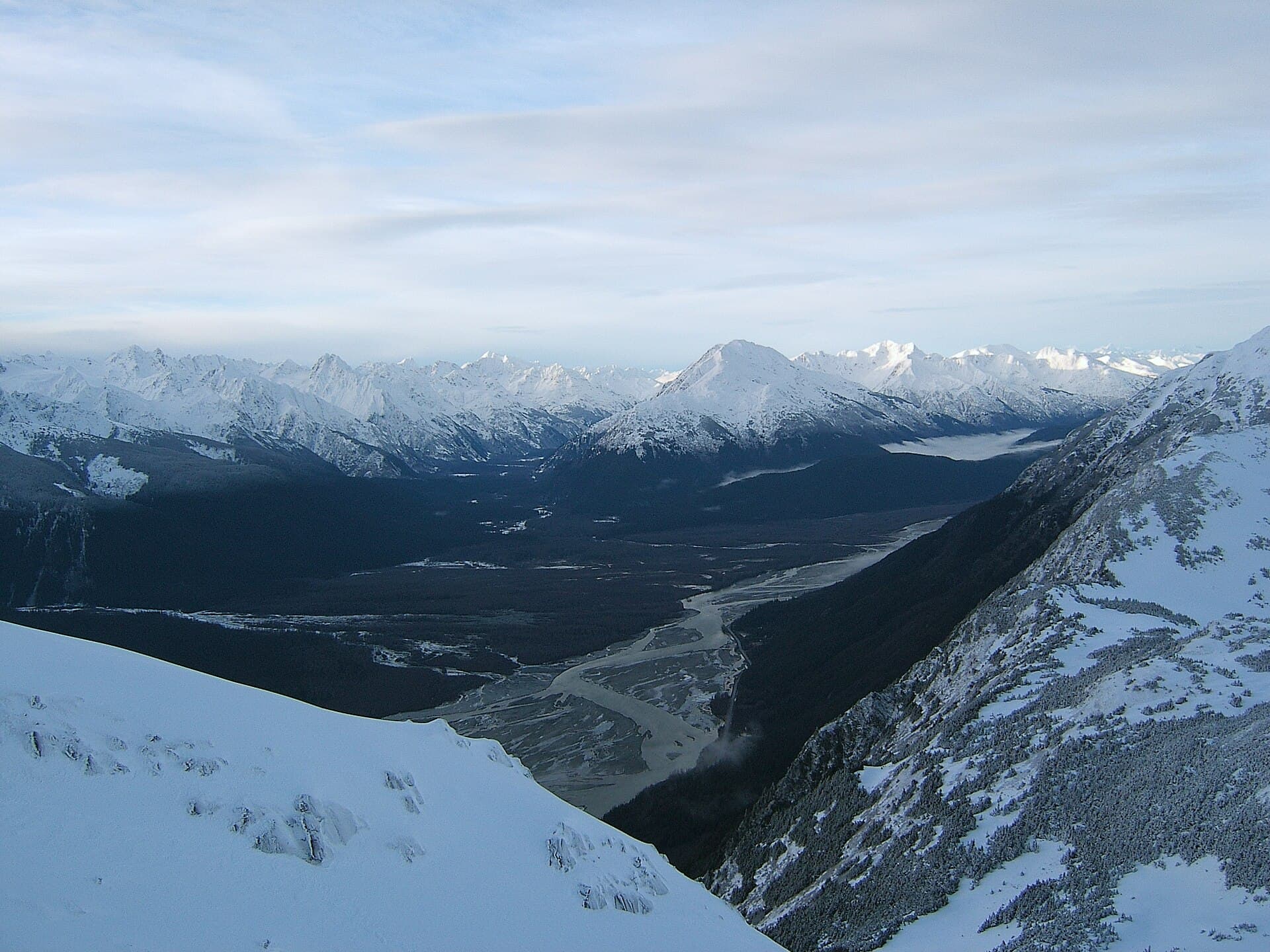
The Dease River drains a vast, lightly populated region of northern British Columbia, flowing northward from Dease Lake through boreal forest and into the Liard River system. Its clear, cold waters support strong populations of bull trout, Arctic grayling, and Dolly Varden, while the surrounding taiga provides habitat for moose, bears, and wolves. Travelers on the Cassiar Highway encounter the river near the community of Dease Lake, where the waterway remains largely free of commercial development.

Fishing and Paddling Opportunities

Anglers wade or drift the river’s gravel bars and deeper runs for trout that average 18–24 inches. Grayling rise readily to dry flies in the slower sections. Canoeists and kayakers can launch at the outlet of Dease Lake and paddle north in multi-day trips, camping on gravel bars. The current is generally moderate, though several Class II rapids require scouting. No permits are needed for day use, but travelers must follow Leave No Trace principles in this remote setting.

Wildlife and Scenery

Early morning and evening outings frequently yield sightings of moose feeding in side channels and black bears foraging along the banks. The river valley offers unobstructed views of the Cassiar Mountains to the west and expansive wetlands that attract migratory waterfowl. Autumn colors of dwarf birch and willow provide striking contrast against the dark spruce forest.

Access and Logistics

The river is reached via Highway 37, the Cassiar Highway, which connects the Yellowhead Highway in the south with the Alaska Highway near Watson Lake. From Dease Lake, short gravel roads lead to informal launch points. Most visitors arrive by private vehicle; fuel, basic groceries, and mechanical services are available in Dease Lake. Float planes can be chartered from Smithers or Terrace for access to upper reaches.

Best Time to Visit

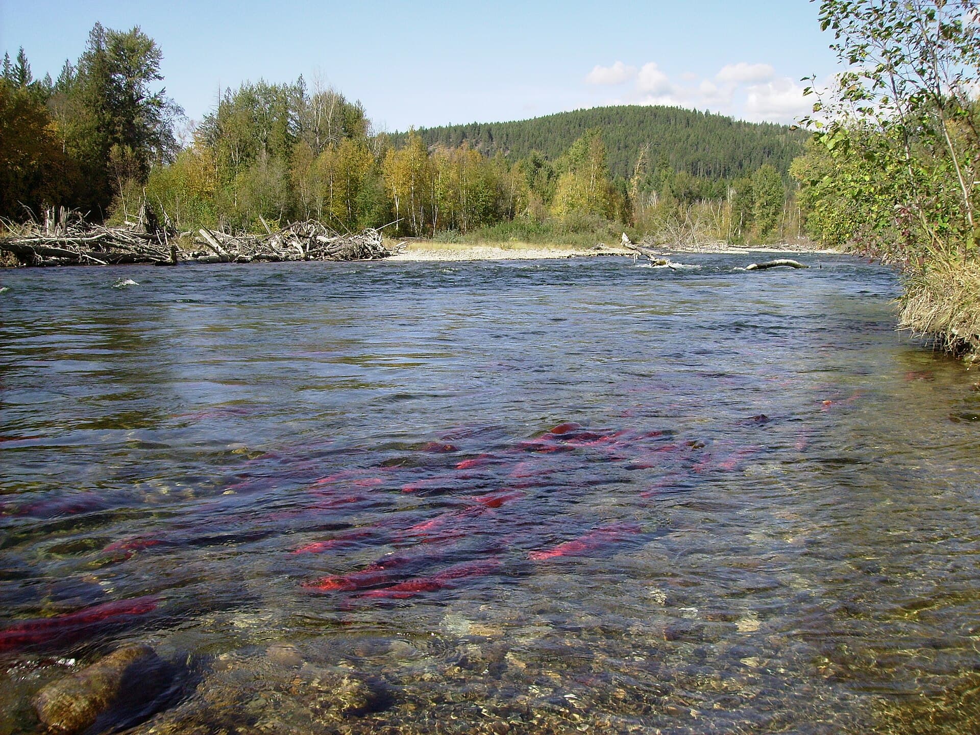
Peak conditions occur from mid-June through early September when river levels stabilize and daytime temperatures range from 15–25 °C. Insect hatches are strongest in July, while September brings fewer bugs and the chance to see spawning salmon in the lower river. Winter travel is possible only by snowmobile or ski, as the highway remains open but side roads close.

Nearby Destinations

Dease Lake itself offers boat launches and a small museum interpreting the region’s mining history. Southward lies the dramatic basalt canyons of the Stikine River; northward the Liard River and hot springs near Watson Lake. Mount Edziza Provincial Park, reached by float plane or multi-day hike, provides volcanic landscapes and obsidian deposits within a day’s travel of the river valley.

Visitor tips

  • Carry extra fuel and spare tires; services are sparse between communities along Highway 37.
  • Pack bear spray and store food securely, as grizzly and black bears frequent the river corridor.
  • Check current water levels with local outfitters before launching a canoe, as spring runoff can create strong currents.

Frequently asked questions

Is the Dease River suitable for beginners to paddle?+

The upper sections near Dease Lake are calm enough for experienced beginners, but several Class II rapids farther north require prior whitewater skills and scouting.

Do I need a fishing license for the Dease River?+

Yes, a British Columbia non-tidal angling license is required; additional conservation stamps may apply for certain trout species.

Are there established campgrounds along the river?+

No formal campgrounds exist directly on the river; visitors camp on gravel bars or use the provincial recreation sites near Dease Lake.

What wildlife should I watch for while visiting?+

Moose, black bears, and gray wolves are common; be alert near side channels and berry patches, especially at dawn and dusk.

Can I reach the Dease River without a high-clearance vehicle?+

The main highway is paved or well-maintained gravel, but launch-site access roads can be rough; a vehicle with moderate clearance is recommended.

Share
Google Maps Apple Maps Directions

Image: Bruce McKay · CC BY-SA 2.0 · via Wikimedia Commons

Keep reading

Nearby & related

All stories
Chilkat River: Bald Eagle Capital Along the BC-Alaska Border
British Columbia

Chilkat River: Bald Eagle Capital Along the BC-Alaska Border

Float through salmon-rich waters teeming with eagles and bears in one of North America’s premier wildlife corridors.

1 July 2026
Similkameen River: A Scenic Waterway Through British Columbia’s Southern Valleys
British Columbia

Similkameen River: A Scenic Waterway Through British Columbia’s Southern Valleys

Follow the Similkameen River through dramatic canyons, fertile orchards, and quiet parks in the heart of the Similkameen…

1 July 2026
Adams River: Witnessing British Columbia’s Legendary Sockeye Salmon Migration
British Columbia

Adams River: Witnessing British Columbia’s Legendary Sockeye Salmon Migration

Discover the dramatic sockeye salmon runs, clear waters, and surrounding forests of Adams River in British Columbia’s…

1 July 2026