Skip to content
Plan & Tour
DestinationsItinerariesTravel BlogAboutContact
0Sign inPlan a trip
Plan & TourPlan & Tour

Travel guides, destination inspiration and curated itineraries for Canada, the USA and beyond, plus a free tool to plan your own day-by-day trip.

Get travel inspiration

Explore

  • All Destinations
  • Curated Itineraries
  • Travel Blog
  • Plan a Trip

Topics

  • Hiking & Nature
  • Food & Drink
  • City Breaks
  • Budget Travel

Company

  • About Us
  • Contact
  • Privacy Policy
  • Terms of Service

© 2026 Plan & Tour. Built for travellers.

Discover the world, one trip at a time.

Zapaleri: Bolivia’s Remote Tri-Border Volcano Summit
  1. Home
  2. Destinations
  3. Potosí Department
  4. Zapaleri: Bolivia’s Remote Tri-Border Volcano Summit
Mountain

Zapaleri: Bolivia’s Remote Tri-Border Volcano Summit

Hike to the 5,656-meter peak marking the meeting point of Bolivia, Chile, and Argentina in the stark Andean highlands.

Potosí DepartmentUpdated 11 October 2026

Why Visit Zapaleri

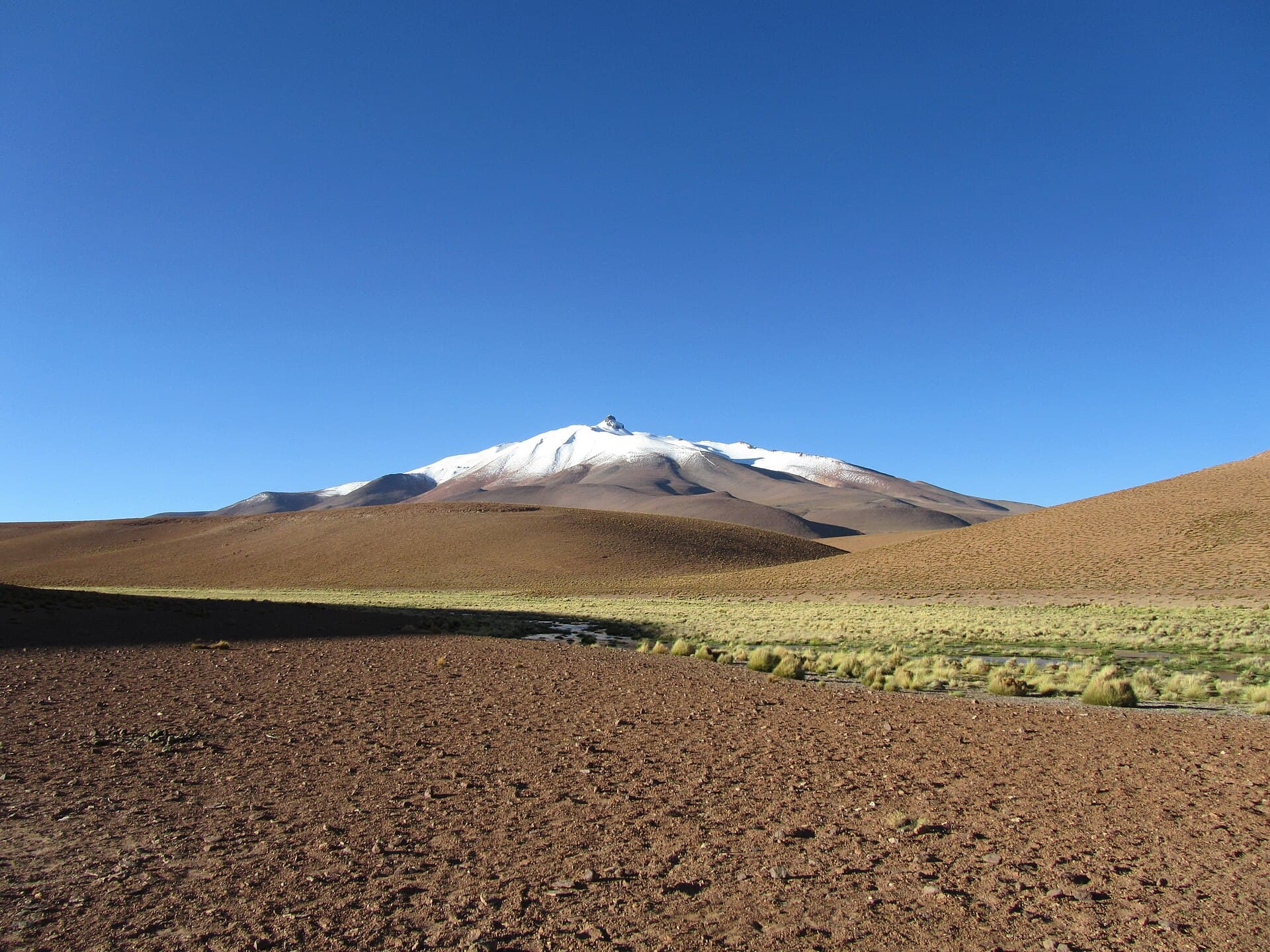
Zapaleri rises as an isolated stratovolcano on Bolivia’s southwestern frontier, offering one of the rare opportunities to stand in three countries at once. Its barren slopes and sweeping altiplano vistas reward visitors who reach the summit with views across the Chilean Puna, Argentine puna, and Bolivian salt flats. The mountain’s isolation preserves a raw high-Andean landscape rarely disturbed by crowds.

Getting There

Access begins in the Potosí Department, typically from the town of Uyuni or the village of San Pablo de Lípez. Most travelers join organized 4×4 expeditions that cross the Eduardo Avaroa Andean Fauna National Reserve. The final approach follows rough tracks past Laguna Colorada and several smaller volcanic cones; the last stretch is often covered on foot. Independent travel requires a high-clearance vehicle, detailed topographic maps, and prior permission from border authorities.

What to See and Do

The primary activity is the ascent itself. Routes start from the Bolivian side and ascend gradually over scree and firm volcanic rock. At the summit a simple marker denotes the tripoint. Photographers prize the 360-degree panorama that includes the smoking cone of Licancabur to the west and the vast white expanse of Salar de Uyuni to the north. Wildlife sightings may include vicuñas and Andean flamingos in the surrounding wetlands.

Practical Considerations for the Climb

  • Allow two full days from Uyuni for the round trip, including acclimatization.
  • Carry at least three liters of water per person; no reliable sources exist above 4,500 meters.
  • Expect strong winds and rapid temperature drops even in clear weather.

Best Time to Visit

The dry season from May through October provides the most stable conditions. Skies are usually clear, tracks remain passable, and nighttime temperatures, while cold, are more predictable. January to March brings occasional snow and swollen rivers that can block access roads.

Nearby Attractions

Zapaleri forms part of a larger volcanic corridor. Visitors often combine the trip with Laguna Colorada, the Sol de Mañana geysers, and the Chilean border crossing at Hito Cajones. Extending the journey southward leads to the vast Salar de Tara and the international tripoint area around Cerro del León.

Visitor tips

  • Acclimatize for at least two nights above 3,500 meters before attempting the summit to reduce altitude-sickness risk.
  • Travel with a licensed local guide who knows the unmarked border zone and can handle vehicle recovery on loose volcanic gravel.
  • Pack layered clothing, sun protection, and extra fuel; services are nonexistent once you leave the main reserve road.

Frequently asked questions

How high is Zapaleri and how difficult is the climb?+

The summit sits at 5,656 meters. The route is non-technical but demanding because of altitude and loose scree; most fit hikers complete the final ascent in four to six hours.

Do I need a visa or special permit to reach the tripoint?+

Bolivian authorities require advance notification for border-zone travel. Crossing into Chile or Argentina at the summit is not permitted without formal immigration clearance at official posts.

What is the nearest town with supplies and lodging?+

Uyuni, roughly 200 kilometers north, offers the widest range of hotels, restaurants, and tour operators. Smaller outposts like San Pablo de Lu00edpez provide basic lodging but limited provisions.

Is Zapaleri suitable for beginners or families?+

The mountain is best suited to experienced high-altitude hikers. Children and anyone with altitude or respiratory concerns should remain at lower viewpoints within the reserve.

Can I drive all the way to the summit?+

No. The final 400 vertical meters must be walked; vehicle tracks stop well below the crater rim on the Bolivian flank.

Share
Google Maps Apple Maps Directions

Image: Mquarg · CC BY-SA 3.0 · via Wikimedia Commons

Keep reading

Nearby & related

All stories
S
Potosí Department

Sabaya River: Bolivia’s Remote Highland Waterway in Potosí

Discover the stark Andean beauty and quiet isolation of the Sabaya River in Bolivia’s high desert.

13 October 2026
L
Potosí Department

Laguna Charcota: Remote Turquoise Lake in Bolivia’s Andean Highlands

Explore the striking high-altitude waters and stark volcanic scenery of Laguna Charcota deep in Potosí Department.

12 October 2026
S
Potosí Department

Silala River: Remote Andean Waters in Bolivia’s Potosí Department

Explore the high-altitude springs and wetlands of the Silala River, a striking natural feature on Bolivia’s border with…

12 October 2026