Skip to content
Plan & Tour
DestinationsItinerariesTravel BlogAboutContact
0Sign inPlan a trip
Plan & TourPlan & Tour

Travel guides, destination inspiration and curated itineraries for Canada, the USA and beyond, plus a free tool to plan your own day-by-day trip.

Get travel inspiration

Explore

  • All Destinations
  • Curated Itineraries
  • Travel Blog
  • Plan a Trip

Topics

  • Hiking & Nature
  • Food & Drink
  • City Breaks
  • Budget Travel

Company

  • About Us
  • Contact
  • Privacy Policy
  • Terms of Service

© 2026 Plan & Tour. Built for travellers.

Discover the world, one trip at a time.

Tomasamil: Hiking Bolivia’s Remote Andean Peak
  1. Home
  2. Destinations
  3. Potosí Department
  4. Tomasamil: Hiking Bolivia’s Remote Andean Peak
Mountain

Tomasamil: Hiking Bolivia’s Remote Andean Peak

A guide to climbing Tomasamil mountain in Bolivia's Potosí Department for sweeping high-altitude views and solitude.

Potosí DepartmentUpdated 12 October 2026

Why Visit Tomasamil

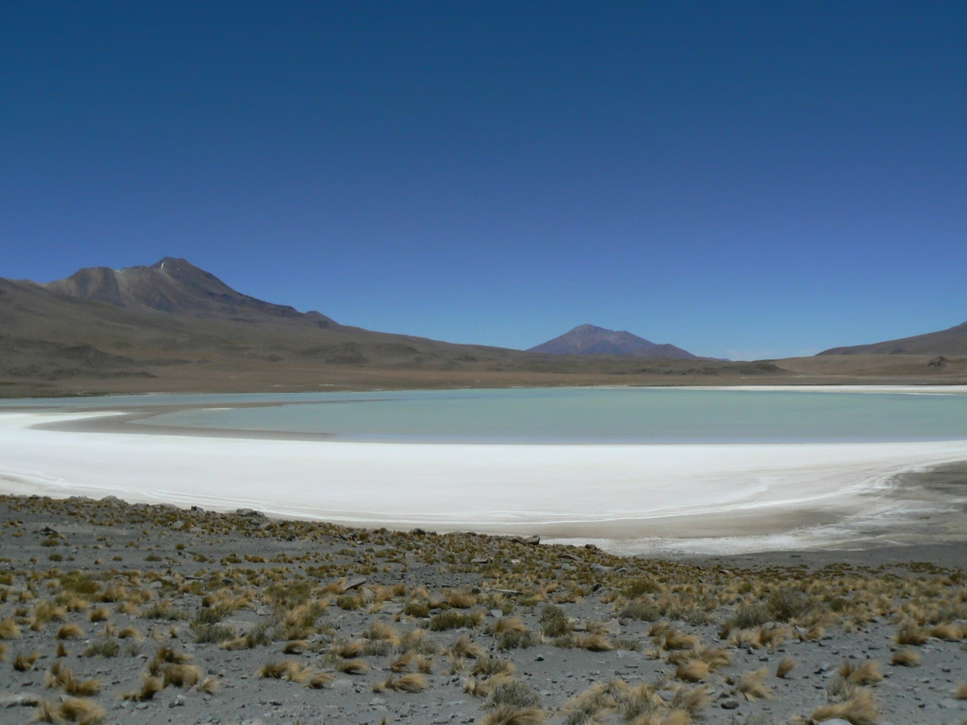
Tomasamil rises as a striking volcanic peak in the arid highlands of Potosí Department, offering hikers and climbers a rare combination of accessible high-altitude terrain and sweeping vistas across the Altiplano. Its isolation means few crowds, allowing visitors to experience the stark beauty of Bolivia’s southwestern Andes, including distant salt flats and neighboring volcanoes.

Getting There

Most travelers reach Tomasamil via the town of Uyuni, roughly 200 kilometers to the northeast. From Uyuni, 4×4 vehicles navigate unpaved roads through the Eduardo Avaroa Andean Fauna National Reserve, passing colorful lagoons and rock formations. Independent drivers require high-clearance vehicles and local knowledge of unmarked tracks; many opt for organized tours that combine the mountain with salt-flat excursions.

Best Time to Visit

The dry season from May through October provides the most reliable weather for hiking and climbing. Clear skies reduce the chance of sudden snow or rain, while daytime temperatures remain manageable at altitude. November to April brings heavier rains that can make access roads impassable and increase rockfall risk.

What to See and Do

Day hikes along the lower slopes reveal herds of vicuñas and dramatic lava fields. Stronger hikers attempt the full ascent, which rewards with 360-degree panoramas stretching to Chile and Argentina on clear days. Photographers favor sunrise or sunset from nearby ridges for golden light on the surrounding desert landscape. Wildlife spotting includes Andean flamingos at nearby lakes and occasional condors riding thermals above the peak.

Nearby Attractions

Tomasamil sits near the southern edge of the Salar de Uyuni, the world’s largest salt flat, making it easy to combine visits. Other highlights within a day’s drive include the geysers and hot springs of Sol de Mañana and the vivid Laguna Colorada, home to thousands of flamingos. The region also offers access to the Siloli Desert and its iconic rock formations.

Visitor tips

  • Acclimatize for several days in Uyuni or Potosu00ed before attempting the summit to reduce altitude sickness risk.
  • Carry plenty of water and layered clothing, as temperatures can drop sharply even in the dry season.
  • Travel with a local guide or established tour operator familiar with unmarked highland routes and weather patterns.

Frequently asked questions

How difficult is the hike to the summit of Tomasamil?+

The ascent involves steep, rocky terrain at high altitude and is best suited to experienced hikers with good fitness. Guided groups typically complete it in a long day.

Do I need a permit to climb Tomasamil?+

Access falls under the regulations of the surrounding national reserve; most visitors join licensed tours that handle necessary permissions.

What wildlife might I see around Tomasamil?+

Expect vicuu00f1as on the slopes, Andean flamingos at nearby lagoons, and occasional condors overhead, especially during early morning or late afternoon.

Can Tomasamil be visited in a day from Uyuni?+

Yes, many tours combine the mountain with stops at the salt flats and lagoons, though the round-trip drive and hike make for a very full day.

Is Tomasamil suitable for beginners?+

The combination of altitude and rough terrain makes it challenging for novices. Beginners should consider easier hikes on the lower slopes or join a supported group.

Share
Google Maps Apple Maps Directions

Image: Iain and Sarah from London, UK · CC BY 2.0 · via Wikimedia Commons

Keep reading

Nearby & related

All stories
S
Potosí Department

Sabaya River: Bolivia’s Remote Highland Waterway in Potosí

Discover the stark Andean beauty and quiet isolation of the Sabaya River in Bolivia’s high desert.

13 October 2026
L
Potosí Department

Laguna Charcota: Remote Turquoise Lake in Bolivia’s Andean Highlands

Explore the striking high-altitude waters and stark volcanic scenery of Laguna Charcota deep in Potosí Department.

12 October 2026
S
Potosí Department

Silala River: Remote Andean Waters in Bolivia’s Potosí Department

Explore the high-altitude springs and wetlands of the Silala River, a striking natural feature on Bolivia’s border with…

12 October 2026