Skip to content
Plan & Tour
DestinationsItinerariesTravel BlogAboutContact
0Sign inPlan a trip
Plan & TourPlan & Tour

Travel guides, destination inspiration and curated itineraries for Canada, the USA and beyond, plus a free tool to plan your own day-by-day trip.

Get travel inspiration

Explore

  • All Destinations
  • Curated Itineraries
  • Travel Blog
  • Plan a Trip

Topics

  • Hiking & Nature
  • Food & Drink
  • City Breaks
  • Budget Travel

Company

  • About Us
  • Contact
  • Privacy Policy
  • Terms of Service

© 2026 Plan & Tour. Built for travellers.

Discover the world, one trip at a time.

Serranía del Aguaragüe: Trekking Bolivia’s Remote Tarija Mountain Range
  1. Home
  2. Destinations
  3. Tarija Department
  4. Serranía del Aguaragüe: Trekking Bolivia’s Remote Tarija Mountain Range
Mountain

Serranía del Aguaragüe: Trekking Bolivia’s Remote Tarija Mountain Range

This rugged national park near Tarija delivers subtropical canyons, diverse wildlife, and quiet trails away from Bolivia's better-known peaks.

Tarija DepartmentUpdated 12 October 2026

Why Serranía del Aguaragüe Stands Out

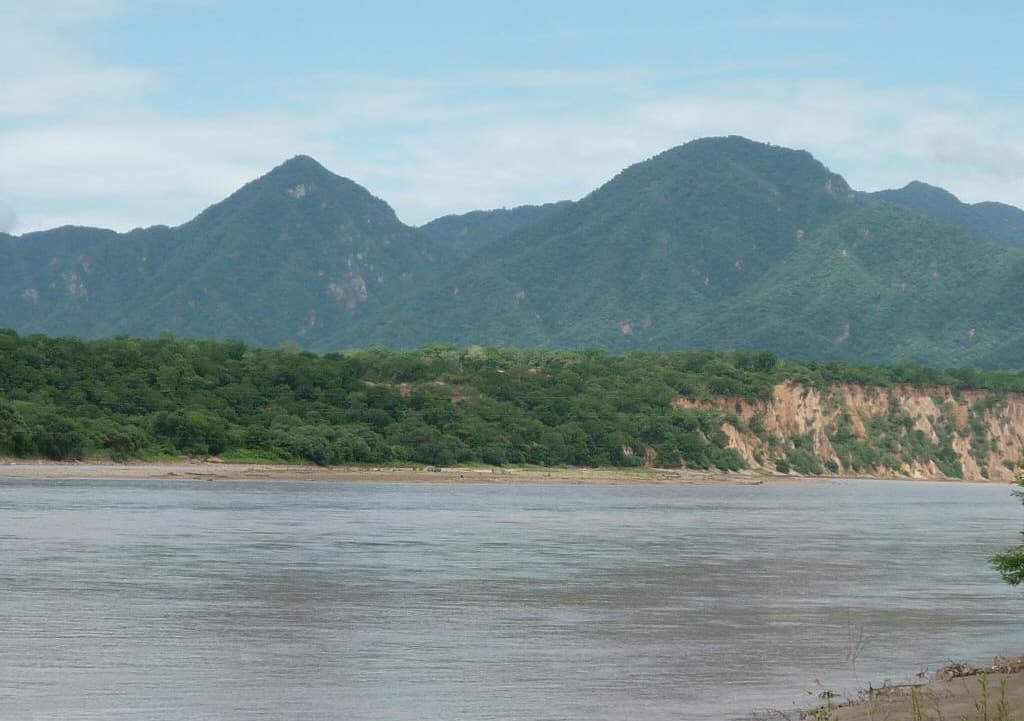
Forming the eastern edge of the Tarija Department, Serranía del Aguaragüe rises as a narrow, forested cordillera separating the Andean foothills from the vast Gran Chaco plains. Its steep limestone ridges, deep canyons, and seasonal waterfalls support one of Bolivia’s most biodiverse protected areas, home to jaguars, peccaries, and over 300 bird species. Travelers seeking uncrowded hiking and genuine wilderness find it here rather than in the more developed national parks farther north.

What to See and Do

Day hikes from the main access points lead through dry forest transitioning into cloud forest at higher elevations. Popular routes follow old logging tracks to viewpoints overlooking the Pilcomayo River and the distant Chaco horizon. Birdwatchers target the endemic Bolivian recurvebill and military macaws near permanent springs. Longer treks require local guides to reach remote waterfalls and limestone caves that shelter ancient petroglyphs. The park also offers opportunities to visit nearby Guaraní communities that maintain traditional knowledge of medicinal plants.

Wildlife and Landscapes

Early morning or late afternoon walks increase chances of spotting howler monkeys and coatis. The range’s abrupt topography creates microclimates: shaded ravines stay moist year-round while exposed slopes support cactus and bromeliads. Seasonal rains turn normally dry riverbeds into rushing streams, revealing hidden cascades accessible only on foot.

How to Get There

Most visitors start from Tarija city, traveling southeast by shared taxi or private vehicle along the road toward Villamontes. The park entrance lies roughly two hours from Tarija; from there, rough tracks require high-clearance transport or guided transport arranged in advance. Those coming from the Chaco side can enter via Yacuiba but should confirm road conditions after heavy rains.

Best Time to Visit

The dry season from May through October offers the most reliable access and clearest trails. April and November mark transition periods with fewer visitors and occasional wildflowers, though some side roads may still be muddy. December to March brings heavy rains that close many routes and increase the risk of flash floods in canyons.

Nearby Attractions

Combine a visit with Tarija’s renowned wine valleys for tastings of high-altitude reds, or continue south to the Pilcomayo River canyons. The colonial town of San Lorenzo and the paleontological sites around Padcaya provide additional half-day excursions without straying far from the main access road.

Visitor tips

  • Hire a local guide from the surrounding Guaranu00ed communities; unmarked trails and seasonal water sources make independent travel risky.
  • Carry at least three liters of water per person and wear long sleevesu2014dense vegetation and ticks are common even on short walks.
  • Check road conditions and park regulations with the Tarija tourism office before departure, as flash floods can isolate sections for days.

Frequently asked questions

Do I need a permit to enter Serranu00eda del Aguaragu00fce?+

Park entry is managed at the main ranger stations; visitors should register on arrival and may need to join an authorized guide for overnight trips.

Are there accommodations inside the park?+

No formal lodges exist within the boundaries. Most travelers base themselves in Tarija or Villamontes and visit on day trips or simple camping with prior authorization.

How difficult are the trails?+

Routes range from moderate ridge walks to strenuous canyon scrambles. Even short hikes involve elevation gain and uneven limestone terrain, so good boots are essential.

Is the area safe for solo travelers?+

Daytime visits are generally safe when using official access points, but solo travelers should inform park staff of their route and return time due to limited cell coverage.

Can I combine a visit with wine tours in Tarija?+

Yes. Many visitors spend mornings hiking in the serranu00eda and afternoons tasting wines in the valleys west of Tarija, as the two areas lie within a two-hour drive.

Share
Google Maps Apple Maps Directions

Image: Walter Segovia · Public domain · via Wikimedia Commons

Keep reading

Nearby & related

All stories
C
Tarija Department

Caraparí River: A Scenic Waterway Through Tarija’s Southern Landscapes

Discover Bolivia’s Caraparí River for its tranquil banks, birdlife, and access to remote Tarija wilderness.

13 October 2026
The Nuevo Guadalquivir River: Tarija’s Scenic Heart in Bolivia’s Wine Country
Tarija Department

The Nuevo Guadalquivir River: Tarija’s Scenic Heart in Bolivia’s Wine Country

Winding through the fertile valleys of Tarija Department, this river anchors Bolivia’s finest vineyards and offers…

13 October 2026
Tajzara Lake: Bolivia’s Highland Flamingo Sanctuary in Tarija
Tarija Department

Tajzara Lake: Bolivia’s Highland Flamingo Sanctuary in Tarija

Tajzara Lake rewards visitors with rare high-altitude birdlife, sweeping Andean vistas, and quiet trails in Bolivia’s…

12 October 2026