Skip to content
Plan & Tour
DestinationsItinerariesTravel BlogAboutContact
0Sign inPlan a trip
Plan & TourPlan & Tour

Travel guides, destination inspiration and curated itineraries for Canada, the USA and beyond, plus a free tool to plan your own day-by-day trip.

Get travel inspiration

Explore

  • All Destinations
  • Curated Itineraries
  • Travel Blog
  • Plan a Trip

Topics

  • Hiking & Nature
  • Food & Drink
  • City Breaks
  • Budget Travel

Company

  • About Us
  • Contact
  • Privacy Policy
  • Terms of Service

© 2026 Plan & Tour. Built for travellers.

Discover the world, one trip at a time.

Ring Mountain: Hiking the Volcanic Summit Near Squamish
  1. Home
  2. Destinations
  3. British Columbia
  4. Ring Mountain: Hiking the Volcanic Summit Near Squamish
Mountain

Ring Mountain: Hiking the Volcanic Summit Near Squamish

A compact Coast Mountains tuya offering sweeping views, wildflower meadows, and an accessible summit hike from the Sea-to-Sky corridor.

British ColumbiaUpdated 8 August 2026

Why Ring Mountain Stands Out

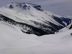
Ring Mountain rises as a flat-topped volcanic tuya just north of Squamish, its distinctive circular shape formed by ancient subglacial eruptions. The summit delivers 360-degree vistas of the Tantalus Range, the Cheakamus River valley, and distant Garibaldi peaks without the crowds that gather on more famous nearby trails.

Getting There

From Highway 99, turn onto the Squamish Valley Road and follow signs toward the Cheakamus Lake area. A gravel forest-service road leads to a small trailhead parking area; high-clearance vehicles handle the final stretch best, though passenger cars can manage in dry conditions. The trail begins immediately behind the parking pullout and climbs steadily through second-growth forest before breaking onto open subalpine slopes.

Best Time to Visit

Late June through early October offers the most reliable access once snow has melted from the upper trail. July and August bring peak wildflower displays across the summit meadows, while September provides cooler temperatures and fewer insects. Winter visits require avalanche awareness and snow-travel skills; the road is usually unplowed.

Trails and Summit Experience

The main route is a well-defined 6 km out-and-back that gains roughly 600 m. After the initial forested section, hikers cross open basalt slabs and grassy benches where mountain goats are sometimes spotted. The final pitch to the rim is a moderate scramble on stable rock; once on top, a short loop around the crater rim reveals the mountain’s volcanic origins and unobstructed views south toward Squamish and north toward Whistler.

Other Activities

  • Rock climbing on the lower basalt columns near the trailhead
  • Photography of the distinctive circular summit crater at sunrise
  • Wildlife viewing for black bears and hoary marmots in the meadows

Nearby Destinations

Combine a morning on Ring Mountain with an afternoon at nearby Cheakamus Lake or the Shannon Falls Provincial Park viewpoints. The town of Squamish offers craft breweries and the Sea-to-Sky Gondola for additional viewpoints on the same day.

Visitor tips

  • Carry at least two litres of water per person; no reliable sources exist on the upper trail.
  • Download an offline map before departing, as cell service fades quickly past the trailhead.
  • Practice Leave No Trace principles; the fragile alpine meadows recover slowly from foot traffic.

Frequently asked questions

How difficult is the hike to the summit of Ring Mountain?+

The trail is rated moderate overall, with the final 200 m requiring basic scrambling on solid rock. Most fit hikers complete the round trip in four to five hours.

Are dogs allowed on Ring Mountain trails?+

Dogs are permitted but must remain under control at all times; the open summit terrain offers little shade or water, so bring extra for pets.

Is there cell service on the mountain?+

Service is unreliable past the trailhead; hikers should carry a printed map or GPS device and inform someone of their plans.

What wildlife might I encounter?+

Black bears, mountain goats, and marmots are common; store food properly and make noise on blind corners through the forest section.

Can I camp on Ring Mountain?+

No designated campsites exist; overnight stays are discouraged to protect the fragile alpine vegetation and because the area lacks reliable water.

Share
Google Maps Apple Maps Directions

Image: nass5518 · CC BY 2.0 · via Wikimedia Commons

Keep reading

Nearby & related

All stories
Wedgemount Lake: Hiking to a Turquoise Alpine Gem Near Whistler
British Columbia

Wedgemount Lake: Hiking to a Turquoise Alpine Gem Near Whistler

A rewarding backcountry trek leads to glacial waters and sweeping mountain views in British Columbia’s Coast Range.

8 August 2026
Yellowhead Lake: Turquoise Waters and Mountain Backdrops in Mount Robson Provincial Park
British Columbia

Yellowhead Lake: Turquoise Waters and Mountain Backdrops in Mount Robson Provincial Park

This serene lake in British Columbia’s Rockies delivers quiet paddling, trout fishing, and easy access to dramatic peaks…

8 August 2026
Swindle Island: Remote Wilderness on British Columbia’s Central Coast
British Columbia

Swindle Island: Remote Wilderness on British Columbia’s Central Coast

Discover pristine rainforest, marine wildlife, and quiet anchorages on this secluded island in the Inside Passage.

8 August 2026


