Skip to content
Plan & Tour
DestinationsItinerariesTravel BlogAboutContact
0Sign inPlan a trip
Plan & TourPlan & Tour

Travel guides, destination inspiration and curated itineraries for Canada, the USA and beyond, plus a free tool to plan your own day-by-day trip.

Get travel inspiration

Explore

  • All Destinations
  • Curated Itineraries
  • Travel Blog
  • Plan a Trip

Topics

  • Hiking & Nature
  • Food & Drink
  • City Breaks
  • Budget Travel

Company

  • About Us
  • Contact
  • Privacy Policy
  • Terms of Service

© 2026 Plan & Tour. Built for travellers.

Discover the world, one trip at a time.

Cheakamus Lake: Turquoise Waters and Mountain Trails in Garibaldi Park
  1. Home
  2. Destinations
  3. British Columbia
  4. Cheakamus Lake: Turquoise Waters and Mountain Trails in Garibaldi Park
Lake

Cheakamus Lake: Turquoise Waters and Mountain Trails in Garibaldi Park

Hike to the vivid blue waters of Cheakamus Lake for quiet shoreline paths and dramatic Coast Mountain views in British Columbia.

British ColumbiaUpdated 31 July 2026

Why Cheakamus Lake Stands Out

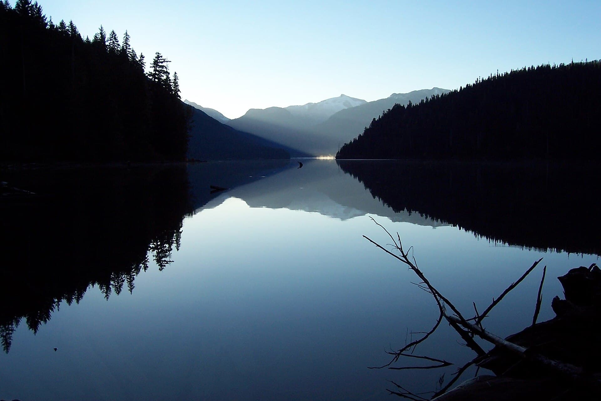
Cheakamus Lake sits in the southern section of Garibaldi Provincial Park, where the Cheakamus River feeds a long, narrow body of water ringed by steep forested slopes and jagged peaks. The lake’s striking turquoise color comes from glacial silt carried from upstream icefields, creating a vivid contrast against the dark evergreens and gray rock faces. Visitors come for the easy access to a true backcountry lake without the crowds found at more famous spots farther north.

Getting There

Most travelers reach the lake from the Cheakamus Lake trailhead parking area off Highway 99 between Squamish and Whistler. The road is paved until the final few kilometers, which are gravel but maintained for ordinary vehicles. From the lot a well-graded path leads 3.5 kilometers to the lake’s north end; the route stays mostly level, crossing old-growth cedar and hemlock forest with occasional glimpses of the river. No shuttle service operates, so plan to drive or arrange a ride.

What to See and Do

The main activity is the lakeshore walk. The trail continues south along the east side of the lake for several more kilometers, passing small pebble beaches and occasional campsites tucked into the trees. Anglers cast for rainbow trout near the inlet streams. In summer, clear days reveal the glaciated summit of Mount Davidson across the water. Photographers favor the early-morning light when the surface is calm and reflections are sharpest. Winter visitors on snowshoes or skis can reach the frozen lake surface, though the trail requires avalanche awareness and route-finding skills beyond the first few kilometers.

Best Time to Visit

Late June through early October offers the most reliable weather and snow-free trails. July and August bring the longest days and warmest water for quick dips, while September delivers quieter trails and colorful fall foliage on the surrounding slopes. Spring and fall shoulder seasons can still work but require checking current snow levels on the access road and trail.

Nearby Places Worth Exploring

After a lake visit, many travelers continue to Whistler for gondola rides and village dining or head south to the Sea-to-Sky Gondola and Shannon Falls near Squamish. Within the same park, the Black Tusk and Panorama Ridge trails offer more strenuous day hikes with broader alpine views. The Cheakamus River canyon downstream provides additional short walks and river viewpoints.

Visitor tips

  • Pack layers and rain gear; mountain weather changes quickly even on sunny forecast days.
  • Bring a bear canister or hang food properlyu2014black bears frequent the lakeshore in berry season.
  • Start early to secure parking at the trailhead, which fills on summer weekends.

Frequently asked questions

Is Cheakamus Lake suitable for swimming?+

The water stays cold year-round due to glacial inflow, but a quick dip is possible on hot summer afternoons near the north-end beaches.

Are dogs allowed on the trail?+

Dogs are permitted on leash along the main trail and lakeshore; owners must pack out all waste.

Can I camp at the lake?+

Several designated backcountry campsites exist along the east shore; a park permit is required and sites are first-come, first-served.

How difficult is the hike to Cheakamus Lake?+

The initial 3.5 km to the lake is rated easy with minimal elevation gain and is suitable for most fitness levels.

What wildlife might I see?+

Black bears, deer, and various birds are common; keep a respectful distance and store food properly at all times.

Share
Google Maps Apple Maps Directions

Image: ec (talk · contribs) · Public domain · via Wikimedia Commons

Keep reading

Nearby & related

All stories
Vedder River: Salmon Fishing, Paddling and Riverside Trails in British Columbia
British Columbia

Vedder River: Salmon Fishing, Paddling and Riverside Trails in British Columbia

A clear, productive river in the Fraser Valley offering consistent chinook and coho runs, easy paddling and quiet hiking…

1 August 2026
E
British Columbia

Englishman River: Waterfalls, Forests and Salmon Runs on Vancouver Island

Hike to dramatic waterfalls, swim in clear pools, and watch salmon spawn along this Vancouver Island river.

1 August 2026
B
British Columbia

Bella Coola River: Wilderness Fishing and Grizzly Viewing in British Columbia’s Great Bear Rainforest

This remote river in the Bella Coola Valley offers world-class steelhead and salmon fishing, abundant wildlife, and…

1 August 2026


