Skip to content
Plan & Tour
DestinationsItinerariesTravel BlogAboutContact
0Sign inPlan a trip
Plan & TourPlan & Tour

Travel guides, destination inspiration and curated itineraries for Canada, the USA and beyond, plus a free tool to plan your own day-by-day trip.

Get travel inspiration

Explore

  • All Destinations
  • Curated Itineraries
  • Travel Blog
  • Plan a Trip

Topics

  • Hiking & Nature
  • Food & Drink
  • City Breaks
  • Budget Travel

Company

  • About Us
  • Contact
  • Privacy Policy
  • Terms of Service

© 2026 Plan & Tour. Built for travellers.

Discover the world, one trip at a time.

Quetena Volcano: Trekking Bolivia’s Remote Andean Peak
  1. Home
  2. Destinations
  3. Sur Lípez Province
  4. Quetena Volcano: Trekking Bolivia’s Remote Andean Peak
Mountain

Quetena Volcano: Trekking Bolivia’s Remote Andean Peak

A practical guide to visiting the striking Quetena Volcano in Bolivia's Sur Lípez Province and the surrounding Altiplano wilderness.

Sur Lípez ProvinceUpdated 12 October 2026

Why Quetena Volcano Stands Out

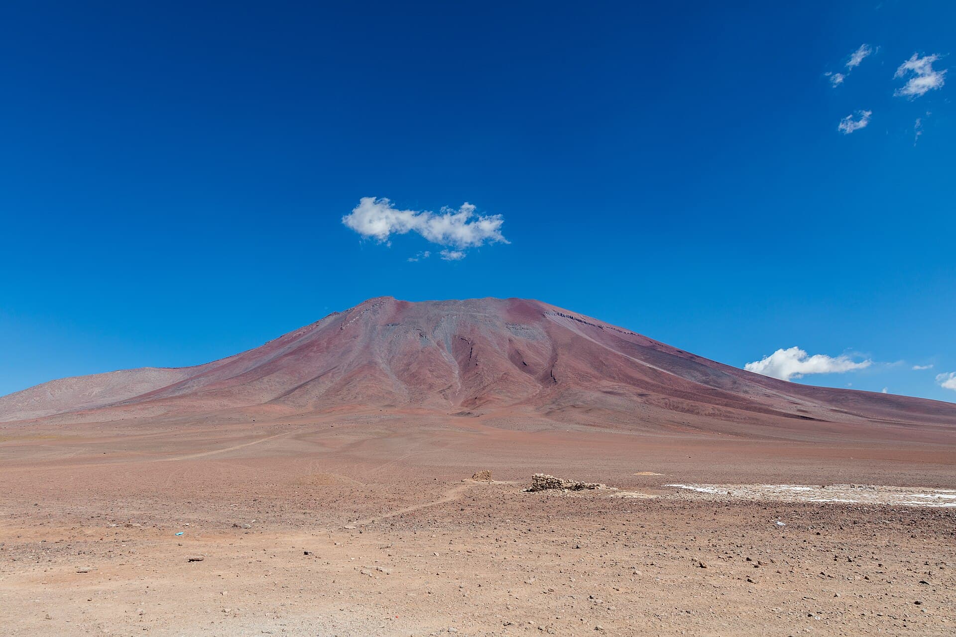
Quetena Volcano rises from the high desert of southern Bolivia, offering hikers and photographers a raw, uncrowded alternative to better-known Andean summits. Its dark volcanic slopes contrast sharply with the surrounding pale salt flats and vivid mineral lakes that define the Eduardo Avaroa Andean Fauna National Reserve. The mountain itself is a classic stratovolcano, its cone-shaped profile visible for many kilometers across the plateau.

Getting There

Most visitors reach Quetena Volcano as part of a multi-day 4×4 circuit that begins in Uyuni. The drive south passes through the village of Quetena Chico before entering the reserve; expect several hours of rough tracks and river crossings. Independent travelers can also approach from the Chilean border at Hito Cajones, though Bolivian visa and park-entry formalities must be completed first. No public transport serves the volcano directly, so a licensed driver or guided tour is essential.

What to See and Do

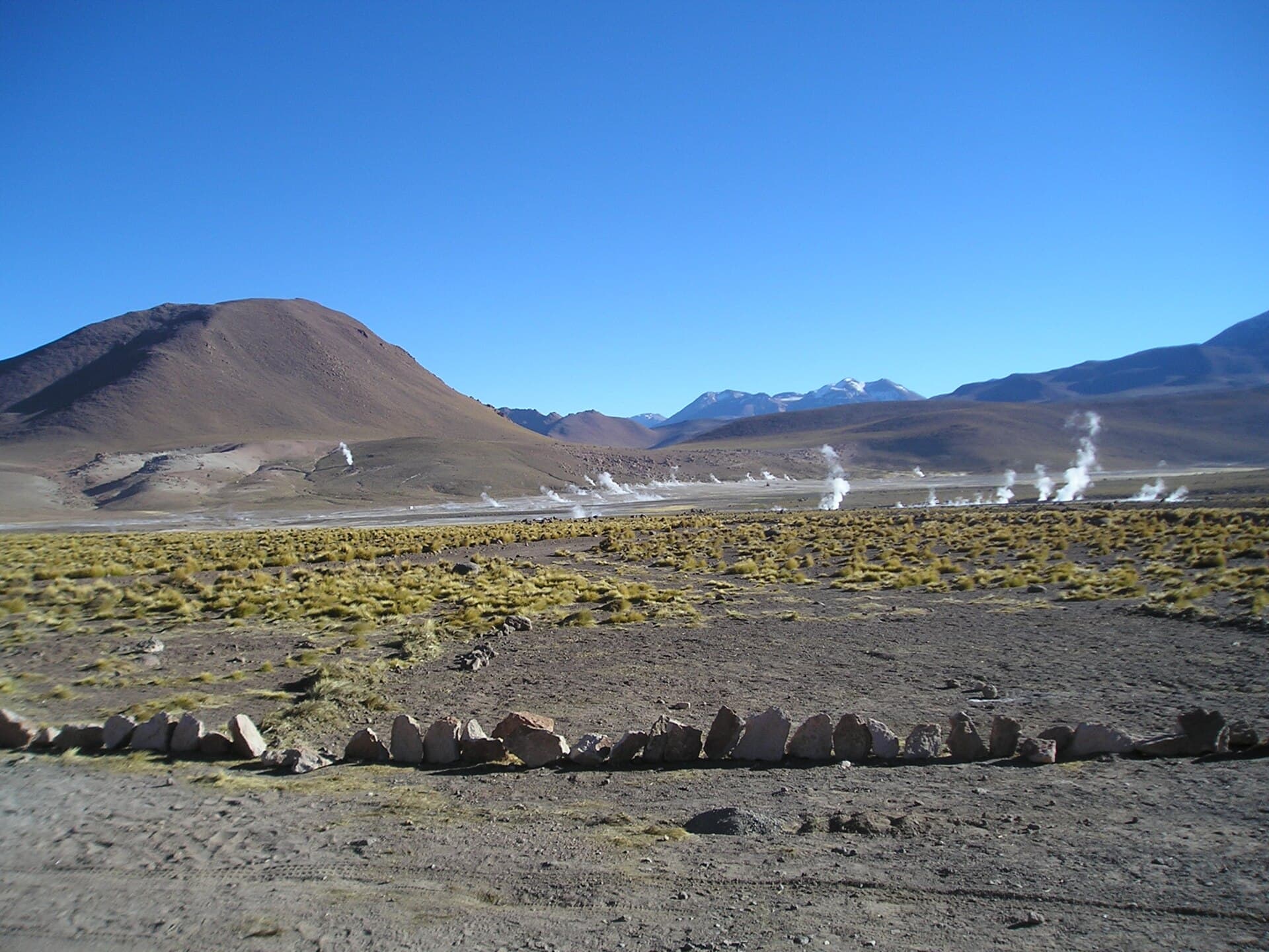
The primary activity is hiking the lower slopes and ridges, where lava fields, fumaroles, and sweeping views of Laguna Colorada reward steady effort. Birders look for three species of flamingo that feed in the nearby lakes, while vicuñas and Andean foxes are frequently spotted on the open plains. Photographers often time visits for sunrise or sunset when the volcano’s profile glows against the colorful water bodies. Overnight camping is permitted in designated zones within the reserve, allowing stargazing at one of the clearest high-altitude skies in South America.

Best Time to Visit

The dry season from May through October brings stable weather and passable roads. Temperatures drop below freezing at night year-round, so warm layers and wind protection are required even in summer. The wet months of December to March can make tracks impassable and obscure views with afternoon clouds.

Nearby Highlights

Quetena Volcano sits within a dense cluster of natural wonders. A short drive north leads to the steaming geysers of Sol de Mañana and the hot springs of Polques. Further south, the vast Salar de Uyuni and the striking Laguna Verde complete the classic southern circuit. Many travelers combine the volcano with a visit to the stone village of San Antonio de Lípez for a glimpse of traditional highland life.

Visitor tips

  • Acclimatize in Uyuni or Potosu00ed for several days before ascending to avoid altitude sickness.
  • Travel only with experienced 4x4 drivers who carry extra fuel, water, and spare parts.
  • Carry all trash out of the reserve and avoid disturbing nesting birds around the lagoons.

Frequently asked questions

Do I need a guide to visit Quetena Volcano?+

Yes. The area lies inside a national reserve with limited signage and no services; a licensed guide or driver is required for safety and park regulations.

How high is Quetena Volcano?+

The summit exceeds 5,000 meters. Even day hikes reach elevations where oxygen is thin, so pace yourself and watch for signs of altitude issues.

Can I climb to the crater?+

The upper slopes are steep and loose; most visitors explore the accessible lower ridges rather than attempting a technical summit.

Is camping allowed near the volcano?+

Designated campsites exist within the reserve. Bring all supplies, including water, as no facilities are available on site.

What wildlife might I see?+

Vicuu00f1as graze the plains, and three flamingo species frequent the nearby lakes. Foxes and Andean geese are also common.

Share
Google Maps Apple Maps Directions

Image: RabidTuberculosis · CC0 · via Wikimedia Commons

Keep reading

Nearby & related

All stories
Guayaques: Bolivia’s Remote Andean Volcano in Sur Lípez
Sur Lípez Province

Guayaques: Bolivia’s Remote Andean Volcano in Sur Lípez

Experience the stark volcanic landscapes and high-altitude solitude of Guayaques in Bolivia’s southernmost province.

12 October 2026
Juriques: Climbing Bolivia’s Remote Andean Volcano in Sur Lípez
Sur Lípez Province

Juriques: Climbing Bolivia’s Remote Andean Volcano in Sur Lípez

A guide to hiking Juriques, the striking 5,704-meter volcano offering sweeping views across Bolivia’s high-altitude…

12 October 2026
Linzor: Scaling Bolivia’s Remote Andean Volcano in Sur Lípez
Sur Lípez Province

Linzor: Scaling Bolivia’s Remote Andean Volcano in Sur Lípez

A guide to reaching and exploring the high-altitude Linzor volcano amid the stark landscapes of Bolivia’s southwestern…

12 October 2026