Skip to content
Plan & Tour
DestinationsItinerariesTravel BlogAboutContact
0Sign inPlan a trip
Plan & TourPlan & Tour

Travel guides, destination inspiration and curated itineraries for Canada, the USA and beyond, plus a free tool to plan your own day-by-day trip.

Get travel inspiration

Explore

  • All Destinations
  • Curated Itineraries
  • Travel Blog
  • Plan a Trip

Topics

  • Hiking & Nature
  • Food & Drink
  • City Breaks
  • Budget Travel

Company

  • About Us
  • Contact
  • Privacy Policy
  • Terms of Service

© 2026 Plan & Tour. Built for travellers.

Discover the world, one trip at a time.

Piani di Pezza: Hiking the Karst Meadows of Abruzzo’s Sirente-Velino Park
  1. Home
  2. Destinations
  3. Abruzzo
  4. Piani di Pezza: Hiking the Karst Meadows of Abruzzo’s Sirente-Velino Park
Park

Piani di Pezza: Hiking the Karst Meadows of Abruzzo’s Sirente-Velino Park

This high plateau in the Apennines offers expansive meadows, dramatic mountain views, and excellent trails for hikers seeking quiet wilderness.

AbruzzoUpdated 13 August 2026

Why Piani di Pezza Stands Out

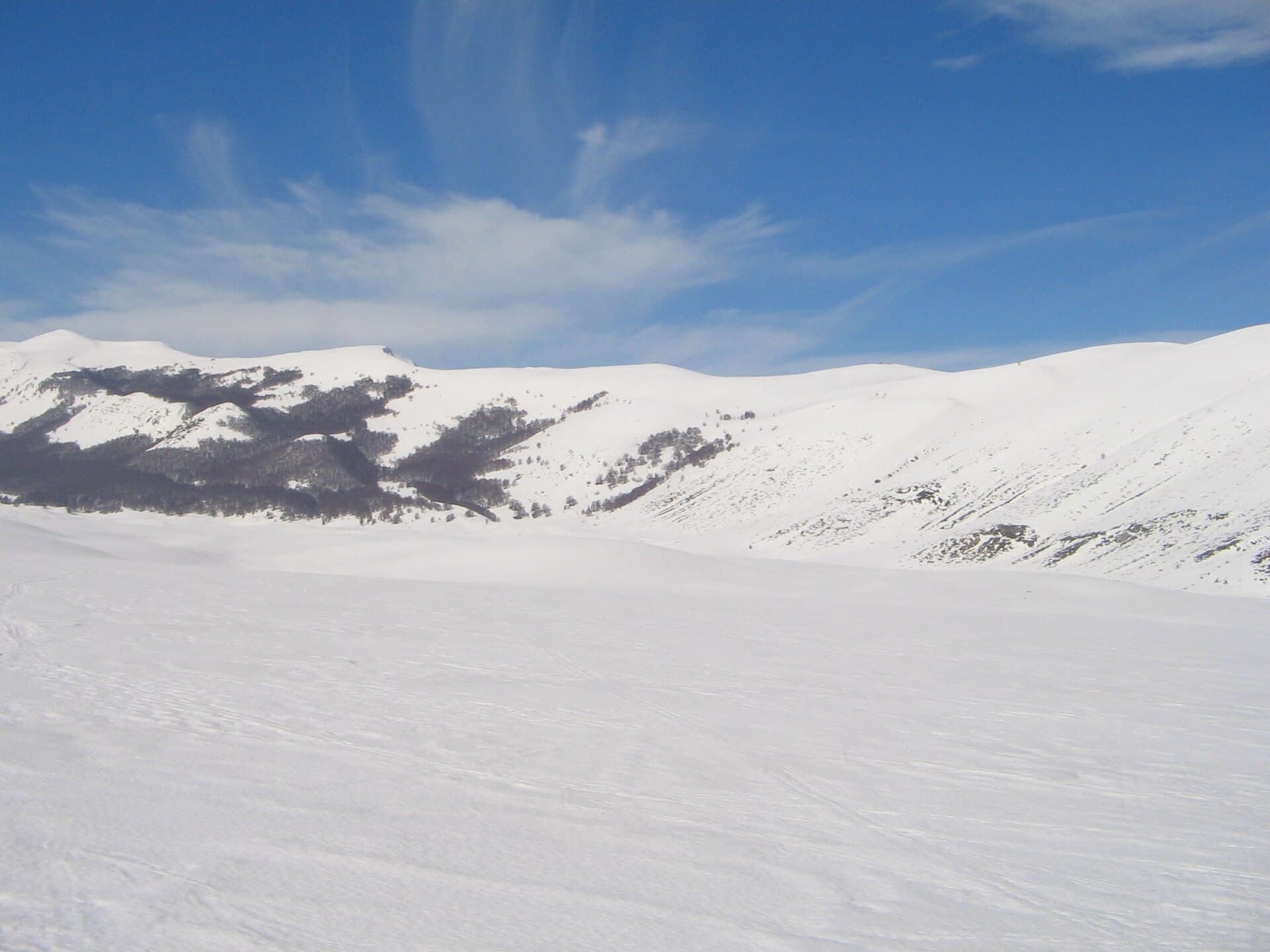
At over 1,500 meters in the Sirente-Velino Regional Park, Piani di Pezza is a broad karst plateau ringed by the Velino and Sirente massifs. Its flat meadows, sinkholes, and seasonal wetlands create a distinctive landscape that feels both open and enclosed by jagged limestone peaks. The area supports chamois, golden eagles, and colorful alpine flora, making it a rewarding destination for nature-focused visitors.

What to See and Do

Start with the easy loop across the central plain to appreciate the scale of the meadows and the surrounding ridges. Longer hikes lead to the summit of Monte Velino or along the ridge toward the Rocca di Cambio area. In early summer the plateau blooms with gentians and orchids; in autumn the larch forests on the slopes turn golden. Wildlife spotting is best at dawn or dusk from the edges of the meadows.

Practical Hiking Routes

  • Central plateau circuit: 4–6 km on mostly level ground, suitable for most fitness levels.
  • Monte Velino ascent: 12–14 km round trip with 800 m elevation gain, for experienced hikers.
  • Link to Campo Felice: A longer traverse passing through beech woods and offering ski-area views in winter.

Getting There

The plateau is reached by a winding mountain road from the SS5 near L’Aquila or from the Ovindoli side. The final stretch is unpaved and best suited to ordinary cars in dry conditions. Public transport is limited, so most visitors arrive by car and park at the trailhead near the small chapel.

Best Time to Visit

Late spring through early autumn offers the most comfortable hiking weather and accessible trails. Snow can linger into May and return by late October; winter visits require snowshoes or skis and avalanche awareness. July and August bring wildflower displays but also occasional afternoon thunderstorms.

Nearby Attractions

Combine a visit with the medieval hill town of Rocca di Mezzo, the Campo Felice ski resort, or the shores of Lake Scandarello. The Gran Sasso massif and its national park lie a short drive north, while the ancient ruins of Amiternum are reachable from L’Aquila.

Visitor tips

  • Carry plenty of water and sun protection; the open plateau offers little shade at midday.
  • Check weather forecasts carefullyu2014storms move in quickly over the surrounding peaks.
  • Wear sturdy boots; the karst surface is uneven and can be slippery when wet or frosted.

Frequently asked questions

Is Piani di Pezza suitable for families with children?+

The central meadow loop is flat and easy, making it family-friendly, but longer routes to the ridges require good fitness and supervision.

Are there facilities like toilets or cafu00e9s on the plateau?+

There are no permanent services; bring everything you need and plan to return to nearby villages for meals or supplies.

Can I visit in winter without special equipment?+

Deep snow usually covers the access road and plateau from December to March, so snowshoes or cross-country skis are recommended.

How far is Piani di Pezza from Lu2019Aquila?+

The drive takes about 45 minutes via the SS5 and the mountain road, depending on road conditions.

Is wild camping allowed on the plateau?+

Camping is restricted; overnight stays are permitted only in designated areas or at nearby rifugiu2014check current park rules before planning.

Share
Google Maps Apple Maps Directions

Visitor info

  • 24/7

Contact info via © OpenStreetMap contributors

Image: Public domain · via Wikimedia Commons

Keep reading

Nearby & related

All stories
T
Abruzzo

Toppe Vurgo: Hiking Abruzzo’s Quiet Apennine Summit

A rewarding day hike to sweeping limestone views in Italy’s lesser-visited central highlands.

20 August 2026
M
Abruzzo

Monte del Casale: Hiking Abruzzo’s Quiet Apennine Summit

A rewarding, low-crowd mountain hike in central Abruzzo offering sweeping views across the Majella and Gran Sasso…

20 August 2026
M
Abruzzo

Monte Piselli: Hiking the Quiet Ridges of Abruzzo’s Gran Sasso

Traverse beech forests and limestone ridges on this overlooked peak inside Italy’s largest national park.

20 August 2026