Skip to content
Plan & Tour
DestinationsItinerariesTravel BlogAboutContact
0Sign inPlan a trip
Plan & TourPlan & Tour

Travel guides, destination inspiration and curated itineraries for Canada, the USA and beyond, plus a free tool to plan your own day-by-day trip.

Get travel inspiration

Explore

  • All Destinations
  • Curated Itineraries
  • Travel Blog
  • Plan a Trip

Topics

  • Hiking & Nature
  • Food & Drink
  • City Breaks
  • Budget Travel

Company

  • About Us
  • Contact
  • Privacy Policy
  • Terms of Service

© 2026 Plan & Tour. Built for travellers.

Discover the world, one trip at a time.

Ollagüe: Climbing Bolivia’s Active Border Volcano
  1. Home
  2. Destinations
  3. Nor Lípez Province
  4. Ollagüe: Climbing Bolivia’s Active Border Volcano
Mountain

Ollagüe: Climbing Bolivia’s Active Border Volcano

Hike the fumarole-lined crater of this 5,870-meter stratovolcano on the Bolivia-Chile frontier for sweeping Altiplano vistas.

Nor Lípez ProvinceUpdated 11 October 2026

Why Ollagüe Stands Out

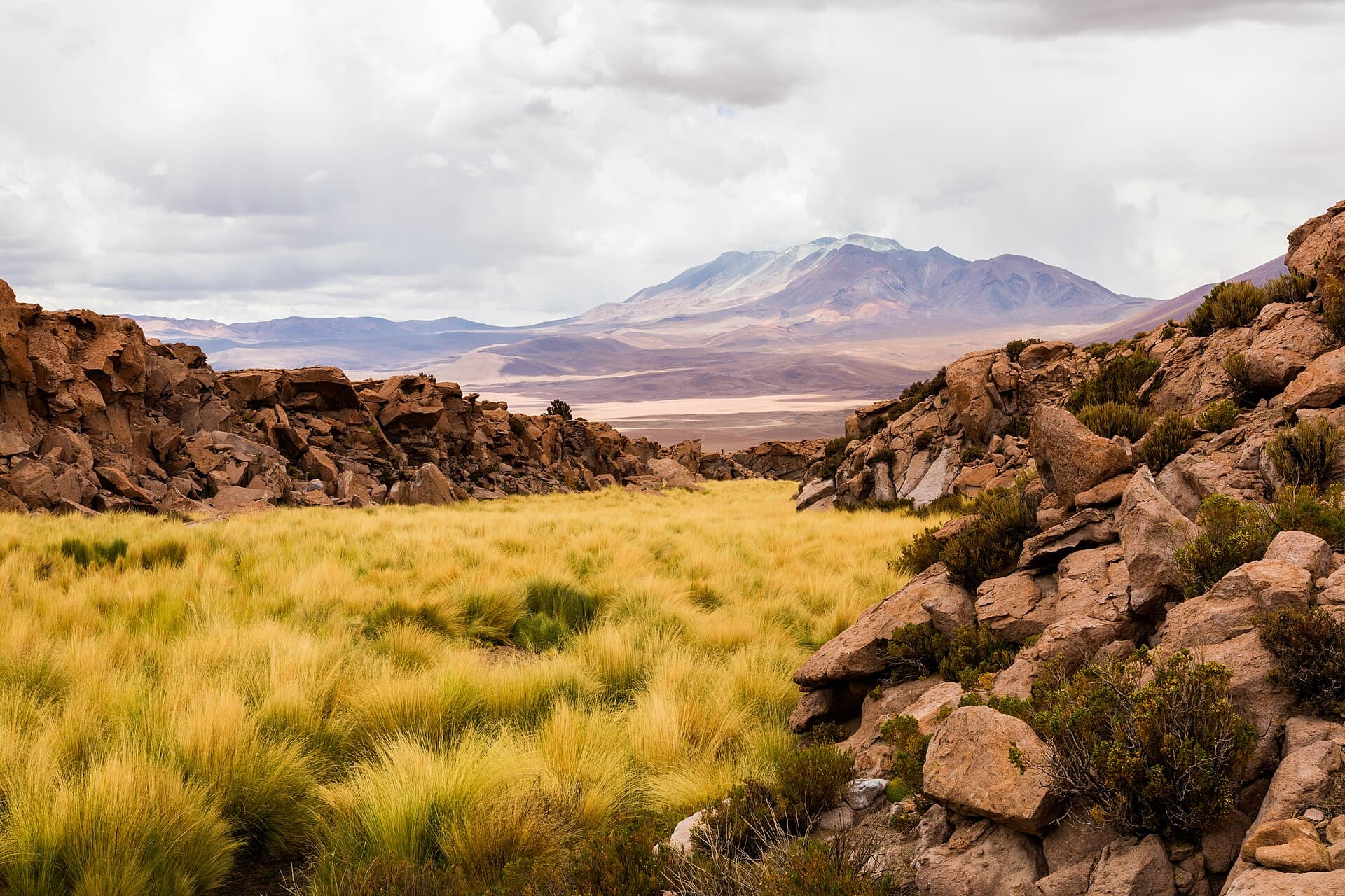
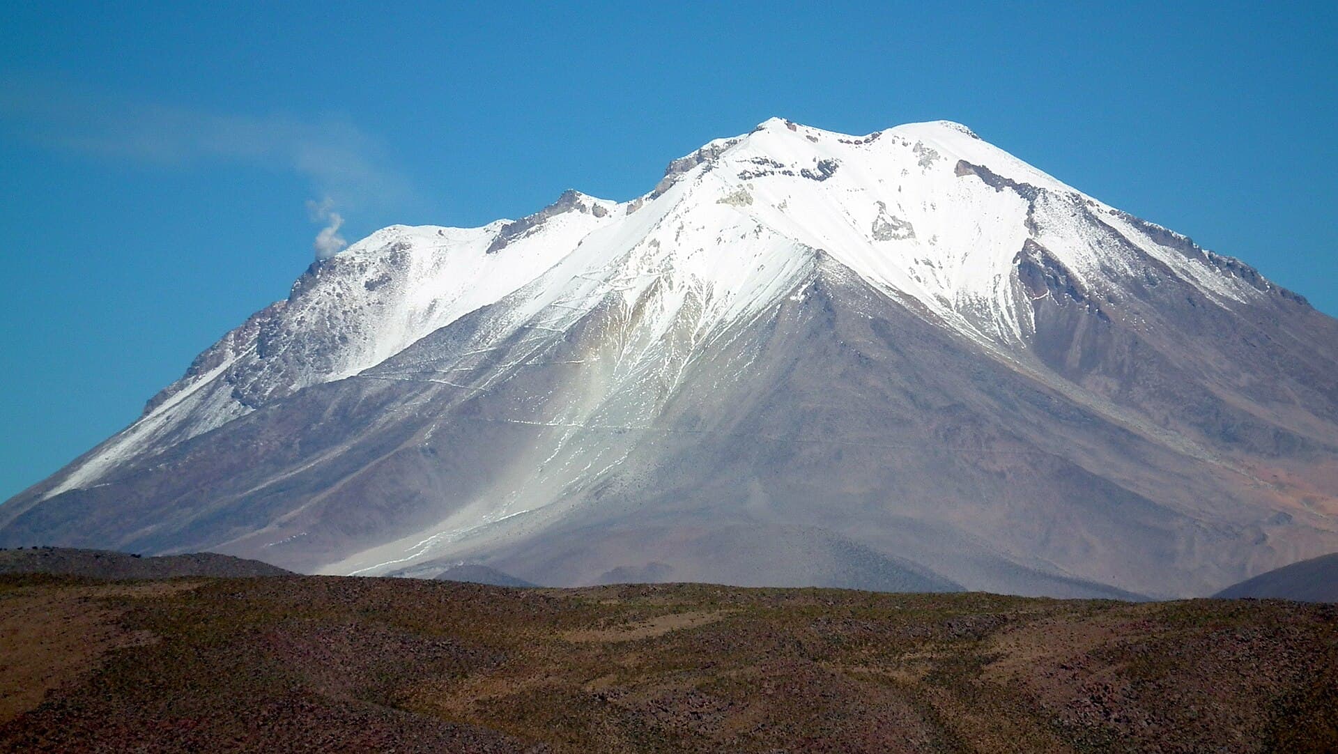
Ollagüe rises as a stark, symmetrical cone above the high desert of Nor Lípez Province. Its active status shows in persistent fumaroles that stain the crater walls yellow and gray, creating one of the most accessible volcanic landscapes in the Bolivian Andes. The mountain sits directly on the international border, so clear days reveal Chilean volcanoes such as Aucanquilcha and the distant Salar de Atacama basin.

Getting There

Most visitors reach Ollagüe from Uyuni. A scheduled train stops at the small border town of Ollagüe, or 4×4 tours continue over rough tracks past the village of Chiguana. From the town, a mining road climbs toward the volcano’s western flank; the final approach is on foot or with a high-clearance vehicle. Allow a full day from Uyuni, including border formalities if continuing into Chile.

Best Time to Visit

The dry season from May through October brings stable weather and firm ground for hiking. Afternoon winds are common, so early starts are essential. November to April sees occasional snow and electrical storms that can close routes.

Climbing the Volcano

The standard route begins at roughly 4,800 meters and ascends gentle scree slopes to the crater rim. The hike takes six to eight hours round-trip for fit acclimatized walkers. Highlights include steaming vents, sulfur-encrusted rocks, and panoramic views of the Salar de Coipasa and the Eduardo Avaroa reserve to the east. No technical gear is required, yet the altitude demands slow pacing and frequent rest stops.

Nearby Attractions

  • Train spotting at Ollagüe station, where freight cars cross the border daily.
  • Hot springs at Polques, a short detour on the return toward Uyuni.
  • The vast salt flats of the Salar de Uyuni and the colored lagoons of the southern reserve, both reachable within a day’s drive.

Practical Considerations

Carry at least three liters of water per person and sun protection at this elevation. A local guide or tour operator familiar with the border zone is recommended for route finding and emergency support.

Visitor tips

  • Acclimatize for at least two nights in Uyuni (3,650 m) before attempting the summit to reduce altitude-sickness risk.
  • Travel with a licensed Bolivian operator who carries oxygen and knows current border crossing rules.
  • Pack windproof layers and start the hike at dawn; temperatures can drop below freezing even in the dry season.

Frequently asked questions

How high is Ollagu00fce and how difficult is the climb?+

The summit reaches 5,870 meters. The hike is strenuous due to altitude but non-technical; most fit hikers complete it in a long day with proper acclimatization.

Do I need a permit or guide to climb Ollagu00fce?+

No special climbing permit is required, but a local guide is strongly advised for navigation and safety on the remote border slopes.

Can I cross into Chile from Ollagu00fce?+

Yes, the border post at Ollagu00fce town allows pedestrian and vehicle crossings during daylight hours with valid passports and vehicle papers.

What should I bring for a day on Ollagu00fce?+

Plenty of water, sun hat, wind jacket, warm layers, snacks, and a basic first-aid kit. Trekking poles help on loose scree.

Are there facilities or lodging near the mountain?+

Only basic services exist in Ollagu00fce town. Most visitors overnight in Uyuni or camp at established high camps on the volcanou2019s lower slopes.

Share
Google Maps Apple Maps Directions

Image: Albert Backer · CC BY-SA 3.0 · via Wikimedia Commons

Keep reading

Nearby & related

All stories
P
Nor Lípez Province

Pampa Luxsar: Bolivia’s Remote Andean Mountain in Nor Lípez

A stark volcanic peak offering solitude, sweeping altiplano views, and access to the dramatic landscapes of southwest…

12 October 2026
P
Nor Lípez Province

Paruma: Hiking Bolivia’s Remote Stratovolcano in Nor Lípez

A stark, high-altitude Andean peak offering solitude, volcanic landscapes, and sweeping views over the Bolivian…

11 October 2026
Olca Volcano: Hiking Bolivia’s Remote Andean Stratovolcano
Nor Lípez Province

Olca Volcano: Hiking Bolivia’s Remote Andean Stratovolcano

A guide to reaching, exploring, and understanding Olca, the striking 5,407-meter volcano on Bolivia’s western Altiplano.

11 October 2026