Why Mount Mageik Stands Out
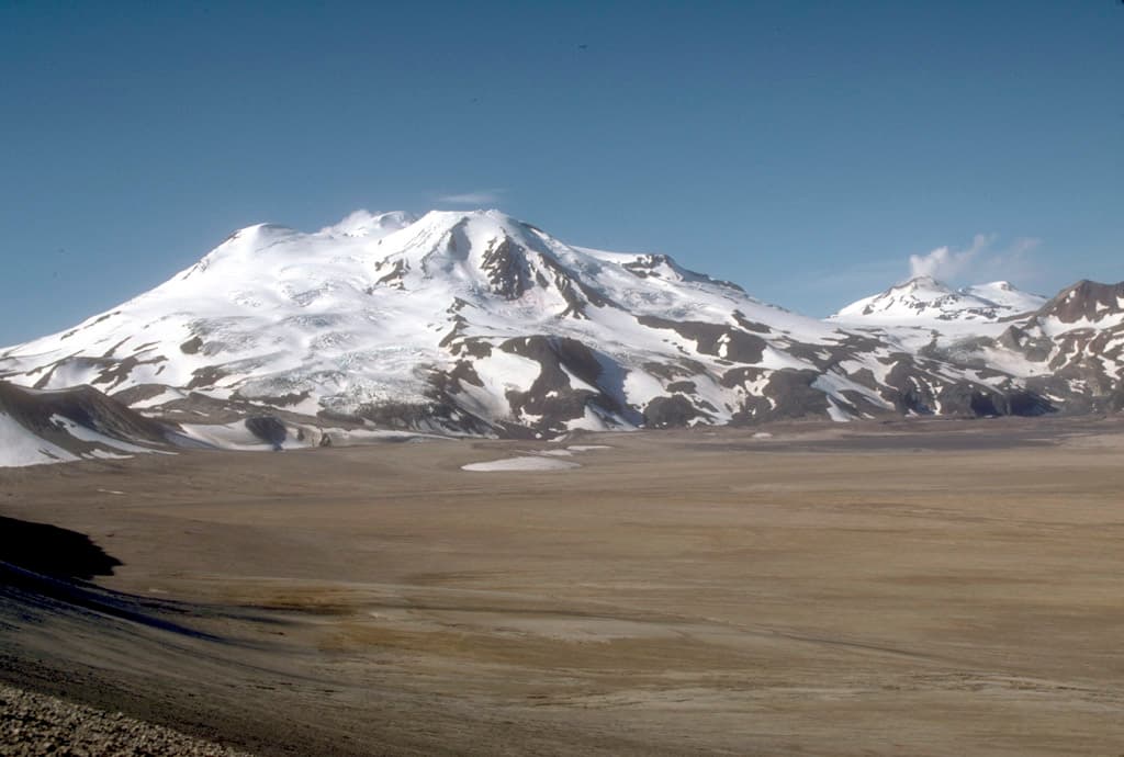
Mount Mageik rises to 7,350 feet as part of the active volcanic cluster within Katmai National Park and Preserve. Its steep slopes and summit crater overlook the Valley of Ten Thousand Smokes, the vast ash-flow plain created by the 1912 Novarupta eruption. The mountain provides a tangible connection to ongoing geological processes while serving as habitat for brown bears, caribou, and Dall sheep.
Reaching the Mountain
Access begins with a flight to King Salmon, followed by a float-plane or boat transfer to Brooks Camp. From there, visitors continue by float plane to the Mageik Lakes area or hike along established trails that skirt the lower flanks. No roads reach the peak, so every approach involves small aircraft or foot travel across tundra and volcanic debris.
Best Time to Visit
June through early September offers the most reliable weather and longest daylight for travel. Snow lingers on higher slopes into July, while August brings peak berry season that draws bears to lower elevations. Shoulder months can deliver clear views but require greater self-sufficiency for weather changes.
Activities on and Around the Peak
Day hikes from Mageik Lakes lead to viewpoints of the summit and adjacent Trident Volcano. Longer routes traverse ridgelines for expansive panoramas of the Aleutian Range. Photographers often position themselves near fumaroles on the lower slopes for steam plumes against the volcanic backdrop. Anglers find trout in nearby streams, and wildlife viewing remains excellent throughout the area.
Essential Preparation
Travelers must carry bear-resistant food containers, navigation tools, and layers for rapid weather shifts. Guided trips with authorized outfitters provide the safest introduction to the terrain and reduce the risk of disorientation in fog.
Nearby Destinations
The Valley of Ten Thousand Smokes lies immediately east, accessible by shuttle bus from Brooks Camp. Brooks Falls offers world-famous bear viewing, while the summit of nearby Mount Katmai provides another strenuous climb for experienced hikers. The entire region forms part of the larger volcanic arc that continues westward along the Alaska Peninsula.