Skip to content
Plan & Tour
DestinationsItinerariesTravel BlogAboutContact
0Sign inPlan a trip
Plan & TourPlan & Tour

Travel guides, destination inspiration and curated itineraries for Canada, the USA and beyond, plus a free tool to plan your own day-by-day trip.

Get travel inspiration

Explore

  • All Destinations
  • Curated Itineraries
  • Travel Blog
  • Plan a Trip

Topics

  • Hiking & Nature
  • Food & Drink
  • City Breaks
  • Budget Travel

Company

  • About Us
  • Contact
  • Privacy Policy
  • Terms of Service

© 2026 Plan & Tour. Built for travellers.

Discover the world, one trip at a time.

Mount Alverstone: Climbing Alaska’s Remote Saint Elias Border Peak
  1. Home
  2. Destinations
  3. Alaska
  4. Mount Alverstone: Climbing Alaska’s Remote Saint Elias Border Peak
Mountain

Mount Alverstone: Climbing Alaska’s Remote Saint Elias Border Peak

An expert guide to reaching and climbing this formidable peak on the Alaska-Yukon boundary inside Wrangell-St. Elias National Park.

AlaskaUpdated 14 August 2026

Why Mount Alverstone Draws Serious Mountaineers

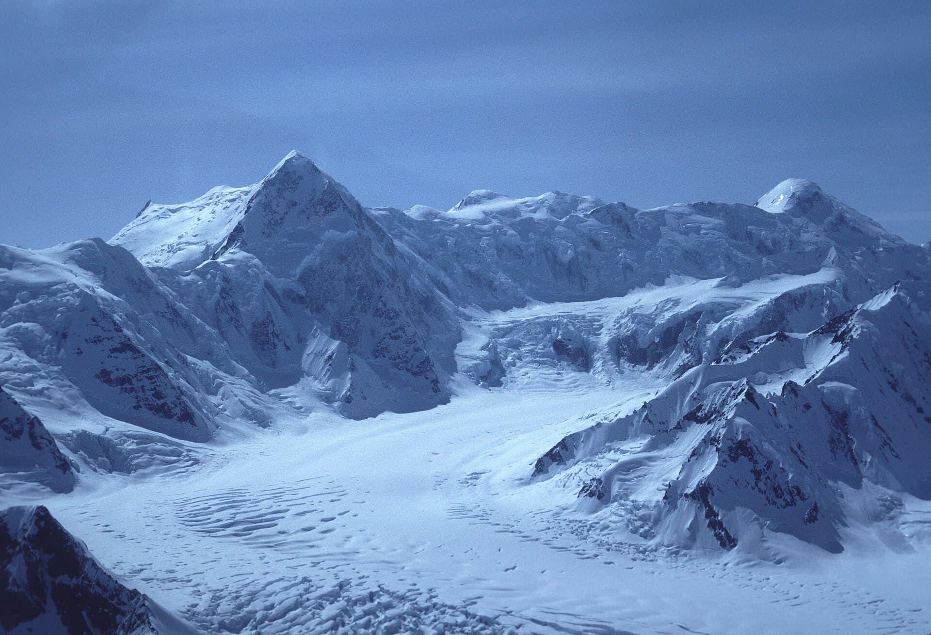
Mount Alverstone rises to 14,565 feet along the Alaska-Yukon border, forming part of the Saint Elias Mountains’ dramatic crest. Its steep rock and ice faces, combined with extreme isolation, attract only experienced climbers seeking a true wilderness ascent. The peak offers sweeping views across the largest non-polar icefield in the world and stands as one of North America’s most remote 14,000-foot summits.

Getting There

Access begins with flights to Yakutat, Alaska, or Whitehorse, Yukon. From there, travelers arrange bush-plane flights or helicopter support into the Alverstone Glacier or nearby landing zones. No roads reach the mountain; all approaches involve glacier travel or technical climbing routes. Most parties fly directly to high camps on the Hubbard or Alverstone Glacier systems.

Best Time to Visit

The climbing season runs from late May through early September when daylight is longest and avalanche risk is lower. June and July typically provide the most stable weather windows, though storms can arrive quickly even then. Winter ascents are possible only for highly prepared expeditions equipped for extreme cold and darkness.

What to See and Do

Most visitors come to attempt the standard West Ridge or South Face routes, both requiring glacier travel, crevasse navigation, and mixed rock-and-ice climbing. Non-climbers can join flightseeing tours that circle the peak or land on nearby glaciers for short hikes. Photographers prize the dramatic contrast between the mountain’s dark rock and surrounding icefields.

Essential Preparation

  • Strong glacier-travel and crevasse-rescue skills are mandatory.
  • Carry satellite communication devices; cell service is nonexistent.
  • Plan for multi-day commitments with full self-sufficiency for weather delays.

Nearby Attractions

The surrounding Wrangell-St. Elias National Park offers additional objectives such as Mount Logan’s lower flanks and the massive Malaspina Glacier. Visitors often combine an Alverstone trip with exploration of the historic mining town of McCarthy or rafting on the Copper River.

Visitor tips

  • Hire a local guide service familiar with Saint Elias logistics and weather patterns.
  • File a detailed trip plan with park rangers and share satellite coordinates with a trusted contact.
  • Pack extra fuel and food; weather can strand parties for several days on the glaciers.

Frequently asked questions

Do I need a permit to climb Mount Alverstone?+

No special climbing permit is required, but registration with Wrangell-St. Elias National Park is strongly recommended for safety tracking.

How long does a typical expedition take?+

Most teams plan 10 to 14 days round-trip from Yakutat, including weather days and the multi-day glacier approach.

Is Mount Alverstone suitable for first-time mountaineers?+

No. The peak demands advanced glacier travel, crevasse rescue, and technical climbing experience in remote conditions.

What wildlife might I encounter?+

Bears, wolves, and mountain goats inhabit lower elevations; keep all food secured and maintain distance from any animals.

Can I reach the summit without flying?+

Overland approaches from the coast take weeks and cross extremely difficult terrain; nearly all successful climbs rely on air support.

Share
Google Maps Apple Maps Directions

Image: Gary Clark · CC BY-SA 3.0 · via Wikimedia Commons

Keep reading

Nearby & related

All stories
Sagavanirktok River: Rafting Alaska’s Remote Arctic Frontier
North Slope Borough

Sagavanirktok River: Rafting Alaska’s Remote Arctic Frontier

Experience the wild, roadless beauty of one of Alaska’s northernmost rivers on the North Slope.

17 August 2026
Buckland River: Remote Wilderness Fishing in Alaska’s Arctic Frontier
Northwest Arctic Borough

Buckland River: Remote Wilderness Fishing in Alaska’s Arctic Frontier

Paddle, fish, and explore the untouched Buckland River deep in northwest Alaska’s Arctic landscape.

17 August 2026
Gulkana River: Alaska’s Premier Salmon Fishing and Wilderness Float
Southeast Fairbanks Census Area

Gulkana River: Alaska’s Premier Salmon Fishing and Wilderness Float

The Gulkana River delivers remote Alaska wilderness, world-class salmon runs, and scenic multi-day floats in the Copper…

17 August 2026