Skip to content
Plan & Tour
DestinationsItinerariesTravel BlogAboutContact
0Sign inPlan a trip
Plan & TourPlan & Tour

Travel guides, destination inspiration and curated itineraries for Canada, the USA and beyond, plus a free tool to plan your own day-by-day trip.

Get travel inspiration

Explore

  • All Destinations
  • Curated Itineraries
  • Travel Blog
  • Plan a Trip

Topics

  • Hiking & Nature
  • Food & Drink
  • City Breaks
  • Budget Travel

Company

  • About Us
  • Contact
  • Privacy Policy
  • Terms of Service

© 2026 Plan & Tour. Built for travellers.

Discover the world, one trip at a time.

Mayo Tsanaga River: Exploring Cameroon’s Remote Far North Waterway
  1. Home
  2. Destinations
  3. Far North
  4. Mayo Tsanaga River: Exploring Cameroon’s Remote Far North Waterway
River

Mayo Tsanaga River: Exploring Cameroon’s Remote Far North Waterway

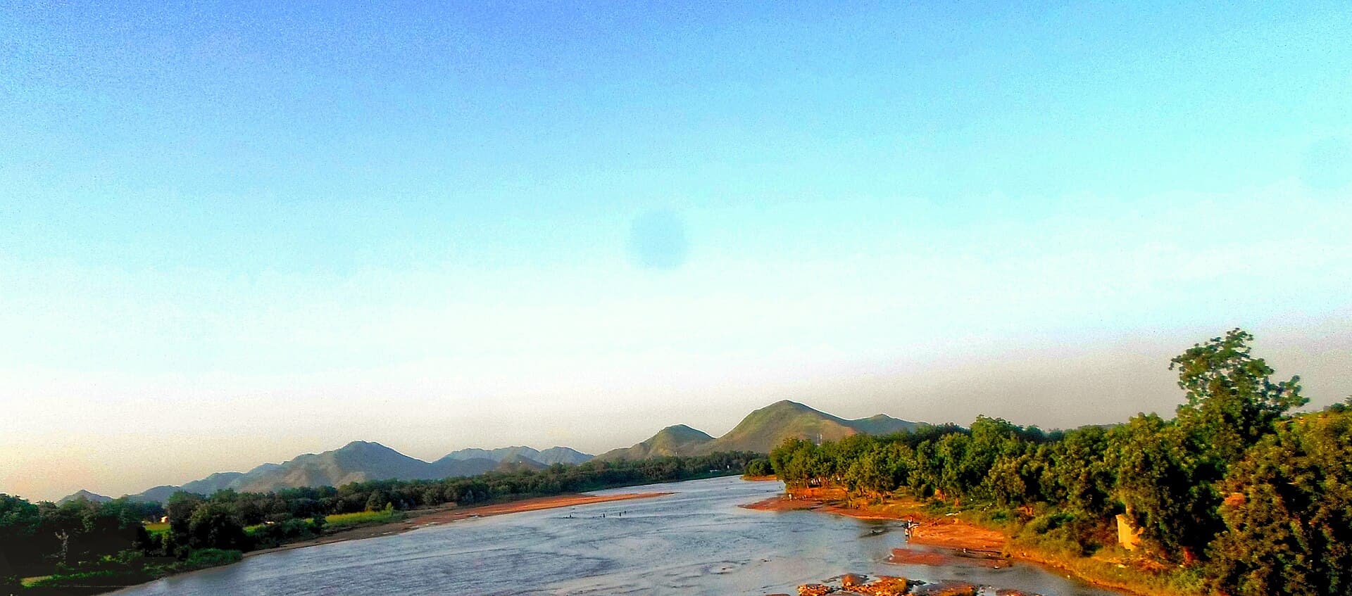
This seasonal river cuts through the Mandara foothills near Maroua, offering visitors a glimpse of Sahelian landscapes, village life, and seasonal wildlife.

Far NorthUpdated 30 October 2026

Why the Mayo Tsanaga River Draws Visitors

The Mayo Tsanaga flows across the flat, semi-arid plains of Cameroon’s Far North Region, eventually joining the Logone system that feeds Lake Chad. Its wide, sandy bed and scattered pools create a striking contrast with the surrounding dry savanna and the rugged Mandara Mountains to the west. Travelers come for the quiet scenery, the chance to observe daily life along its banks, and the proximity to both natural and cultural sites.

Things to See and Do

Walk or drive along the river’s course east of Maroua to watch cattle herds crossing at traditional fords and women washing clothes at shallow pools. In the wet season the water spreads into seasonal wetlands that attract storks, herons, and other waterbirds. Local fishermen use woven traps and small dugout canoes; respectful visitors can observe these techniques from the bank. Short hikes into the nearby foothills reveal granite outcrops and terraced fields tended by Kapsiki and Mafa communities.

Practical Activities

  • Early-morning or late-afternoon drives along the river track for photography and birdwatching.
  • Visits to riverside villages to see traditional mud-brick compounds and market gardens irrigated by the river.
  • Combined day trips with nearby Waza National Park or the Rhumsiki valley for a full picture of the region’s landscapes.

Getting There

Most visitors base themselves in Maroua, the regional capital, then take a 30- to 45-minute drive east on graded tracks that follow the river. Four-wheel-drive vehicles are useful after heavy rains when tracks become muddy. Public transport is limited; shared taxis or motorcycle taxis can reach villages along the lower course, but independent travelers usually arrange a driver through local hotels.

Best Time to Visit

The dry season from November to April offers the most reliable access and clearer views of the riverbed and wildlife. From June to September the river can rise quickly after storms, cutting off tracks and increasing mosquito activity. Early dry season (November–December) brings green vegetation along the banks; late dry season (March–April) concentrates animals around remaining pools.

Nearby Places Worth Combining

The river lies between Maroua’s bustling markets and the dramatic granite peaks of the Mandara Mountains. A single day can include the river, the terraced villages of Rhumsiki, and the wildlife viewing tracks of Waza National Park to the north.

Visitor tips

  • Carry plenty of water and sun protection; shade is scarce along most stretches of the river.
  • Hire a local guide from a riverside village to navigate tracks and introduce you to fishing or farming practices.
  • Travel with a 4x4 or reliable driver after any rain, as the clay tracks turn slippery quickly.

Frequently asked questions

Is the Mayo Tsanaga River safe for swimming?+

Most sections are shallow with strong seasonal currents and occasional crocodiles; swimming is not recommended without local advice.

Do I need a special permit to visit the river?+

No special permit is required for the river itself, but travel in the Far North Region may involve checkpoints; carry your passport and obtain any required regional authorization in Maroua.

What wildlife can I expect to see?+

Waterbirds, monitor lizards, and occasionally hippos or crocodiles in deeper pools during the dry season; larger mammals are more common inside nearby Waza National Park.

Are there places to stay right by the river?+

Accommodation is concentrated in Maroua; simple guesthouses exist in villages along the lower river, but most visitors return to Maroua each night.

Can I visit during the rainy season?+

Access becomes difficult and some tracks flood; the period is better suited to those already based in Maroua who can check local conditions daily.

Share
Google Maps Apple Maps Directions

Image: Oncoulhamadou · CC BY-SA 4.0 · via Wikimedia Commons

Keep reading

Nearby & related

All stories
M
Far North

Massif de Mora: Hiking Cameroon’s Dramatic Far North Mountains

Discover the rugged volcanic landscapes, hiking trails, and Mandara Mountain culture at Massif de Mora near the town of…

30 October 2026
The Cultural Center and Museum of the Logone Valley: Exploring Cameroon’s Far North Heritage
Far North

The Cultural Center and Museum of the Logone Valley: Exploring Cameroon’s Far North Heritage

This museum preserves the artistic traditions, archaeological finds, and living cultures of the Logone Valley in a…

30 October 2026
T
Far North

Tikem Lake: A Remote Natural Retreat in Cameroon’s Far North

Discover the quiet shores and surrounding savanna of Tikem Lake, a hidden highland body of water ideal for…

28 October 2026