Skip to content
Plan & Tour
DestinationsItinerariesTravel BlogAboutContact
0Sign inPlan a trip
Plan & TourPlan & Tour

Travel guides, destination inspiration and curated itineraries for Canada, the USA and beyond, plus a free tool to plan your own day-by-day trip.

Get travel inspiration

Explore

  • All Destinations
  • Curated Itineraries
  • Travel Blog
  • Plan a Trip

Topics

  • Hiking & Nature
  • Food & Drink
  • City Breaks
  • Budget Travel

Company

  • About Us
  • Contact
  • Privacy Policy
  • Terms of Service

© 2026 Plan & Tour. Built for travellers.

Discover the world, one trip at a time.

I
  1. Home
  2. Destinations
  3. Nor Lípez Province
  4. Irruputuncu: Bolivia’s Remote Border Volcano in Nor Lípez
Mountain

Irruputuncu: Bolivia’s Remote Border Volcano in Nor Lípez

A high-altitude Andean stratovolcano offering stark altiplano views and solitude on the Bolivia-Chile frontier.

Nor Lípez ProvinceUpdated 11 October 2026

Why Visit Irruputuncu

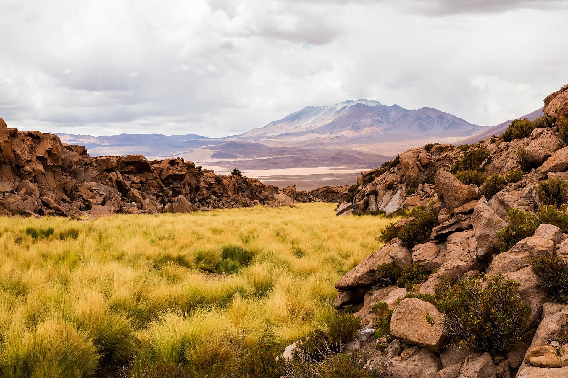
Irruputuncu rises to 5,163 meters on the Bolivia-Chile border in Nor Lípez Province, its symmetrical cone dominating the arid plateau. The mountain rewards visitors with expansive views of neighboring volcanoes, salt-encrusted basins, and occasional fumarolic activity visible from the upper slopes. Its remote location keeps crowds away, making it ideal for travelers seeking authentic high-Andean wilderness rather than developed trails.

Getting There

Most visitors reach the area on multi-day 4×4 tours departing from Uyuni, passing through the Eduardo Avaroa Andean Fauna National Reserve. Independent travelers with high-clearance vehicles can follow the unpaved road south from Uyuni toward the border post at Hito Cajones, then branch west toward the volcano. The final approach requires navigating rough volcanic gravel; a local guide familiar with unmarked tracks is strongly recommended. No public transport serves the mountain directly.

Best Time to Visit

The dry season from May through October brings stable weather, clear skies for photography, and passable roads. Daytime temperatures are cool while nights drop well below freezing; afternoon winds are common. The wet season (November–April) can render tracks impassable and obscure views with clouds or snow.

What to Do

Short hikes along the lower slopes reveal colorful mineral deposits and hardy cushion plants. Photographers favor sunrise from the eastern flanks for dramatic light on the cone and distant salt flats. Birders may spot Andean flamingos at nearby seasonal lagoons. The crater rim itself is rarely climbed due to loose scree and border sensitivities; most travelers content themselves with circumnavigating the base. Combine the visit with stops at nearby hot springs or the striking Laguna Colorada for a full day in the reserve.

Nearby Attractions

The same 4×4 circuit typically includes the polychrome Laguna Colorada, the Sol de Mañana geyser field, and the vast Salar de Uyuni. Further north, the colonial village of San Pablo de Lípez offers basic supplies and a glimpse of traditional altiplano life. Across the border, Chile’s Ollagüe volcano provides a mirror-image perspective on clear days.

Visitor tips

  • Acclimatize for at least two nights in Uyuni (3,665 m) before ascending to avoid altitude sickness.
  • Carry extra fuel, water, and a satellite communicator; cell service is nonexistent beyond the main reserve roads.
  • Hire a licensed local driver-guide who knows current border regulations and unmarked access tracks.

Frequently asked questions

How high is Irruputuncu and is it difficult to climb?+

The summit reaches 5,163 m. Most visitors do not attempt the loose, steep upper slopes; the mountain is usually admired from its base or lower ridges.

Do I need a special permit to visit Irruputuncu?+

No specific permit is required for the Bolivian side, but you must register at the Eduardo Avaroa reserve entrance and carry your passport for possible border checks.

Is Irruputuncu an active volcano?+

It shows fumarolic activity but has no recorded historical eruptions; the risk level remains low for careful visitors staying below the crater.

What should I pack for a day trip to the mountain?+

Layered windproof clothing, sunscreen, at least 2 liters of water per person, snacks, and a basic first-aid kit for altitude-related issues.

Can I cross into Chile from Irruputuncu?+

There is no official border crossing at the volcano; travelers must return to the Hito Cajones post or continue to established crossings near Ollagu00fce.

Share
Google Maps Apple Maps Directions

Keep reading

Nearby & related

All stories
P
Nor Lípez Province

Pampa Luxsar: Bolivia’s Remote Andean Mountain in Nor Lípez

A stark volcanic peak offering solitude, sweeping altiplano views, and access to the dramatic landscapes of southwest…

12 October 2026
P
Nor Lípez Province

Paruma: Hiking Bolivia’s Remote Stratovolcano in Nor Lípez

A stark, high-altitude Andean peak offering solitude, volcanic landscapes, and sweeping views over the Bolivian…

11 October 2026
Olca Volcano: Hiking Bolivia’s Remote Andean Stratovolcano
Nor Lípez Province

Olca Volcano: Hiking Bolivia’s Remote Andean Stratovolcano

A guide to reaching, exploring, and understanding Olca, the striking 5,407-meter volcano on Bolivia’s western Altiplano.

11 October 2026