Skip to content
Plan & Tour
DestinationsItinerariesTravel BlogAboutContact
0Sign inPlan a trip
Plan & TourPlan & Tour

Travel guides, destination inspiration and curated itineraries for Canada, the USA and beyond, plus a free tool to plan your own day-by-day trip.

Get travel inspiration

Explore

  • All Destinations
  • Curated Itineraries
  • Travel Blog
  • Plan a Trip

Topics

  • Hiking & Nature
  • Food & Drink
  • City Breaks
  • Budget Travel

Company

  • About Us
  • Contact
  • Privacy Policy
  • Terms of Service

© 2026 Plan & Tour. Built for travellers.

Discover the world, one trip at a time.

Homathko River: Rafting, Wildlife, and Wilderness in British Columbia’s Coast Mountains
  1. Home
  2. Destinations
  3. British Columbia
  4. Homathko River: Rafting, Wildlife, and Wilderness in British Columbia’s Coast Mountains
River

Homathko River: Rafting, Wildlife, and Wilderness in British Columbia’s Coast Mountains

A remote river valley offering world-class whitewater and grizzly habitat deep in British Columbia's Coast Mountains.

British ColumbiaUpdated 1 August 2026

Why Visit the Homathko River

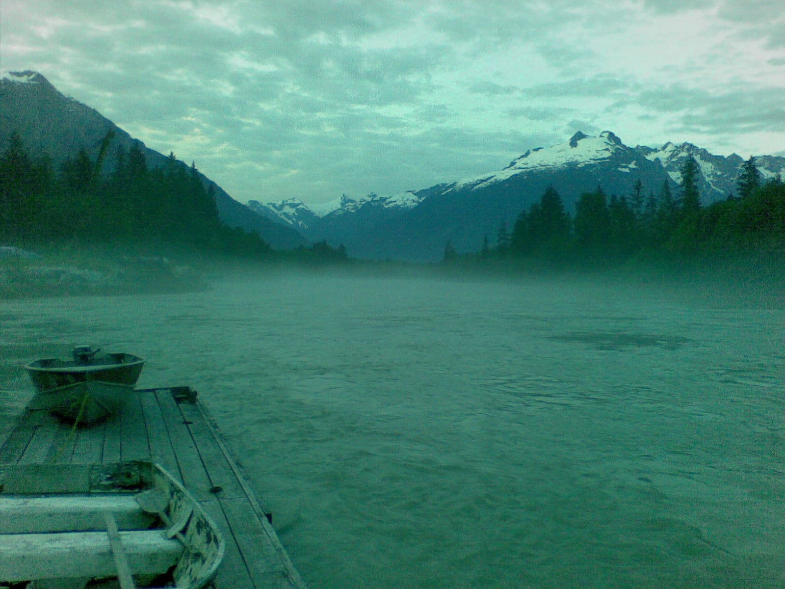
The Homathko River carves a dramatic path from the Chilcotin Plateau through steep Coast Mountain canyons before emptying into Bute Inlet. Its combination of powerful rapids, old-growth forest, and abundant salmon runs creates one of the most pristine wilderness river corridors in southern British Columbia. Visitors experience genuine remoteness without the crowds found on more accessible rivers.

Getting There

Access begins with a long drive from Vancouver via Highway 99 and Highway 20 to Williams Lake, then south on the rough Tatlayoko Lake Forest Service Road. Many travelers arrange float-plane flights from Campbell River or Bella Coola directly to Tatlayoko Lake, shortening the journey and providing aerial views of the river’s canyon. The final approach to the river itself often requires a jet boat or helicopter shuttle arranged through local outfitters.

What to See and Do

Whitewater Rafting and Kayaking

The river’s continuous Class III–V rapids through the Homathko Canyon draw experienced paddlers. Multi-day trips descend the full length of the runnable section, camping on gravel bars beside the water. The cold, glacial-fed current demands solid whitewater skills and proper gear.

Wildlife Viewing

Sockeye and chinook salmon migrate upriver each year, attracting grizzly bears to the lower reaches and estuary. Patient observers may also spot mountain goats on canyon walls and black bears in the valley bottoms. Early morning and evening are the best times for sightings along the riverbanks.

Hiking and Exploration

Short trails lead to viewpoints above the canyon and to small lakes in side valleys. Longer backpacking routes connect to the Waddington Range and the peaks surrounding Mount Waddington, North America’s highest mountain entirely within British Columbia.

Best Time to Visit

July through early September offers the most reliable water levels for rafting and the highest chance of clear weather. Late August and September bring peak salmon runs and active grizzlies. Shoulder months of June and October can work for experienced travelers but bring higher water or early snow risk.

Nearby Destinations

Combine a Homathko trip with visits to Tatlayoko Lake for canoeing, the Chilcotin River for easier floating, or the coastal inlets of Bute and Knight for sea kayaking. The region also serves as a gateway to the more remote Klinaklini River and the Great Bear Rainforest.

Visitor tips

  • Book all transportation and guiding well in advance; the area has no public facilities and limited operator capacity.
  • Pack layers for rapid weather changes and bring bear spray plus a satellite communicator for the remote sections.
  • Choose a reputable local outfitter for any river travel; the canyon contains serious rapids and few escape routes.

Frequently asked questions

Do I need a guide to raft the Homathko River?+

Yes. The river's remote location, continuous rapids, and lack of road access make guided trips the only safe option for most visitors.

How long does a typical trip take?+

Most commercial rafting expeditions last four to six days from put-in to Bute Inlet, including time for wildlife viewing and side hikes.

Are there any developed campgrounds along the river?+

No. Camping occurs on natural gravel bars or designated wilderness sites; visitors must practice Leave No Trace principles and pack out all waste.

What wildlife is most likely to be seen?+

Grizzly bears fishing for salmon are the main attraction in late summer, along with mountain goats on the cliffs and occasional wolves or wolverines.

Can I drive to the river in a regular car?+

No. The final access roads are rough logging routes requiring high-clearance 4x4 vehicles, and most travelers use float planes or guided boat transfers instead.

Share
Google Maps Apple Maps Directions

Image: Matt P. Crawford · CC BY 3.0 · via Wikimedia Commons

Keep reading

Nearby & related

All stories
Vedder River: Salmon Fishing, Paddling and Riverside Trails in British Columbia
British Columbia

Vedder River: Salmon Fishing, Paddling and Riverside Trails in British Columbia

A clear, productive river in the Fraser Valley offering consistent chinook and coho runs, easy paddling and quiet hiking…

1 August 2026
E
British Columbia

Englishman River: Waterfalls, Forests and Salmon Runs on Vancouver Island

Hike to dramatic waterfalls, swim in clear pools, and watch salmon spawn along this Vancouver Island river.

1 August 2026
B
British Columbia

Bella Coola River: Wilderness Fishing and Grizzly Viewing in British Columbia’s Great Bear Rainforest

This remote river in the Bella Coola Valley offers world-class steelhead and salmon fishing, abundant wildlife, and…

1 August 2026


