
Skip to content
Plan & Tour
DestinationsItinerariesTravel BlogAboutContact
0Sign inPlan a trip
Plan & TourPlan & Tour

Travel guides, destination inspiration and curated itineraries for Canada, the USA and beyond, plus a free tool to plan your own day-by-day trip.

Get travel inspiration

Explore

  • All Destinations
  • Curated Itineraries
  • Travel Blog
  • Plan a Trip

Topics

  • Hiking & Nature
  • Food & Drink
  • City Breaks
  • Budget Travel

Company

  • About Us
  • Contact
  • Privacy Policy
  • Terms of Service

© 2026 Plan & Tour. Built for travellers.

Discover the world, one trip at a time.

Deltaform Mountain: Hiking the Iconic Peak in Yoho National Park
  1. Home
  2. Destinations
  3. British Columbia
  4. Deltaform Mountain: Hiking the Iconic Peak in Yoho National Park
Mountain

Deltaform Mountain: Hiking the Iconic Peak in Yoho National Park

Experience the dramatic alpine scenery and challenging trails around Deltaform Mountain in British Columbia's Canadian Rockies.

British ColumbiaUpdated 31 July 2026

Why Visit Deltaform Mountain

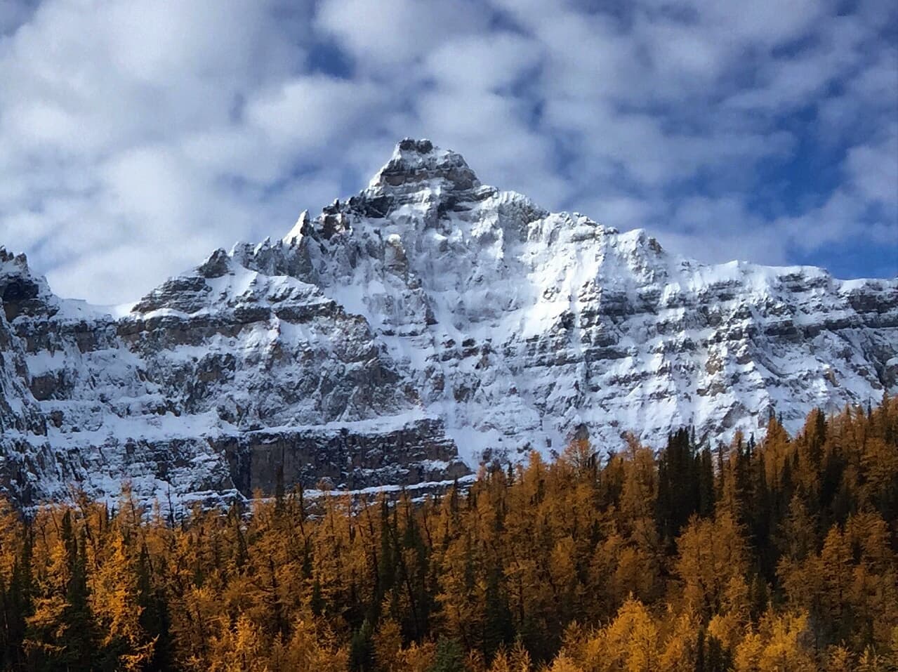
Deltaform Mountain rises sharply in Yoho National Park as one of the most distinctive peaks visible from the Valley of the Ten Peaks area. Its triangular profile and sheer rock faces make it a standout feature of the Wenkchemna range, drawing photographers and hikers seeking authentic high-country wilderness without the crowds of nearby Lake Louise.

Getting There

Access begins from the Trans-Canada Highway near Field, British Columbia. Travelers continue along Yoho Valley Road or connect via the Icefields Parkway to reach trailheads near Takakkaw Falls or the Lake O’Hara region. A high-clearance vehicle helps on the final gravel sections, and Parks Canada shuttle reservations are required for the restricted Lake O’Hara road during peak season.

Best Time to Visit

July through early September offers the most reliable snow-free conditions for hiking and scrambling. Wildflowers peak in late July, while September brings thinner crowds and golden larch trees. Winter visits demand avalanche training and specialized gear because the mountain’s steep couloirs remain dangerous long after lower elevations clear.

Things to Do

  • Attempt the demanding scramble routes that gain the lower ridges for sweeping views of the surrounding icefields.
  • Photograph the mountain’s reflection in small tarns along the Opabin Plateau circuit.
  • Combine a visit with a day at nearby Lake O’Hara, where a network of maintained trails leads to alpine meadows and other Ten Peaks viewpoints.

Nearby Attractions

Within a short drive lie Takakkaw Falls, the highest waterfall in Canada, and the historic town of Field with its railway heritage. Further afield, Emerald Lake and the Burgess Shale fossil beds provide contrasting natural and scientific attractions that round out a multi-day itinerary in Yoho National Park.

Visitor tips

  • Reserve Lake O'Hara access well in advance through Parks Canada, as day-use quotas fill months ahead.
  • Carry bear spray and know how to use it; grizzly activity is common along approach trails.
  • Check current avalanche forecasts and trail conditions even in summer, as snow patches linger on north faces.

Frequently asked questions

Is Deltaform Mountain suitable for beginner hikers?+

No. The routes involve exposed scrambling and route-finding skills best suited to experienced mountain hikers with proper gear.

How long does it take to reach the base of Deltaform Mountain?+

From the Lake O'Hara trailhead, plan on four to six hours round-trip depending on fitness and chosen route.

Can I camp near Deltaform Mountain?+

Yes, but only at designated backcountry sites in the Lake O'Hara area with advance reservations through Parks Canada.

Are there guided tours available for Deltaform Mountain?+

Local outfitters in Field and Canmore offer guided scrambles and photography tours focused on the Wenkchemna peaks.

What wildlife might I encounter around the mountain?+

Expect marmots, pikas, and occasional grizzly bears; always maintain proper food storage and distance from animals.

Share
Google Maps Apple Maps Directions

Image: Nancymcmillan · CC BY-SA 4.0 · via Wikimedia Commons

Keep reading

Nearby & related

All stories
Vedder River: Salmon Fishing, Paddling and Riverside Trails in British Columbia
British Columbia

Vedder River: Salmon Fishing, Paddling and Riverside Trails in British Columbia

A clear, productive river in the Fraser Valley offering consistent chinook and coho runs, easy paddling and quiet hiking…

1 August 2026
E
British Columbia

Englishman River: Waterfalls, Forests and Salmon Runs on Vancouver Island

Hike to dramatic waterfalls, swim in clear pools, and watch salmon spawn along this Vancouver Island river.

1 August 2026
B
British Columbia

Bella Coola River: Wilderness Fishing and Grizzly Viewing in British Columbia’s Great Bear Rainforest

This remote river in the Bella Coola Valley offers world-class steelhead and salmon fishing, abundant wildlife, and…

1 August 2026

