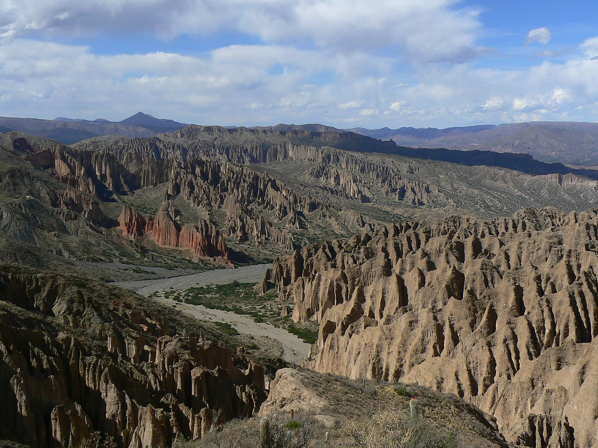
Why Visit the Cordillera de Chichas
The Cordillera de Chichas forms a dramatic southern spur of the Bolivian Andes, rising sharply from the altiplano in Potosí Department. Its serrated ridges, volcanic cones, and deep canyons offer solitude that is rare even by Bolivian standards. Travelers come for multi-day treks across passes above 4,800 meters, encounters with vicuñas and Andean foxes, and sweeping views that stretch toward the Salar de Uyuni on clear days.
Getting There
Most visitors base themselves in the city of Potosí and arrange transport south toward the village of Chichas or the mining settlement of Atocha. The journey follows unpaved roads that climb steadily through llama pastures and abandoned silver workings. Four-wheel-drive vehicles or sturdy buses reach trailheads; independent drivers should carry extra fuel and spare tires. From Tupiza, a longer but scenic route crosses the Cordillera de Lípez before entering Chichas territory.
Best Time to Visit
The dry season from May to October brings stable weather and clear night skies ideal for stargazing. June and July nights can drop below freezing even at lower elevations, so layered clothing is essential. The wet season (November–March) turns tracks to mud and increases the risk of flash floods in narrow canyons, though wildflowers appear on the puna grasslands.
What to See and Do
Popular routes include the traverse from Chichas village over Cerro Chorolque to the high plateau near San Antonio de Esmoruco. Hikers pass turquoise glacial lakes, abandoned colonial-era mines, and stone corrals still used by local herders. Birdwatchers may spot Andean condors riding thermals above the ridges. Cultural stops at small Aymara and Quechua communities reveal traditional weaving and potato cultivation at extreme altitudes. For experienced mountaineers, several unnamed 5,500-meter peaks offer non-technical ascents with spectacular vistas.
Nearby Attractions
Combine a Chichas trek with a visit to the historic silver mines of Potosí or the dramatic rock formations around Tupiza. The vast Salar de Uyuni lies roughly 150 kilometers northwest, reachable in a long day by sturdy vehicle. Smaller salt flats and colorful lagoons of the Lípez region lie to the southwest.
Practical Considerations
Altitude above 4,000 meters demands acclimatization; spend at least two nights in Potosí before heading higher. Local guides are strongly recommended for navigation and to support community economies. Carry ample water, as natural sources are scarce on many routes. Respect mining claims that still operate in the range and avoid entering active shafts.