Skip to content
Plan & Tour
DestinationsItinerariesTravel BlogAboutContact
0Sign inPlan a trip
Plan & TourPlan & Tour

Travel guides, destination inspiration and curated itineraries for Canada, the USA and beyond, plus a free tool to plan your own day-by-day trip.

Get travel inspiration

Explore

  • All Destinations
  • Curated Itineraries
  • Travel Blog
  • Plan a Trip

Topics

  • Hiking & Nature
  • Food & Drink
  • City Breaks
  • Budget Travel

Company

  • About Us
  • Contact
  • Privacy Policy
  • Terms of Service

© 2026 Plan & Tour. Built for travellers.

Discover the world, one trip at a time.

Chorolque: Trekking Bolivia’s Remote Andean Peak in Potosí
  1. Home
  2. Destinations
  3. Potosí Department
  4. Chorolque: Trekking Bolivia’s Remote Andean Peak in Potosí
Mountain

Chorolque: Trekking Bolivia’s Remote Andean Peak in Potosí

A high-altitude guide to climbing Chorolque mountain for dramatic Andean views and authentic highland travel.

Potosí DepartmentUpdated 12 October 2026

Why Chorolque Stands Out

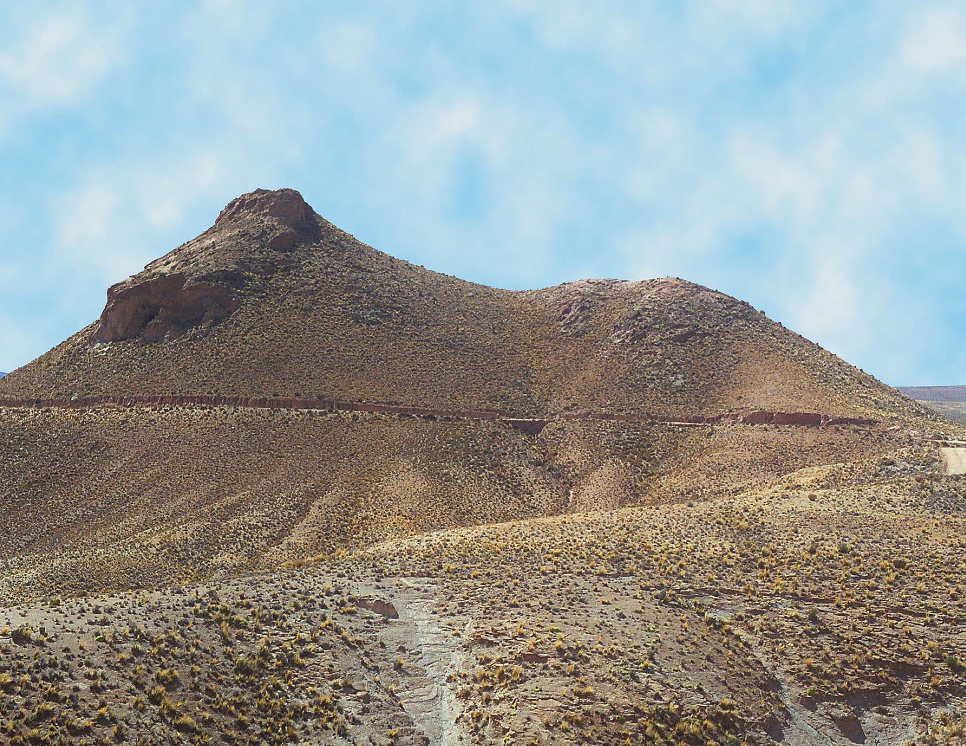
Chorolque rises sharply from the Cordillera de Lípez in Bolivia’s Potosí Department, delivering sweeping vistas across volcanic plateaus, salt flats, and distant snow-capped ranges. Its isolation preserves a raw high-Andean character that attracts trekkers seeking altitude and solitude rather than crowds.

Reaching the Mountain

Most visitors approach from Uyuni or Potosí. Shared 4×4 transfers or private jeeps cover the unpaved roads that lead toward the base; the final stretch often requires a high-clearance vehicle or a multi-hour hike. Allow a full day for travel from either city, and plan an overnight in a nearby village to begin acclimatizing before the ascent.

Best Time to Visit

The dry season from May through October brings stable weather and clearer trails. Daytime temperatures remain cool, while nights drop well below freezing. The wet months of December to March can turn access roads into mud and increase rockfall risk on upper slopes.

What to Do on Chorolque

Most treks target the summit for sunrise or sunset views. The route passes through mineral-rich slopes and offers chances to observe vicuñas and Andean condors. Photographers favor the contrast between the peak’s dark rock and surrounding pastel altiplano. Multi-day itineraries can combine the mountain with nearby volcanic cones or salt-lake circuits.

Practical Considerations

Altitude exceeds 5,000 meters, so spend at least two nights at intermediate elevations before attempting the final push. Carry ample water, layered clothing, and sun protection; the thin air amplifies UV exposure. Local operators in Uyuni can arrange mules for gear on longer approaches.

Nearby Attractions

Chorolque sits within easy reach of the Salar de Uyuni, the world’s largest salt flat, and the colorful lagoons of the Eduardo Avaroa Andean Fauna National Reserve. Combining these sites creates a classic high-desert loop that showcases Bolivia’s extreme landscapes in one journey.

Visitor tips

  • Spend at least two nights at 3,500u20134,000 meters before climbing to reduce altitude-sickness risk.
  • Hire a local guide or join a reputable tour from Uyuni for safe navigation on unmarked highland tracks.
  • Pack layers for rapid temperature swings and carry extra wateru2014sources are scarce above the lower slopes.

Frequently asked questions

How high is Chorolque?+

The summit sits above 5,000 meters, placing it firmly in the high-Andean zone where acclimatization is essential.

Is Chorolque suitable for beginners?+

The terrain demands good fitness and prior high-altitude experience; guided groups are strongly recommended for first-timers.

What should I bring for a day hike?+

Layered clothing, sun protection, at least three liters of water per person, and a headlamp for early starts or late descents.

Can I visit Chorolque year-round?+

Access is easiest during the Mayu2013October dry season; wet-season roads become difficult and weather turns unpredictable.

Are there facilities near the mountain?+

No services exist at the trailhead; plan to carry all supplies and arrange transport and lodging from Uyuni or Potosu00ed.

Share
Google Maps Apple Maps Directions

Image: Mach marco · CC BY-SA 4.0 · via Wikimedia Commons

Keep reading

Nearby & related

All stories
S
Potosí Department

Sabaya River: Bolivia’s Remote Highland Waterway in Potosí

Discover the stark Andean beauty and quiet isolation of the Sabaya River in Bolivia’s high desert.

13 October 2026
L
Potosí Department

Laguna Charcota: Remote Turquoise Lake in Bolivia’s Andean Highlands

Explore the striking high-altitude waters and stark volcanic scenery of Laguna Charcota deep in Potosí Department.

12 October 2026
S
Potosí Department

Silala River: Remote Andean Waters in Bolivia’s Potosí Department

Explore the high-altitude springs and wetlands of the Silala River, a striking natural feature on Bolivia’s border with…

12 October 2026