Skip to content
Plan & Tour
DestinationsItinerariesTravel BlogAboutContact
0Sign inPlan a trip
Plan & TourPlan & Tour

Travel guides, destination inspiration and curated itineraries for Canada, the USA and beyond, plus a free tool to plan your own day-by-day trip.

Get travel inspiration

Explore

  • All Destinations
  • Curated Itineraries
  • Travel Blog
  • Plan a Trip

Topics

  • Hiking & Nature
  • Food & Drink
  • City Breaks
  • Budget Travel

Company

  • About Us
  • Contact
  • Privacy Policy
  • Terms of Service

© 2026 Plan & Tour. Built for travellers.

Discover the world, one trip at a time.

Cerro Lípes: Hiking Bolivia’s Remote Andean Volcano
  1. Home
  2. Destinations
  3. Potosí Department
  4. Cerro Lípes: Hiking Bolivia’s Remote Andean Volcano
Mountain

Cerro Lípes: Hiking Bolivia’s Remote Andean Volcano

A guide to reaching and exploring the isolated 5,929-meter peak in Potosí’s high desert.

Potosí DepartmentUpdated 12 October 2026

Why Cerro Lípes Rewards the Journey

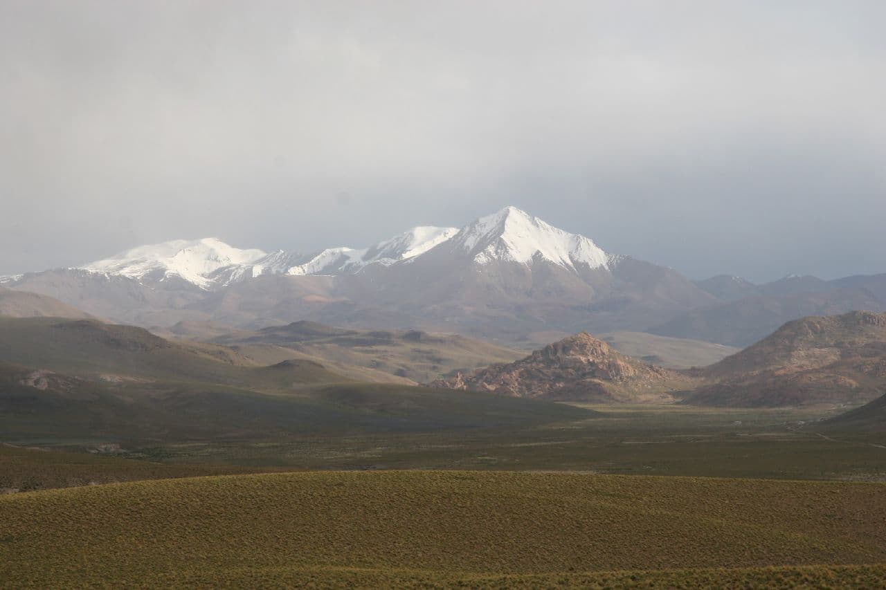
Cerro Lípes rises as a solitary stratovolcano in the arid southwestern corner of Bolivia’s Potosí Department. Its steep slopes and dark volcanic rock stand out against the surrounding altiplano, offering hikers sweeping views across salt flats, colorful lagoons, and distant snow-capped peaks. The mountain lies within a sparsely populated highland region that feels untouched by tourism infrastructure, making it a destination for travelers seeking genuine solitude rather than crowded trails.

Getting There

Access begins in Uyuni or Tupiza. From Uyuni, travelers join organized 4×4 expeditions that head south through the Eduardo Avaroa Andean Fauna National Reserve. The final approach involves a rough track that ends several kilometers from the base; the last stretch must be covered on foot. No public transport reaches the mountain, so independent visitors arrange private transport or join small-group tours that include driver, guide, and basic camping gear.

Best Time to Visit

The dry season from May through October brings stable weather, clear skies for photography, and firm ground for hiking. Nighttime temperatures frequently drop below freezing, while daytime highs remain comfortable. The wet season from November to April can turn tracks into mud and obscure views with clouds, though it also fills nearby lagoons with greater numbers of flamingos.

What to See and Do

The standard route follows a broad ridge on the northern flank, gaining roughly 800 meters over four to six hours depending on acclimatization. At the summit, visitors look out over the vast Salar de Coipasa to the north and the red and green lagoons that dot the southern reserve. Wildlife sightings may include vicuñas, Andean foxes, and occasional condors. Many travelers combine the climb with stops at nearby geothermal sites and hot springs that provide welcome relief after the cold summit wind.

Practical Considerations

Altitude above 5,000 meters demands prior acclimatization in Uyuni or Potosí. Carry at least three liters of water per person, windproof layers, and a headlamp for early starts. No facilities exist on the mountain, so all supplies must be brought in and all waste carried out.

Visitor tips

  • Spend at least two nights at altitude before attempting the summit to reduce the risk of altitude sickness.
  • Hire a local driver familiar with the unmarked tracks; GPS coverage is unreliable and rescue services are nonexistent.
  • Pack layers for extreme temperature swings and bring a portable stove, as no food or fuel is available near the mountain.

Frequently asked questions

How high is Cerro Lu00edpes?+

The summit reaches 5,929 meters above sea level, making it one of the higher non-technical peaks in the Bolivian Andes.

Do I need a permit to climb Cerro Lu00edpes?+

No special climbing permit is required, but entry into the Eduardo Avaroa reserve requires payment of the standard park fee at the entrance station.

Is Cerro Lu00edpes suitable for beginners?+

The route involves steep scree and loose rock; prior high-altitude hiking experience and good physical condition are strongly recommended.

Can I visit Cerro Lu00edpes without a guide?+

Independent travel is possible but discouraged due to unmarked routes, extreme weather, and lack of rescue infrastructure; most visitors join small-group tours.

What is the nearest town with supplies?+

Uyuni, roughly 200 kilometers north, offers the closest reliable fuel, food, and medical services.

Share
Google Maps Apple Maps Directions

Image: Jonathan Lewis · CC BY-SA 2.0 · via Wikimedia Commons

Keep reading

Nearby & related

All stories
S
Potosí Department

Sabaya River: Bolivia’s Remote Highland Waterway in Potosí

Discover the stark Andean beauty and quiet isolation of the Sabaya River in Bolivia’s high desert.

13 October 2026
L
Potosí Department

Laguna Charcota: Remote Turquoise Lake in Bolivia’s Andean Highlands

Explore the striking high-altitude waters and stark volcanic scenery of Laguna Charcota deep in Potosí Department.

12 October 2026
S
Potosí Department

Silala River: Remote Andean Waters in Bolivia’s Potosí Department

Explore the high-altitude springs and wetlands of the Silala River, a striking natural feature on Bolivia’s border with…

12 October 2026