Skip to content
Plan & Tour
DestinationsItinerariesTravel BlogAboutContact
0Sign inPlan a trip
Plan & TourPlan & Tour

Travel guides, destination inspiration and curated itineraries for Canada, the USA and beyond, plus a free tool to plan your own day-by-day trip.

Get travel inspiration

Explore

  • All Destinations
  • Curated Itineraries
  • Travel Blog
  • Plan a Trip

Topics

  • Hiking & Nature
  • Food & Drink
  • City Breaks
  • Budget Travel

Company

  • About Us
  • Contact
  • Privacy Policy
  • Terms of Service

© 2026 Plan & Tour. Built for travellers.

Discover the world, one trip at a time.

Cerro Cañapa: Bolivia’s Remote Andean Volcano in Potosí
  1. Home
  2. Destinations
  3. Potosí Department
  4. Cerro Cañapa: Bolivia’s Remote Andean Volcano in Potosí
Mountain

Cerro Cañapa: Bolivia’s Remote Andean Volcano in Potosí

A high-altitude volcanic peak offering stark altiplano vistas and solitude in Bolivia’s southwestern highlands.

Potosí DepartmentUpdated 12 October 2026

Why Cerro Cañapa Stands Out

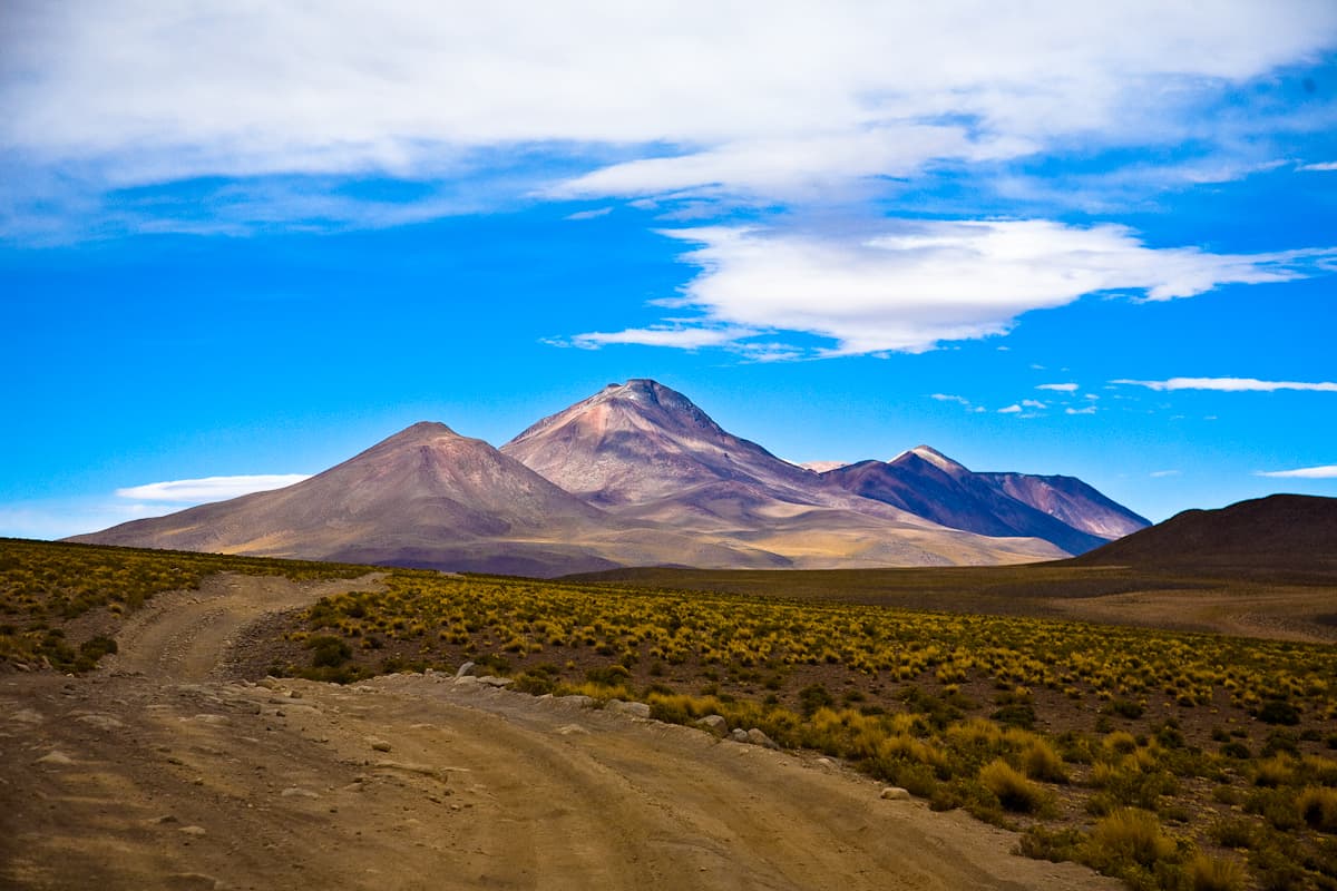
Cerro Cañapa rises from the arid Puna de Atacama plateau in Bolivia’s Potosí Department, its symmetrical cone marking one of the many volcanic landmarks that punctuate the southern Altiplano. At over 5,000 meters, the mountain rewards visitors with sweeping views across salt-crusted basins and distant snow-streaked cordilleras. Its isolation means few crowds, making it a destination for travelers seeking the raw geology and silence of the high Andes rather than developed trails.

How to Reach the Mountain

Most visitors approach from Uyuni, the gateway town for the Salar de Uyuni. The route follows graded dirt roads southwest through the Eduardo Avaroa Andean Fauna National Reserve, passing colorful lagoons and geothermal sites. Four-wheel-drive vehicles with local operators are essential; independent travel is discouraged because of the lack of services and the risk of sudden weather changes at altitude. The final approach involves a short hike across open pampa to the lower slopes.

Best Time to Visit

The dry season from May through October brings stable weather and clearer skies, ideal for photography and longer walks. Temperatures drop sharply at night, so layered clothing is required year-round. January to March sees occasional rains that can turn tracks to mud and limit visibility, while the shoulder months of April and November offer fewer tour groups but more variable conditions.

Things to See and Do

Day hikes around the base reveal volcanic rock formations and occasional vicuña herds. Photographers often position themselves at sunrise to capture the cone lit against the pastel tones of the surrounding salt flats. Birders may spot Andean flamingos at nearby seasonal wetlands. For those acclimatized, a longer trek circles the lower slopes, offering perspectives on neighboring peaks such as Cerro Tomasamil. No technical climbing gear is needed for the standard routes, but strong winds and thin air demand respect.

Nearby Attractions

Cerro Cañapa sits within a cluster of natural highlights that define southwestern Bolivia. The vast Salar de Uyuni lies to the north, while the red waters of Laguna Colorada and the steaming Sol de Mañana geysers lie to the south. Many multi-day 4×4 circuits combine the mountain with these sites, allowing travelers to experience the progression from white salt crust to mineral-rich lagoons in a single journey.

Visitor tips

  • Acclimatize for several days in Uyuni or Potosu00ed before attempting any walking at Cerro Cau00f1apau2019s elevation to reduce altitude sickness risk.
  • Travel only with reputable local operators who carry oxygen, extra fuel, and satellite communication; the area has no rescue infrastructure.
  • Carry ample water, sun protection, and warm layersu2014even in dry season the temperature can swing 20 u00b0C between day and night.

Frequently asked questions

How high is Cerro Cau00f1apa?+

The summit reaches approximately 5,300 meters above sea level, placing it among the higher non-technical peaks of the Bolivian Altiplano.

Is Cerro Cau00f1apa suitable for beginners?+

The lower slopes can be explored on foot without technical skills, but the altitude and remote location require solid fitness and prior acclimatization.

Do I need a guide to visit Cerro Cau00f1apa?+

Yes. The region lacks marked trails, signage, and services; joining an organized 4x4 expedition from Uyuni is the standard and safest approach.

What wildlife might I see around the mountain?+

Vicunas, Andean foxes, and occasional flamingos at nearby lagoons are the most common sightings in the surrounding reserve.

Can I combine Cerro Cau00f1apa with the Salar de Uyuni?+

Yes. Most multi-day tours that cross the southern Altiplano include the mountain as a stop on the return leg from Laguna Colorada.

Share
Google Maps Apple Maps Directions

Image: profe_miguel · CC BY-SA 2.0 · via Wikimedia Commons

Keep reading

Nearby & related

All stories
S
Potosí Department

Sabaya River: Bolivia’s Remote Highland Waterway in Potosí

Discover the stark Andean beauty and quiet isolation of the Sabaya River in Bolivia’s high desert.

13 October 2026
L
Potosí Department

Laguna Charcota: Remote Turquoise Lake in Bolivia’s Andean Highlands

Explore the striking high-altitude waters and stark volcanic scenery of Laguna Charcota deep in Potosí Department.

12 October 2026
S
Potosí Department

Silala River: Remote Andean Waters in Bolivia’s Potosí Department

Explore the high-altitude springs and wetlands of the Silala River, a striking natural feature on Bolivia’s border with…

12 October 2026