Skip to content
Plan & Tour
DestinationsItinerariesTravel BlogAboutContact
0Sign inPlan a trip
Plan & TourPlan & Tour

Travel guides, destination inspiration and curated itineraries for Canada, the USA and beyond, plus a free tool to plan your own day-by-day trip.

Get travel inspiration

Explore

  • All Destinations
  • Curated Itineraries
  • Travel Blog
  • Plan a Trip

Topics

  • Hiking & Nature
  • Food & Drink
  • City Breaks
  • Budget Travel

Company

  • About Us
  • Contact
  • Privacy Policy
  • Terms of Service

© 2026 Plan & Tour. Built for travellers.

Discover the world, one trip at a time.

Y
  1. Home
  2. Destinations
  3. Santa Cruz Department
  4. Yapacaní River: Bolivia’s Amazonian Waterway in Santa Cruz
River

Yapacaní River: Bolivia’s Amazonian Waterway in Santa Cruz

Discover wildlife, fishing, and forest scenery along this remote tributary of the Río Grande.

Santa Cruz DepartmentUpdated 12 October 2026

Why the Yapacaní River Draws Visitors

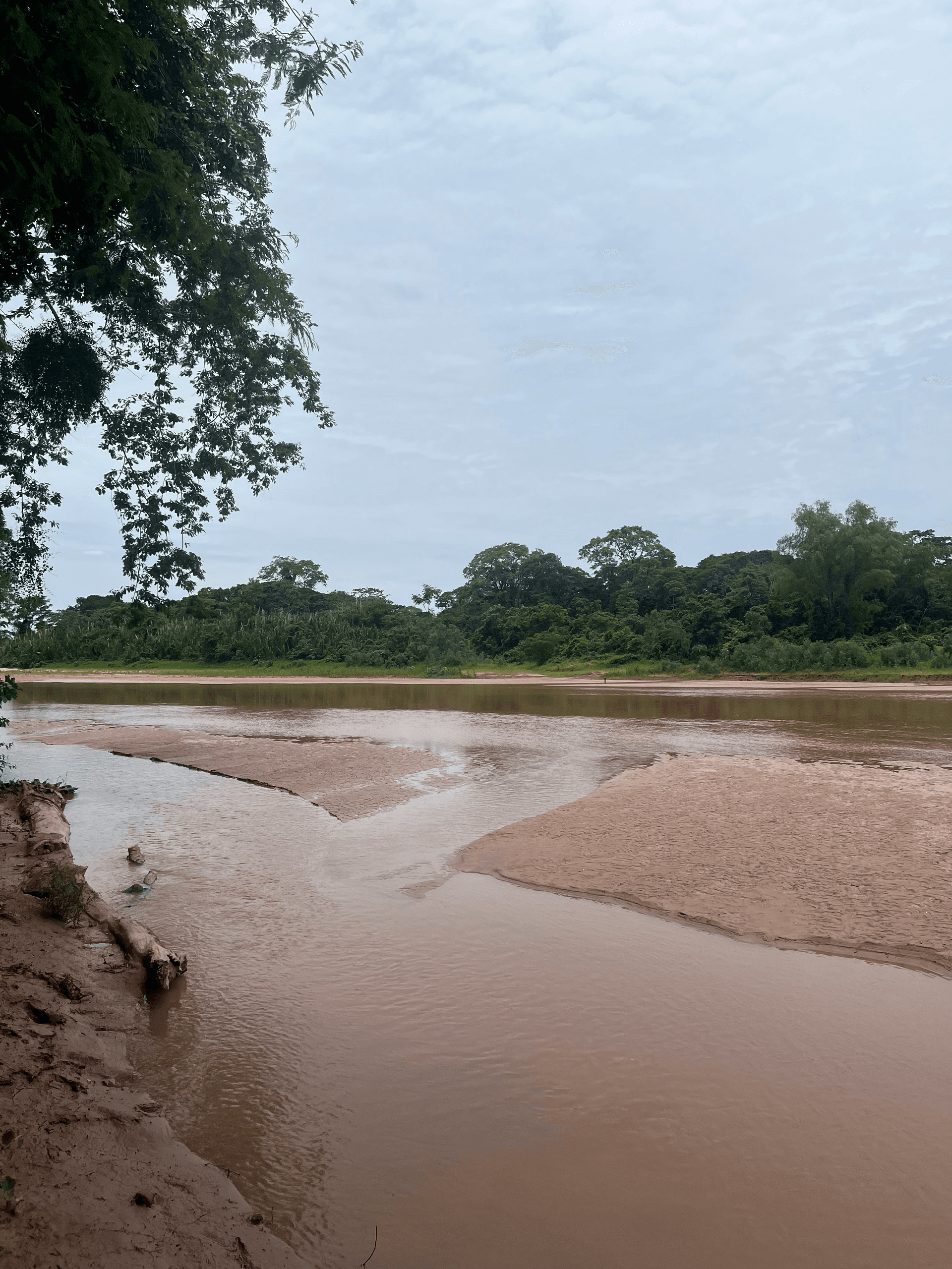
The Yapacaní River cuts through the tropical lowlands of Santa Cruz Department, feeding into the larger Río Grande and forming part of the Amazon basin. Its slow-moving waters and surrounding gallery forests support abundant birdlife, monkeys, and occasional caimans, offering a quieter alternative to more famous Bolivian rivers. Travelers come for multi-day boat journeys, catch-and-release fishing for species like surubí and dorado, and simple riverside camping under the canopy.

Getting There

Most visitors start in Santa Cruz de la Sierra and travel northwest by bus or private vehicle along the highway toward Montero and Yapacani town. From there, unpaved roads and local boat launches provide access to the riverbanks. Four-wheel-drive vehicles handle the final stretches best during the wet season, while regular buses reach nearby settlements year-round. Arrange river transport with local operators once you arrive, as no scheduled ferry service exists.

Best Time to Visit

The dry season from May to October brings lower water levels and easier navigation, with clearer trails through the forest. November to April sees higher flows and occasional flooding, which can limit land access but enhance fishing in some stretches. Early morning departures are ideal to avoid afternoon heat and thunderstorms common in the region.

Activities on and Around the River

Day trips focus on birdwatching from motorized canoes or dugout boats, spotting toucans, parrots, and herons along the banks. Anglers target the deeper pools near bends in the river. Longer excursions allow stops at small riverside communities where travelers can observe traditional fishing techniques and buy fresh produce. Short hikes into the adjacent forest reveal orchids and medicinal plants when guided by local residents.

Nearby Destinations

Combine a river visit with Amboró National Park to the west for mountain trails and waterfalls, or continue south to the Río Grande for larger-scale boating. The colonial town of Samaipata lies a few hours away by road, providing a contrast with its pre-Inca ruins and cooler highland climate.

  • Bring binoculars and a field guide for the diverse avian species visible from the water.
  • Travel with a local guide familiar with shifting sandbars and seasonal currents.

Visitor tips

  • Pack strong insect repellent and long clothing, as mosquitoes are active near the water year-round.
  • Carry cash in small denominations for boat hires and purchases at riverside communities.
  • Check river levels with locals before launching any self-guided trip, especially after heavy rains.

Frequently asked questions

Can I swim in the Yapacanu00ed River?+

Swimming is possible in calmer sections away from strong currents, but watch for submerged branches and occasional caimans; ask local boatmen for safe spots.

Do I need a guide for river travel?+

A local guide is strongly recommended for navigation, wildlife interpretation, and access to private riverbanks or communities.

What fish are commonly caught here?+

Anglers frequently land surubu00ed catfish, dorado, and pacu00fa; catch-and-release is encouraged to maintain stocks.

Is the area safe for solo travelers?+

Daytime visits are generally safe when using established boat operators, but overnight stays benefit from traveling with a small group or guide.

Are there any indigenous communities along the river?+

Small farming and fishing villages dot the banks; respectful visits can be arranged through local tourism contacts.

Share
Google Maps Apple Maps Directions

Keep reading

Nearby & related

All stories
Surutú River: Bolivia’s Clear-Water Gem in Santa Cruz Department
Santa Cruz Department

Surutú River: Bolivia’s Clear-Water Gem in Santa Cruz Department

The Surutú River winds through biodiverse lowland forest near Amboró National Park, offering quiet swimming holes,…

13 October 2026
Laguna San Jorge: Bolivia’s Remote Lake Sanctuary in Santa Cruz
Santa Cruz Department

Laguna San Jorge: Bolivia’s Remote Lake Sanctuary in Santa Cruz

A quiet freshwater lake surrounded by lowland forest, Laguna San Jorge rewards travelers who seek unspoiled nature and…

12 October 2026
Paraguá River: Remote Wilderness and Wildlife in Bolivia’s Santa Cruz Department
Santa Cruz Department

Paraguá River: Remote Wilderness and Wildlife in Bolivia’s Santa Cruz Department

Paddle, fish, and spot wildlife along the biodiverse Paraguá River, a quiet tributary deep in Bolivia’s eastern…

12 October 2026