Skip to content
Plan & Tour
DestinationsItinerariesTravel BlogAboutContact
0Sign inPlan a trip
Plan & TourPlan & Tour

Travel guides, destination inspiration and curated itineraries for Canada, the USA and beyond, plus a free tool to plan your own day-by-day trip.

Get travel inspiration

Explore

  • All Destinations
  • Curated Itineraries
  • Travel Blog
  • Plan a Trip

Topics

  • Hiking & Nature
  • Food & Drink
  • City Breaks
  • Budget Travel

Company

  • About Us
  • Contact
  • Privacy Policy
  • Terms of Service

© 2026 Plan & Tour. Built for travellers.

Discover the world, one trip at a time.

Wapta Falls: British Columbia’s Wide, Thunderous Waterfall on the Kicking Horse River
  1. Home
  2. Destinations
  3. British Columbia
  4. Wapta Falls: British Columbia’s Wide, Thunderous Waterfall on the Kicking Horse River
Waterfall

Wapta Falls: British Columbia’s Wide, Thunderous Waterfall on the Kicking Horse River

A short walk from the Trans-Canada Highway leads to one of the Kootenays’ most impressive roadside cascades.

British ColumbiaUpdated 1 July 2026

Why Wapta Falls Stands Out

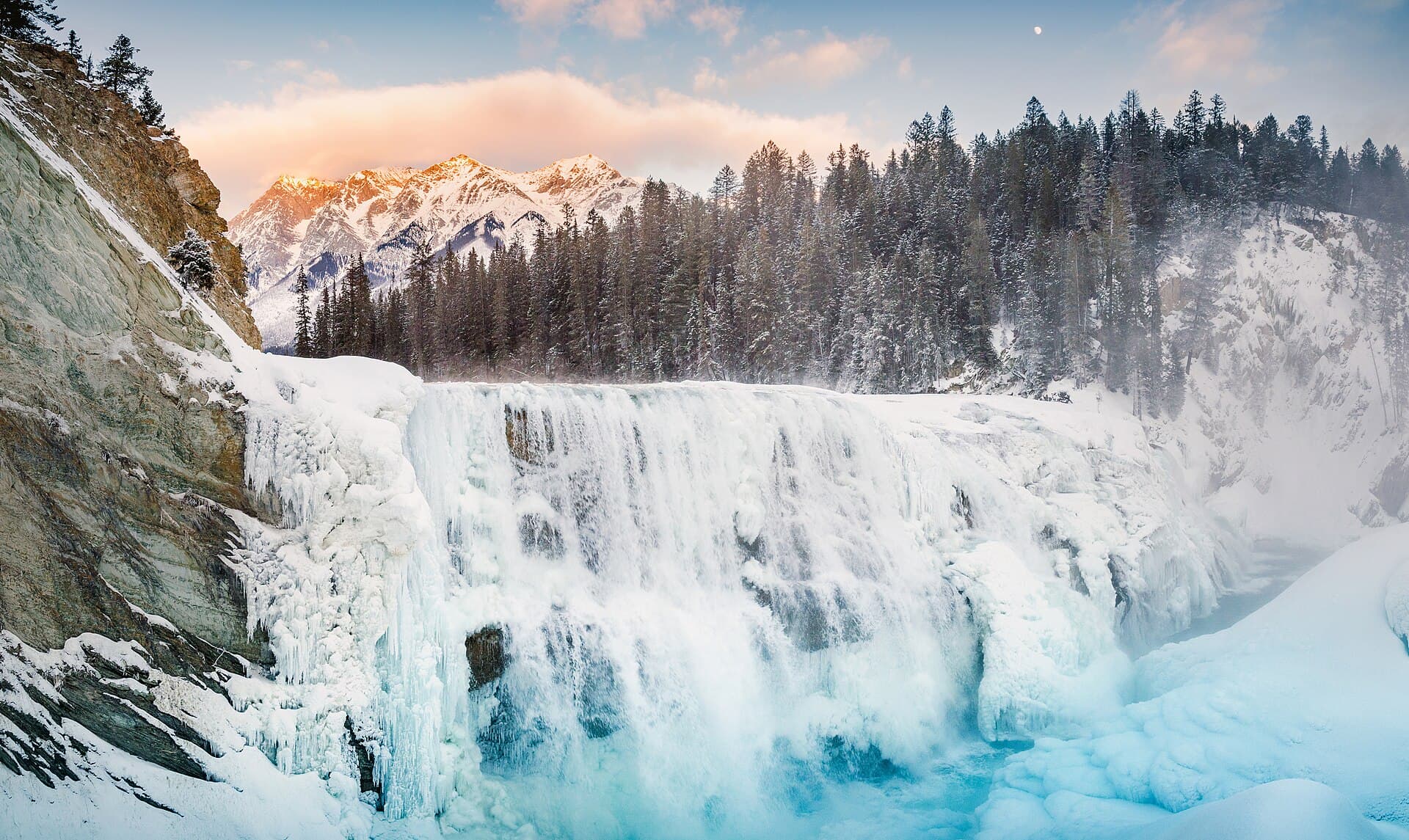
Wapta Falls drops across the full width of the Kicking Horse River in a broad, powerful sheet rather than a narrow plume. The river splits around a central rock island before plunging roughly 30 metres, creating a continuous wall of white water that is especially dramatic after spring snowmelt. Because the falls sit inside the boundary of Kootenay National Park yet lie only minutes from the Trans-Canada Highway, they offer an easy, high-reward stop for drivers crossing the Rockies.

Getting There

Exit the Trans-Canada Highway at the signed Wapta Falls turn-off between Golden and Field. A short gravel access road ends at a small parking area. From the lot a well-defined trail descends gently through mixed forest for about 20 minutes to the first viewpoint on the west bank. A short spur continues upstream to a second overlook directly above the lip of the falls. No special equipment is required, but the path can be muddy after rain.

Best Time to Visit

Peak water volume occurs from late May through early July, when the thunder is loudest and rainbows frequently form in the mist. The trail remains open year-round; winter visitors may find ice formations along the gorge walls, though traction devices are advisable. Autumn brings fewer crowds and colourful larch and aspen along the approach road.

Photography Tips

The west-bank viewpoint provides the classic wide-angle composition. Arrive in late afternoon for side lighting on the falling water. A polarizing filter helps cut glare on sunny days. The upper overlook is useful for showing the river’s approach and the scale of the drop.

Nearby Attractions

Continuing west on Highway 1 brings you to the town of Golden and the Columbia River wetlands. Eastward, the highway quickly enters Yoho National Park, where Emerald Lake and the Natural Bridge are short detours. South of the falls, the Radium Hot Springs pools and the Sinclair Canyon offer a relaxing contrast to the cold river water.

Visitor tips

  • Park only in the designated lot; the shoulder of the Trans-Canada is not safe for stopping.
  • Carry water and a light jacketu2014temperatures drop quickly near the mist even on warm days.
  • Stay behind railings and on marked trails; the river current is extremely strong near the brink.

Frequently asked questions

How long is the hike to Wapta Falls?+

The main trail is roughly 1.6 km return with minimal elevation change and takes 30u201345 minutes round-trip for most visitors.

Is Wapta Falls suitable for children?+

Yes, the wide, well-graded path is family-friendly, but supervise closely at the fenced viewpoints where the river is powerful.

Can I swim or get close to the base of the falls?+

Swimming is not recommended; the current is dangerous and there is no safe access to the base from the maintained trail.

Are dogs allowed on the trail?+

Dogs are permitted on leash in Kootenay National Park; bring waste bags and keep them away from the river edge.

Is there cell service at Wapta Falls?+

Coverage is spotty along this stretch of Highway 1; download maps and park information before leaving Golden or Field.

Share
Google Maps Apple Maps Directions

Image: Jakub Fryš · CC BY-SA 4.0 · via Wikimedia Commons

Keep reading

Nearby & related

All stories
Chilkat River: Bald Eagle Capital Along the BC-Alaska Border
British Columbia

Chilkat River: Bald Eagle Capital Along the BC-Alaska Border

Float through salmon-rich waters teeming with eagles and bears in one of North America’s premier wildlife corridors.

1 July 2026
Similkameen River: A Scenic Waterway Through British Columbia’s Southern Valleys
British Columbia

Similkameen River: A Scenic Waterway Through British Columbia’s Southern Valleys

Follow the Similkameen River through dramatic canyons, fertile orchards, and quiet parks in the heart of the Similkameen…

1 July 2026
Adams River: Witnessing British Columbia’s Legendary Sockeye Salmon Migration
British Columbia

Adams River: Witnessing British Columbia’s Legendary Sockeye Salmon Migration

Discover the dramatic sockeye salmon runs, clear waters, and surrounding forests of Adams River in British Columbia’s…

1 July 2026


