Tseax Cone: Hiking to British Columbia’s Youngest Volcano
A remote cinder cone and vast lava field in the Nass Valley that preserves a dramatic 18th-century eruption and Nisga’a history.
Why Tseax Cone Is Worth Visiting
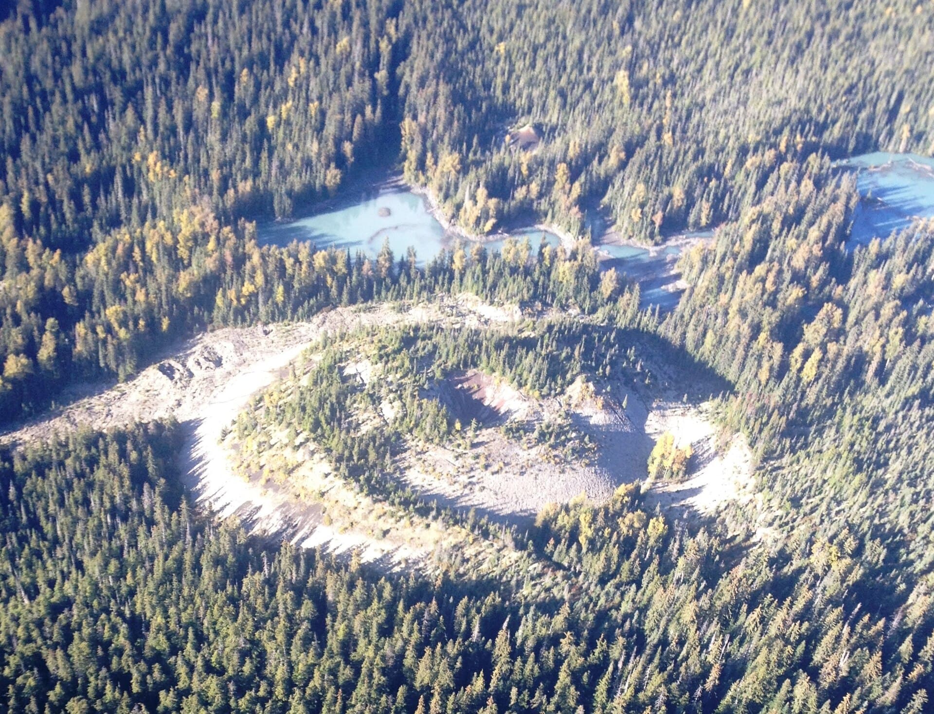
Tseax Cone stands as one of the most recent volcanic features in Canada, formed by an eruption roughly three centuries ago that sent a river of lava down the Tseax River valley. The dark, jagged basalt flows remain starkly visible today, creating an otherworldly landscape amid the coastal mountains of northern British Columbia. For visitors interested in geology, Indigenous history, and wilderness hiking, the site offers direct evidence of how volcanic events shaped both the land and the Nisga’a people who have lived here for millennia.
Getting There
The cone lies in the Nass River valley west of Highway 37, near the community of Gitwinksihlkw. Most travelers reach the area by driving the paved but remote Nass Road from Terrace or New Aiyansh, then following forestry roads that become gravel. A high-clearance vehicle is strongly recommended. From trailheads near the lava beds, hikers follow marked paths across the flows to reach the base of the 300-metre cone. No maintained roads lead to the summit itself; the final approach is on foot.
Best Time to Visit
July through early September provides the most reliable weather and snow-free trails. Outside this window, heavy snow and short daylight hours make access difficult and potentially hazardous. Summer also coincides with longer days for exploring the extensive lava field before temperatures drop sharply at night.
What to See and Do
Walk across the smooth and ropy pahoehoe surfaces and the rough, jagged aa flows that blanket the valley floor. The contrast between the black rock and surrounding spruce forest highlights the eruption’s reach. From the cone’s lower slopes, panoramic views open across the Nass Valley and toward the Coast Mountains. Many visitors combine the hike with stops at the Nisga’a Memorial Lava Bed Provincial Park to learn about the oral histories recounting the event. Photographers find striking compositions where vegetation is slowly reclaiming the lava.
Nearby Attractions
Within a short drive are the Nisga’a villages of Gitwinksihlkw and Gitlaxt’aamiks, where travelers can visit cultural centres and totem-pole sites. The Nass River itself offers fishing and scenic paddling opportunities. Further afield, the volcanic landscape continues toward Mount Edziza Provincial Park, another significant volcanic region in northern British Columbia.
Visitor tips
- Carry extra fuel, water, and a satellite communicator; cell coverage is absent once you leave the highway.
- Stay on established paths across the lava to avoid damaging fragile new plant life and to reduce the risk of ankle injuries on uneven rock.
- Check current road conditions with the Nisgau2019a Lisims Government before departure, as forestry roads can wash out after heavy rain.
Frequently asked questions
Is Tseax Cone an active volcano?
No. The cone last erupted around 1700 AD and is now considered dormant, though it remains part of the Northern Cordilleran Volcanic Province where future activity is possible over geologic timescales.
How difficult is the hike to Tseax Cone?
The approach crosses uneven lava for several kilometres before a moderate ascent of the coneu2019s lower slopes. Good boots, plenty of water, and route-finding skills are essential.
Can I camp at Tseax Cone?
Primitive camping is possible in designated areas near the lava field, but there are no facilities. Visitors must pack out all waste and follow Leave No Trace principles.
Are guided tours available?
Local Nisgau2019a guides occasionally offer interpretive walks focused on geology and cultural history; inquire at the visitor centre in Gitwinksihlkw during summer months.
What should I bring for a day trip?
Sturdy hiking boots, sun protection, layered clothing for rapid weather changes, ample water, snacks, a map or GPS, and a first-aid kit are recommended.