Skip to content
Plan & Tour
DestinationsItinerariesTravel BlogAboutContact
0Sign inPlan a trip
Plan & TourPlan & Tour

Travel guides, destination inspiration and curated itineraries for Canada, the USA and beyond, plus a free tool to plan your own day-by-day trip.

Get travel inspiration

Explore

  • All Destinations
  • Curated Itineraries
  • Travel Blog
  • Plan a Trip

Topics

  • Hiking & Nature
  • Food & Drink
  • City Breaks
  • Budget Travel

Company

  • About Us
  • Contact
  • Privacy Policy
  • Terms of Service

© 2026 Plan & Tour. Built for travellers.

Discover the world, one trip at a time.

Taaw Tldáaw: Hiking the Sacred Haida Mountain in British Columbia
  1. Home
  2. Destinations
  3. British Columbia
  4. Taaw Tldáaw: Hiking the Sacred Haida Mountain in British Columbia
Mountain

Taaw Tldáaw: Hiking the Sacred Haida Mountain in British Columbia

A remote peak on Haida Gwaii offering profound cultural significance and sweeping coastal views.

British ColumbiaUpdated 8 August 2026

Introduction to Taaw Tldáaw

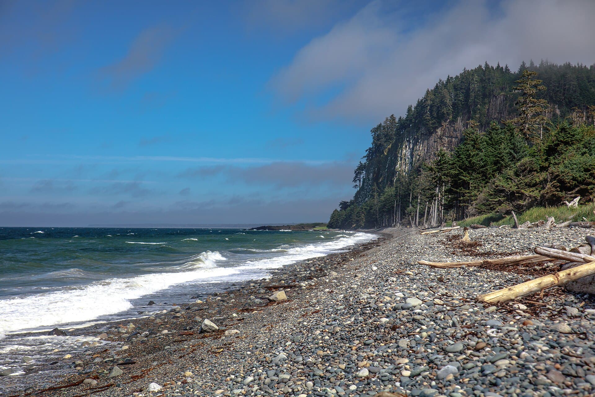
Taaw Tldáaw rises on Graham Island in the Haida Gwaii archipelago of British Columbia, a place of deep spiritual importance to the Haida people. The mountain stands as a living connection to ancient stories and traditions while providing hikers with dramatic vistas of the North Pacific and surrounding rainforest.

Getting There

Reach Haida Gwaii by ferry from Prince Rupert on the mainland, landing at Skidegate. From there, drive north along Highway 16 toward Masset; the trailhead for Taaw Tldáaw lies near the village of Old Massett. Local outfitters can arrange boat or vehicle transfers for the final stretch when roads are wet. Allow a full day for travel from the mainland.

Best Time to Visit

July through early September offers the most stable weather for hiking, with long daylight and fewer storms. Winter visits are possible for experienced travelers but bring high winds, heavy rain, and limited daylight. Always check marine forecasts before setting out.

What to See and Do

The primary activity is the hike to the summit ridge, passing through old-growth cedar and spruce forest. Along the way, watch for bald eagles, Sitka deer, and occasional black bears. At the top, clear days reveal the chain of islands stretching south toward Gwaii Haanas. Cultural tours led by Haida guides provide context on the mountain’s role in oral histories and traditional harvesting.

  • Day hikes to viewpoints below the summit
  • Wildlife viewing from established pullouts
  • Photography of coastal fog and moss-draped trees

Respecting the Land

Taaw Tldáaw remains a site of ongoing cultural practice. Stay on marked paths, avoid disturbing cedar bark or medicinal plants, and follow guidance from local Haida stewards. Pack out all waste and leave no trace.

Nearby Attractions

Combine a visit with the beaches of Naikoon Provincial Park to the east or the totem poles at Haida Heritage Centre in Skidegate. Many travelers continue south by boat into Gwaii Haanas National Park Reserve for multi-day paddling trips.

Visitor tips

  • Carry waterproof layers and extra food; weather can change rapidly even in summer.
  • Book ferry crossings and any cultural tours well ahead, especially during peak season.
  • Hire a local Haida guide for summit access to ensure both safety and cultural respect.

Frequently asked questions

Is Taaw Tldu00e1aw suitable for beginners?+

The lower trails offer moderate walking suitable for fit hikers, but the final ridge requires good balance and weather awareness; novices should join a guided group.

Do I need a permit to hike Taaw Tldu00e1aw?+

No formal permit is required for day hikes, yet visitors must respect Haida protocols and obtain permission from local communities for overnight stays or cultural activities.

What wildlife might I encounter?+

Expect bald eagles, ravens, Sitka black-tailed deer, and occasional black bears; carry bear spray and make noise on the trail.

How long does the hike take?+

A round-trip to the main viewpoint typically takes four to six hours depending on fitness and stops for wildlife viewing.

Are there facilities near the trailhead?+

Basic parking and a small information kiosk exist near Old Massett; bring all supplies as no services are available on the mountain itself.

Share
Google Maps Apple Maps Directions

Image: Murray Foubister · CC BY-SA 2.0 · via Wikimedia Commons

Keep reading

Nearby & related

All stories
Wedgemount Lake: Hiking to a Turquoise Alpine Gem Near Whistler
British Columbia

Wedgemount Lake: Hiking to a Turquoise Alpine Gem Near Whistler

A rewarding backcountry trek leads to glacial waters and sweeping mountain views in British Columbia’s Coast Range.

8 August 2026
Yellowhead Lake: Turquoise Waters and Mountain Backdrops in Mount Robson Provincial Park
British Columbia

Yellowhead Lake: Turquoise Waters and Mountain Backdrops in Mount Robson Provincial Park

This serene lake in British Columbia’s Rockies delivers quiet paddling, trout fishing, and easy access to dramatic peaks…

8 August 2026
Swindle Island: Remote Wilderness on British Columbia’s Central Coast
British Columbia

Swindle Island: Remote Wilderness on British Columbia’s Central Coast

Discover pristine rainforest, marine wildlife, and quiet anchorages on this secluded island in the Inside Passage.

8 August 2026


