
Keep reading
Nearby & related

Wedgemount Lake: Hiking to a Turquoise Alpine Gem Near Whistler
A rewarding backcountry trek leads to glacial waters and sweeping mountain views in British Columbia’s Coast Range.
8 August 2026
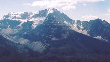
A standout peak in British Columbia’s Rockies offering sweeping alpine views and accessible high-country trails.
Stanley Peak rises prominently above the Vermilion River valley in Kootenay National Park, delivering classic Canadian Rockies scenery without the crowds found at more famous Banff summits. Its broad south face and sharp north ridge create a striking profile visible from Highway 93, while the summit plateau rewards hikers with unobstructed views across the Rockwall and toward the distant peaks of Yoho National Park.
The most common approach begins at the Stanley Glacier trailhead along Highway 93, roughly midway between Radium Hot Springs and the Alberta border. From the parking area, the route follows the well-marked Stanley Glacier trail for the first several kilometres before branching onto an unofficial but clearly worn climbers’ path that ascends steep talus and a final rocky gully to the summit. Most visitors reach the top in four to six hours round-trip; those seeking a longer day can continue along the ridge toward Stanley Glacier itself.
July through mid-September offers the most reliable snow-free conditions on the upper slopes. Early summer may still hold cornices and lingering snow patches on north aspects, while September brings cooler temperatures and fewer insects but a higher chance of early-season storms. Shoulder-season visits in late June or October require ice-axe and crampon skills for safe travel.
The primary objective is the non-technical scramble to the 3,094-metre summit. Strong hikers can complete the round-trip in a single day, while photographers often overnight at the Stanley Glacier campground to capture alpenglow on the peak. Winter visitors travel the same corridor on skis or snowshoes, though avalanche terrain demands proper training and equipment. Nearby, the Rockwall Trail provides a multi-day backpacking alternative with dramatic cliff views, and short interpretive walks along the highway showcase the park’s famous paint pots and marble canyons.
Stanley Peak sits within easy reach of other Kootenay highlights: the ochre mineral springs at Paint Pots, the short but steep trail to Marble Canyon, and the longer drive to Radium Hot Springs for a post-hike soak. Cross the border into Banff National Park via Highway 93 to reach Lake Louise or Moraine Lake in under an hour, or head west into Yoho National Park for the famous Emerald Lake circuit.
Keep reading
A rewarding backcountry trek leads to glacial waters and sweeping mountain views in British Columbia’s Coast Range.
The route is a moderate-to-difficult scramble requiring route-finding ability and comfort on steep, loose terrain; it is not a maintained hiking trail.
Novice hikers usually turn back at the base of the final gully; experienced scramblers and strong day-hikers complete the ascent comfortably.
A vault toilet and small parking area are provided; no potable water or services exist beyond the highway.
The lower Stanley Glacier trail is family-friendly, but the summit scramble is not recommended for children due to exposure and loose rock.
Black bears, grizzlies, and mountain goats frequent the area; carry bear spray and make noise on blind corners.
This serene lake in British Columbia’s Rockies delivers quiet paddling, trout fishing, and easy access to dramatic peaks…

Discover pristine rainforest, marine wildlife, and quiet anchorages on this secluded island in the Inside Passage.
