Skip to content
Plan & Tour
DestinationsItinerariesTravel BlogAboutContact
0Sign inPlan a trip
Plan & TourPlan & Tour

Travel guides, destination inspiration and curated itineraries for Canada, the USA and beyond, plus a free tool to plan your own day-by-day trip.

Get travel inspiration

Explore

  • All Destinations
  • Curated Itineraries
  • Travel Blog
  • Plan a Trip

Topics

  • Hiking & Nature
  • Food & Drink
  • City Breaks
  • Budget Travel

Company

  • About Us
  • Contact
  • Privacy Policy
  • Terms of Service

© 2026 Plan & Tour. Built for travellers.

Discover the world, one trip at a time.

Poopó Lake: Bolivia’s Highland Lagoon in the Oruro Altiplano
  1. Home
  2. Destinations
  3. Oruro Department
  4. Poopó Lake: Bolivia’s Highland Lagoon in the Oruro Altiplano
Lake

Poopó Lake: Bolivia’s Highland Lagoon in the Oruro Altiplano

Explore the stark landscapes, birdlife, and changing ecology of Poopó Lake in Bolivia’s Oruro Department.

Oruro DepartmentUpdated 11 October 2026

Why Visit Poopó Lake

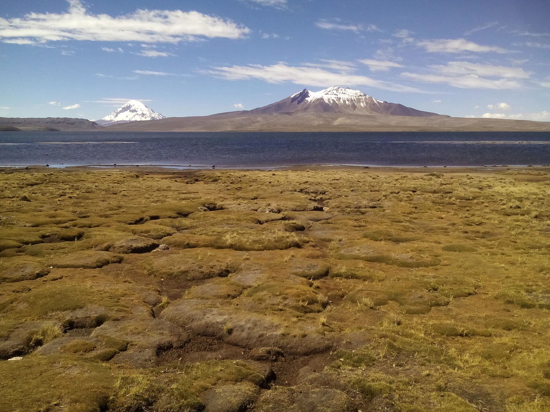
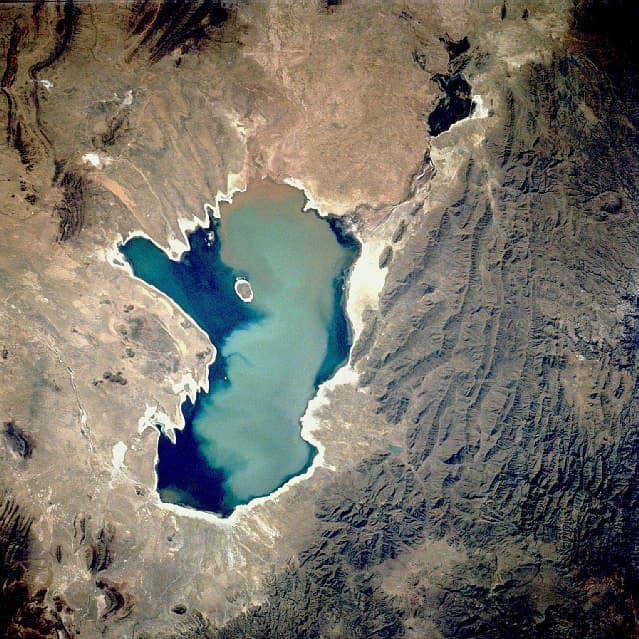
Poopó Lake sits on the high Bolivian Altiplano, offering visitors a rare look at a saline body of water shaped by extreme altitude and arid conditions. The lake’s expansive shallows once supported large flocks of flamingos and other migratory birds, while surrounding villages maintain traditional Aymara livelihoods tied to fishing and salt extraction. Although water levels have fluctuated dramatically in recent decades, the remaining wetlands still attract birdwatchers and photographers drawn to the contrast of mirror-like reflections against the brown cordillera.

Getting There

Most travelers reach Poopó Lake from the city of Oruro, roughly two hours south by road. Regular buses and shared taxis run along the main highway toward Challapata and Huari; from those towns, local transport or arranged tours continue to the lakeshore. Four-wheel-drive vehicles are useful for unpaved tracks that circle the lake’s western and southern edges. Independent drivers should carry extra fuel and water, as services are sparse once you leave the highway.

Best Time to Visit

The clearest skies and most stable roads occur during the dry season from May to October. Flamingo numbers peak between December and March when seasonal inflows create temporary feeding grounds. Early morning visits reduce wind and yield the best light for photography. Afternoon thunderstorms are common in summer, so plan return travel before mid-afternoon.

Things to See and Do

Birdwatching from the western shore near the village of Poopó yields sightings of Andean flamingos, Chilean flamingos, and various shorebirds. Short walks along the reed beds reveal salt-tolerant vegetation and small islands used by nesting colonies. Photographers often stop at viewpoints overlooking the distant peaks of the Azanaques range. Some visitors combine the lake with stops at nearby salt pans where local workers harvest and pile blocks of salt by hand.

Nearby Attractions

Poopó Lake lies between the famous Salar de Uyuni to the south and the smaller Salar de Coipasa to the west, allowing multi-day itineraries across the southern Altiplano. The colonial mining town of Oruro offers additional cultural stops, including its famous carnival museum and the Sanctuary of the Virgin of Socavón. Further north, the hot springs at Pazña provide a relaxing contrast after a day on the windswept plateau.

Visitor tips

  • Carry sufficient water, sun protection, and layered clothing; temperatures swing sharply between day and night at 3,700 meters.
  • Stay on established tracks to avoid damaging fragile wetland vegetation and nesting sites.
  • Hire a local guide from nearby communities for safer navigation and insights into traditional salt-harvesting practices.

Frequently asked questions

Is Poopu00f3 Lake still worth visiting even if water levels are low?+

Yes. The remaining wetlands and salt flats still support birdlife and offer dramatic highland scenery that illustrates the regionu2019s changing climate and hydrology.

How far is Poopu00f3 Lake from Salar de Uyuni?+

The southern tip of the lake lies approximately 150 kilometers north of the Salar de Uyuni, making it a logical stop on a multi-day circuit through the Altiplano.

Do I need a four-wheel-drive vehicle?+

A standard vehicle can reach main viewpoints from the highway, but unpaved lakeshore tracks become muddy after rain, so higher clearance is safer during the wet season.

Are there facilities or restaurants at the lake?+

Services are minimal. Small villages nearby sell basic supplies; most visitors bring food and water or arrange lunch through a tour operator in Oruro.

What altitude-related precautions should I take?+

Acclimatize in Oruro or La Paz beforehand, drink plenty of water, and avoid strenuous activity on arrival to reduce the risk of altitude sickness.

Share
Google Maps Apple Maps Directions

Image: Public domain · via Wikimedia Commons

Keep reading

Nearby & related

All stories
C
Oruro Department

Cosapilla River: Bolivia’s Remote Andean Highland Stream

A high-altitude river valley in Oruro Department offering stark volcanic scenery and quiet access to Bolivia’s western…

12 October 2026
J
Oruro Department

Jach’a Ch’ankha: Trekking Bolivia’s Remote Andean Summit in Oruro

Experience solitude, sweeping Altiplano views, and high-altitude adventure on this lesser-known peak in Bolivia’s Oruro…

12 October 2026
K’isi K’isini: Bolivia’s Remote Andean Volcano for Adventurous Hikers
Oruro Department

K’isi K’isini: Bolivia’s Remote Andean Volcano for Adventurous Hikers

Explore the stark volcanic landscapes and high-altitude trails of this striking peak in Oruro Department.

12 October 2026