Why Visit the Cosapilla River
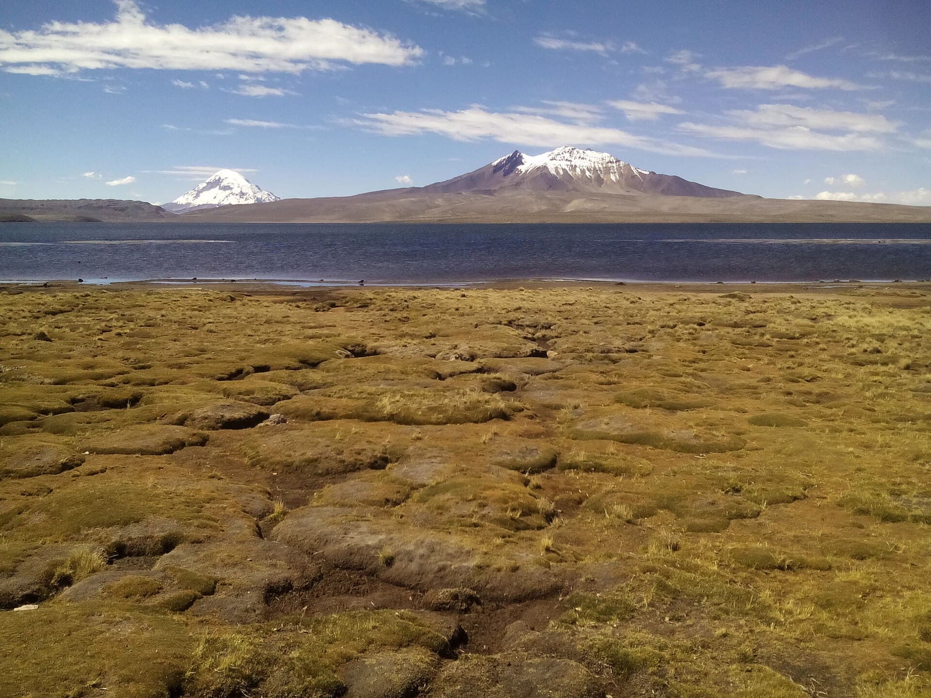
The Cosapilla River flows through a high, arid plateau in western Oruro Department, framed by snow-capped volcanoes and vast puna grasslands. Its clear waters cut through rocky canyons and support scattered wetlands that attract Andean wildlife such as vicuñas, flamingos, and migratory birds. Visitors come for the sense of isolation and the dramatic scale of the landscape rather than developed facilities.
Getting There
Most travelers start in the city of Oruro and continue west on the paved highway toward the Chilean border crossing at Tambo Quemado. After roughly four hours the road reaches the river valley; a short unpaved spur leads to viewpoints and simple river crossings. Four-wheel-drive vehicles are useful after rain, and local drivers are familiar with the unmarked turnoffs. There is no regular public transport, so independent travelers usually arrange a private driver or join a tour from Oruro or La Paz.
What to See and Do
Short walks along the riverbanks reveal layered volcanic rock and occasional stands of totora reeds. Photographers favor sunrise and late afternoon when light rakes across the volcanoes of the Cordillera Occidental. Birdwatchers scan the shallow wetlands for three species of flamingo and occasional Andean geese. The river itself is too cold and fast for swimming, but its banks offer quiet picnic spots. Some visitors continue a short distance upstream to where the Cosapilla joins the larger Lauca drainage and offers broader valley views.
Practical Considerations
Altitude here exceeds 4,000 meters, so allow at least one night in Oruro for acclimatization. Carry plenty of water, sun protection, and layers for sudden temperature drops. Cell service is limited; download offline maps before leaving pavement.
Best Time to Visit
The dry season from May to October brings clear skies and stable roads. Afternoon winds are common but rain is rare. December to March can bring flash floods that close dirt tracks, while nights remain cold year-round.
Nearby Attractions
Continuing west leads to Sajama National Park and the massive cone of Volcán Sajama. Southward routes reach the saline expanses of the Coipasa and Uyuni basins. On clear days the border volcanoes of Parinacota and Pomerape are visible to the southwest, offering a sense of the wider Andean chain that stretches into Chile.