Skip to content
Plan & Tour
DestinationsItinerariesTravel BlogAboutContact
0Sign inPlan a trip
Plan & TourPlan & Tour

Travel guides, destination inspiration and curated itineraries for Canada, the USA and beyond, plus a free tool to plan your own day-by-day trip.

Get travel inspiration

Explore

  • All Destinations
  • Curated Itineraries
  • Travel Blog
  • Plan a Trip

Topics

  • Hiking & Nature
  • Food & Drink
  • City Breaks
  • Budget Travel

Company

  • About Us
  • Contact
  • Privacy Policy
  • Terms of Service

© 2026 Plan & Tour. Built for travellers.

Discover the world, one trip at a time.

J
  1. Home
  2. Destinations
  3. Oruro Department
  4. Jach’a Ch’ankha: Trekking Bolivia’s Remote Andean Summit in Oruro
Mountain

Jach’a Ch’ankha: Trekking Bolivia’s Remote Andean Summit in Oruro

Experience solitude, sweeping Altiplano views, and high-altitude adventure on this lesser-known peak in Bolivia's Oruro Department.

Oruro DepartmentUpdated 12 October 2026

Why Visit Jach’a Ch’ankha

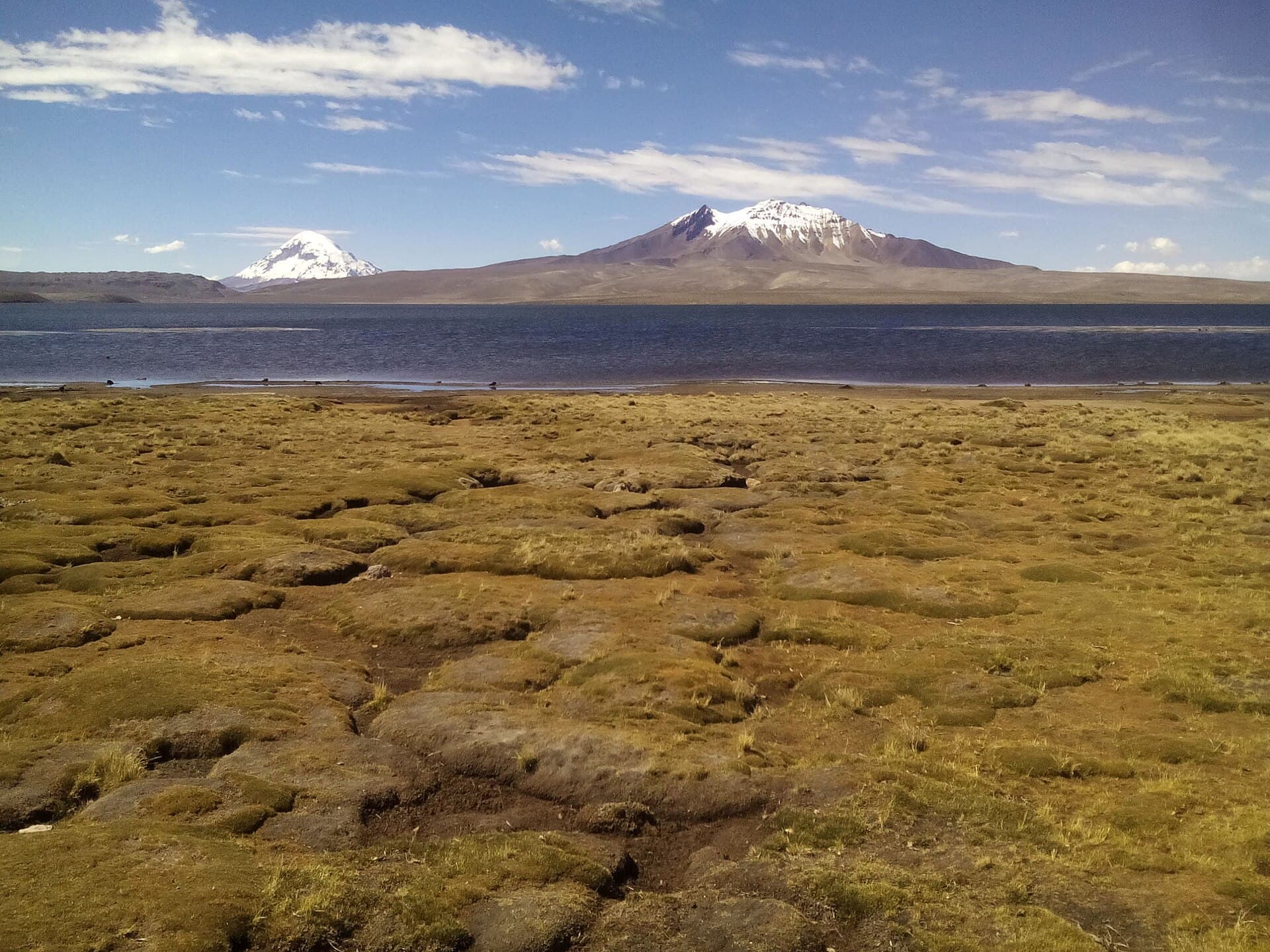
Jach’a Ch’ankha rises sharply from the high plains of Oruro Department, offering hikers and climbers a quieter alternative to more famous Bolivian peaks. Its slopes reveal classic Andean geology with layered rock formations and occasional snow patches even in the dry season. The mountain rewards visitors with unobstructed vistas across the Altiplano toward distant volcanic cones and the salt flats that punctuate western Bolivia.

Getting There

Most travelers begin in the city of Oruro, which sits on the main La Paz–Potosí highway and has regular bus connections from both directions. From Oruro, arrange a private vehicle or join a local tour that heads southwest along unpaved roads toward the mountain’s eastern approach. The final stretch often requires a four-wheel-drive vehicle or several hours of walking from the nearest hamlet. Allow a full day for the journey from Oruro, as road conditions vary with the season.

Best Time to Visit

The dry season from May through October brings the most stable weather and clearest skies, making route-finding easier and reducing the risk of sudden afternoon storms. Early morning starts are essential year-round because winds typically strengthen after midday. November to April sees more rain and snow at elevation, which can turn trails slippery and obscure cairns.

What to See and Do

Most visitors hike the eastern ridge, gaining elevation gradually through puna grassland dotted with hardy cushion plants. The route passes old stone corrals used by local herders and offers frequent sightings of vicuñas and Andean foxes. Reaching the summit plateau rewards climbers with 360-degree views that stretch from the Sajama massif in the west to the Cordillera Quimsa Cruz far to the east. Photographers find the best light in the golden hour just after sunrise.

Nearby Attractions

Combine a Jach’a Ch’ankha trip with visits to the nearby thermal springs at Pazña or the dramatic rock formations of the Turco region. The colonial mining town of Oruro itself provides museums and the famous Carnaval celebrations if your timing aligns with February or March. Aymara communities around the mountain welcome respectful travelers interested in learning about traditional llama herding and textile weaving.

Practical Considerations

Altitude exceeds 5,000 meters, so spend at least two nights in Oruro before attempting the ascent. Carry plenty of water and layers for rapid temperature swings. Local guides from surrounding villages can provide route knowledge and support the regional economy; hiring one is strongly recommended for anyone unfamiliar with high-Andean navigation.

Visitor tips

  • Spend at least two nights at lower elevation in Oruro before climbing to help prevent altitude sickness.
  • Hire a local guide from nearby Aymara communities for safe route-finding and to support regional livelihoods.
  • Travel during the Mayu2013October dry season and start hikes at dawn to avoid strong afternoon winds.

Frequently asked questions

How difficult is the hike up Jach'a Ch'ankha?+

The route is strenuous due to high altitude and loose scree near the top; it suits experienced hikers comfortable with long days above 4,000 meters.

Do I need a permit to climb Jach'a Ch'ankha?+

No formal climbing permit is required, but visitors should check current access with local communities and respect any temporary restrictions during herding seasons.

What wildlife might I see around the mountain?+

Vicuu00f1as, Andean foxes, and occasional condors are commonly sighted on the slopes and surrounding puna grasslands.

Can I visit Jach'a Ch'ankha without a guide?+

Experienced navigators with good maps can go independently, but most travelers benefit from hiring a local guide familiar with changing weather and unmarked trails.

Are there places to stay near Jach'a Ch'ankha?+

Basic lodging is available in nearby villages; many visitors base themselves in Oruro and make a long day trip or overnight camping excursion.

Share
Google Maps Apple Maps Directions

Keep reading

Nearby & related

All stories
C
Oruro Department

Cosapilla River: Bolivia’s Remote Andean Highland Stream

A high-altitude river valley in Oruro Department offering stark volcanic scenery and quiet access to Bolivia’s western…

12 October 2026
K’isi K’isini: Bolivia’s Remote Andean Volcano for Adventurous Hikers
Oruro Department

K’isi K’isini: Bolivia’s Remote Andean Volcano for Adventurous Hikers

Explore the stark volcanic landscapes and high-altitude trails of this striking peak in Oruro Department.

12 October 2026
C
Oruro Department

Cerro Columa: Hiking Bolivia’s Remote Andean Peak

Climb the windswept slopes of Cerro Columa for sweeping Altiplano views and a taste of Bolivia’s highland solitude.

12 October 2026