Skip to content
Plan & Tour
DestinationsItinerariesTravel BlogAboutContact
0Sign inPlan a trip
Plan & TourPlan & Tour

Travel guides, destination inspiration and curated itineraries for Canada, the USA and beyond, plus a free tool to plan your own day-by-day trip.

Get travel inspiration

Explore

  • All Destinations
  • Curated Itineraries
  • Travel Blog
  • Plan a Trip

Topics

  • Hiking & Nature
  • Food & Drink
  • City Breaks
  • Budget Travel

Company

  • About Us
  • Contact
  • Privacy Policy
  • Terms of Service

© 2026 Plan & Tour. Built for travellers.

Discover the world, one trip at a time.

Pico de la Zarza: Hiking Fuerteventura’s Highest Peak
  1. Home
  2. Destinations
  3. Las Palmas
  4. Pico de la Zarza: Hiking Fuerteventura’s Highest Peak
Mountain

Pico de la Zarza: Hiking Fuerteventura’s Highest Peak

Climb to the summit of this volcanic mountain in Jandía Natural Park for sweeping views across the Canary Island.

Las PalmasUpdated 12 November 2026

Why Visit Pico de la Zarza

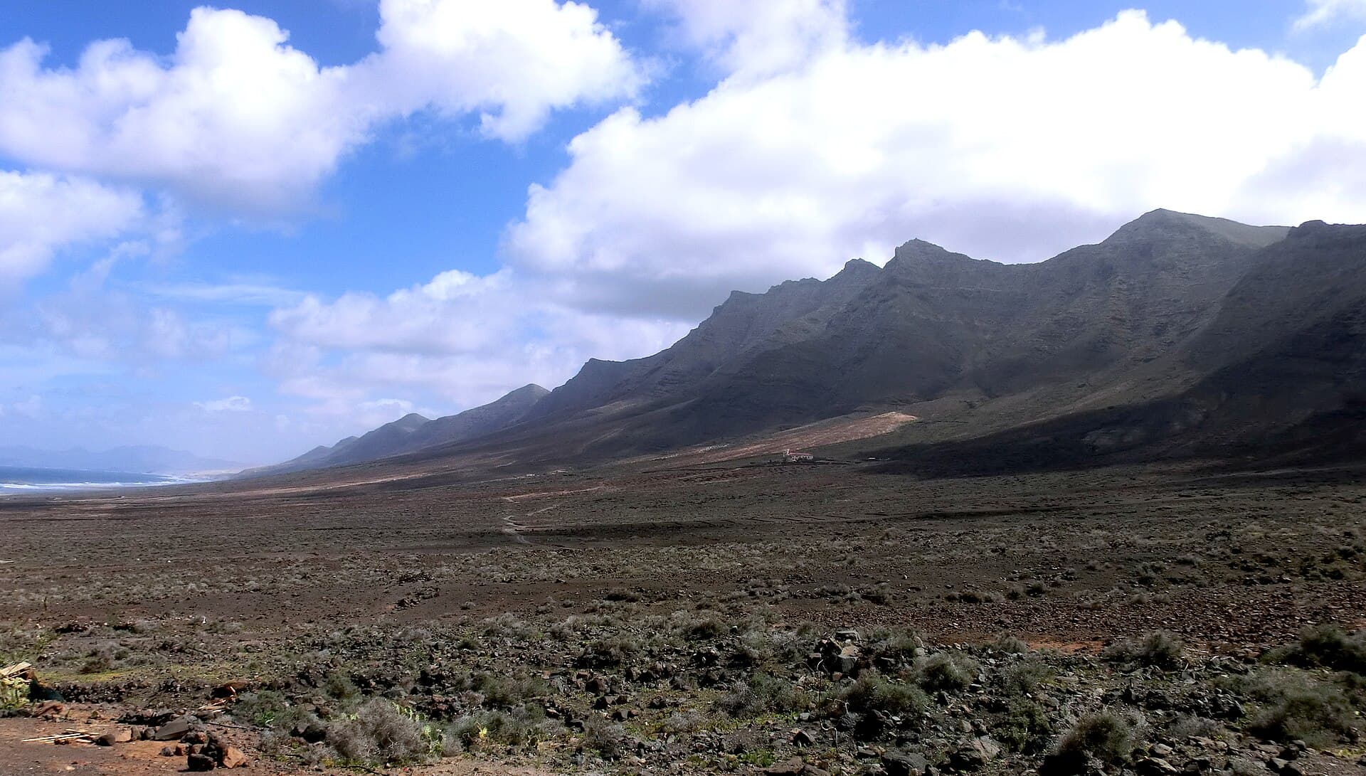
Pico de la Zarza rises as the highest point on Fuerteventura at 807 meters, offering hikers a clear vantage over the Jandía peninsula’s rugged terrain, golden beaches, and the Atlantic Ocean. Its volcanic slopes support unique endemic plants adapted to the arid environment, while the trail rewards visitors with 360-degree panoramas that stretch to neighboring islands on clear days.

The Hike to the Summit

The main route begins from a trailhead near the Jandía ridge and ascends gradually through scrubland and rocky paths. Expect a moderate out-and-back walk of roughly four to five hours round-trip, with steady elevation gain and occasional steep sections near the top. The path remains well-defined, passing through areas where trade winds shape the landscape and occasional cloud formations add drama to the views.

What to See Along the Way

  • Expansive vistas of Playa de Cofete and the wild southern coastline.
  • Layered volcanic rock formations that reveal the island’s geological history.
  • Low-growing flora such as the Canary Island spurge and various lichens clinging to the slopes.

Getting There

Reach the mountain by driving south on the FV-605 road from Morro Jable, following signs into Jandía Natural Park. A short unpaved section leads to the informal parking area at the trailhead. Public buses serve nearby coastal towns, after which a taxi or organized shuttle covers the final stretch to the starting point.

Best Time to Visit

The mild Canary Islands climate allows year-round access, yet winter and spring months deliver the clearest skies and comfortable temperatures for exertion. Early morning starts help avoid afternoon winds that can strengthen near the summit, while the shoulder seasons reduce the chance of encountering larger groups on the trail.

Nearby Attractions

After descending, explore the long sandy stretches of Playa de Sotavento to the north or the remote dunes and cliffs around Cofete. The coastal road also connects to the fishing village of Morro Jable, where fresh seafood and harbor walks provide a relaxed contrast to the mountain experience.

Visitor tips

  • Wear sturdy hiking boots with good grip for the loose volcanic gravel and rocky sections.
  • Carry at least two liters of water per person, as there are no refill points on the trail.
  • Check wind forecasts before setting out, since gusts can intensify at higher elevations.

Frequently asked questions

How difficult is the hike to Pico de la Zarza?+

The route is considered moderate, suitable for fit walkers with some elevation experience; the main challenge comes from steady climbing and occasional wind exposure rather than technical terrain.

Do I need a guide for Pico de la Zarza?+

A guide is not required as the trail is straightforward and marked, though joining a small group can add context about local geology and plants for first-time visitors.

Can children hike Pico de la Zarza?+

Older children accustomed to longer walks can manage the route, but the distance and elevation make it more appropriate for teens than young kids.

What should I bring for the Pico de la Zarza hike?+

Pack layers for changing wind conditions, sun protection, snacks, a map or GPS app, and a basic first-aid kit in addition to ample water.

Is Pico de la Zarza accessible in winter?+

Yes, the trail remains open year-round; winter often provides the clearest visibility, though occasional rain can make sections slippery.

Share
Google Maps Apple Maps Directions

Image: Dreizung · CC BY-SA 3.0 · via Wikimedia Commons

Keep reading

Nearby & related

All stories
Inagua Natural Reserve: Gran Canaria’s Rugged Protected Wilderness
Las Palmas

Inagua Natural Reserve: Gran Canaria’s Rugged Protected Wilderness

Discover volcanic ridges, endemic pine forests, and rare birdlife in this quiet corner of the Canary Islands.

12 November 2026
Malpaís de la Arena: Hiking Fuerteventura’s Ancient Lava Badlands
Las Palmas

Malpaís de la Arena: Hiking Fuerteventura’s Ancient Lava Badlands

Discover the stark volcanic beauty and quiet trails of this protected lava field on Fuerteventura’s northern coast.

12 November 2026
Montaña Tamia: Hiking Lanzarote’s Underrated Volcanic Summit
Las Palmas

Montaña Tamia: Hiking Lanzarote’s Underrated Volcanic Summit

A serene hike up Montaña Tamia delivers sweeping views across Lanzarote’s volcanic landscape without the crowds.

12 November 2026