Skip to content
Plan & Tour
DestinationsItinerariesTravel BlogAboutContact
0Sign inPlan a trip
Plan & TourPlan & Tour

Travel guides, destination inspiration and curated itineraries for Canada, the USA and beyond, plus a free tool to plan your own day-by-day trip.

Get travel inspiration

Explore

  • All Destinations
  • Curated Itineraries
  • Travel Blog
  • Plan a Trip

Topics

  • Hiking & Nature
  • Food & Drink
  • City Breaks
  • Budget Travel

Company

  • About Us
  • Contact
  • Privacy Policy
  • Terms of Service

© 2026 Plan & Tour. Built for travellers.

Discover the world, one trip at a time.

Patilla Pata: High-Altitude Hiking in Bolivia’s Sajama Province
  1. Home
  2. Destinations
  3. Sajama Province
  4. Patilla Pata: High-Altitude Hiking in Bolivia’s Sajama Province
Mountain

Patilla Pata: High-Altitude Hiking in Bolivia’s Sajama Province

A remote Andean peak offering dramatic views, wildlife, and authentic high-plateau experiences in Sajama National Park.

Sajama ProvinceUpdated 11 October 2026

Why Patilla Pata Stands Out

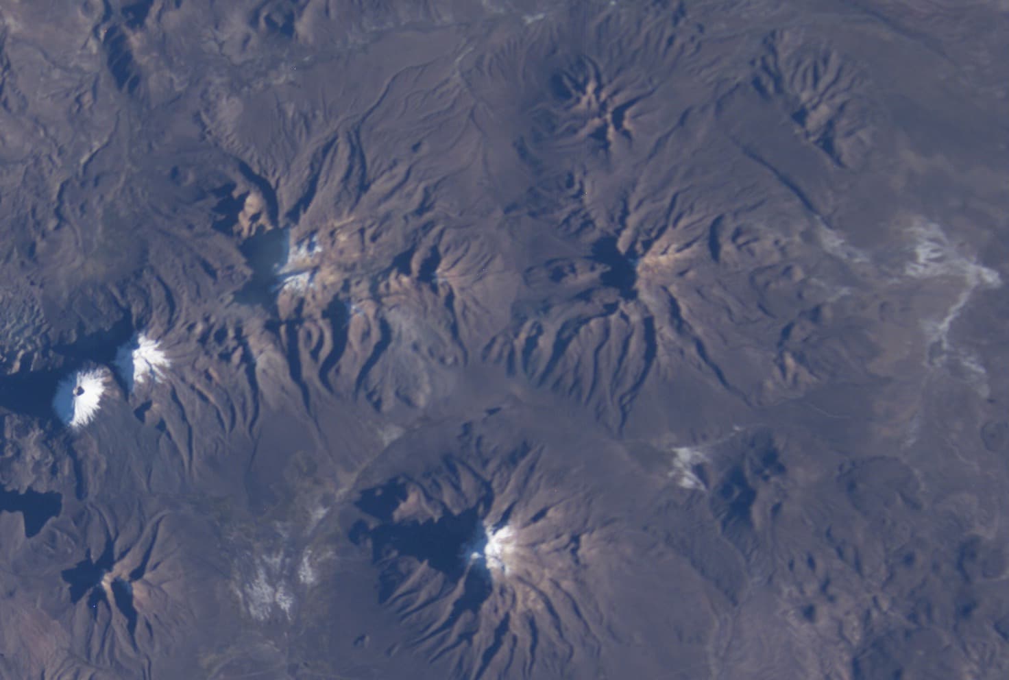
Patilla Pata rises from the arid Altiplano of western Bolivia, part of the volcanic landscape that defines Sajama National Park. Its slopes deliver sweeping vistas of neighboring Sajama volcano and the endless high plains, while the surrounding bofedales wetlands support herds of wild vicuñas and occasional Andean flamingos. The mountain’s isolation preserves a quiet, uncommercial atmosphere rare among more famous Andean summits.

Activities on and Around the Peak

Most visitors come for day hikes or overnight treks along established trails that ascend gradually through puna grassland and rocky scree. Lower routes offer excellent birdwatching and opportunities to photograph the contrast between snow-streaked volcanoes and golden grasslands. Experienced mountaineers may attempt the summit, which requires solid acclimatization and basic glacier-travel skills in winter. Photography, stargazing, and cultural encounters with nearby Aymara communities round out the experience.

Practical Hiking Advice

  • Start early to avoid afternoon winds that funnel across the plateau.
  • Carry plenty of water; natural sources are scarce above 4,500 meters.
  • Travel with a local guide familiar with weather shifts and route-finding on the featureless upper slopes.

Getting There

Patilla Pata lies roughly 200 kilometers southwest of La Paz. Most travelers take a bus or private transfer to the town of Sajama, then arrange a 4×4 or guided hike to the mountain’s base. The final approach follows dirt roads that cross open pampas; a high-clearance vehicle is essential in the rainy season.

Best Time to Visit

The dry season from May to October provides the clearest skies and most stable trail conditions. June through August offers the coldest nights but the best chance of snow-free upper slopes. November to April brings afternoon thunderstorms and muddy access roads, though the landscape turns greener and wildlife is more active near water sources.

Nearby Highlights

Combine a Patilla Pata trip with visits to the thermal springs at Termas de Sajama, the colonial church in the village of Sajama, and viewpoints overlooking the vast salt flats of Coipasa to the south. The park’s vicuña reserve and the dramatic Sajama volcano cone are within a day’s travel.

Visitor tips

  • Spend at least two nights at altitude in Sajama village before attempting any serious ascent to reduce the risk of altitude sickness.
  • Pack layers for extreme temperature swings; daytime sun can be intense while nights drop well below freezing year-round.
  • Hire local Aymara guides through the Sajama community tourism office to support conservation efforts and gain route knowledge.

Frequently asked questions

How difficult is hiking Patilla Pata?+

Lower trails are moderate for fit hikers, but the summit demands prior high-altitude experience and proper acclimatization.

Do I need a guide to visit Patilla Pata?+

Guides are strongly recommended for any route above the lower slopes, both for safety and because the area has limited signage and rescue infrastructure.

What wildlife might I see?+

Vicuu00f1as graze the grasslands, while Andean geese and flamingos frequent the wetlands; condors are occasionally spotted soaring above the ridges.

Is camping allowed near the mountain?+

Yes, designated campsites exist near the base; visitors must follow leave-no-trace rules and obtain permission from local authorities.

Can I combine Patilla Pata with Sajama volcano?+

Many multi-day itineraries link the two peaks, though Sajama is a more technical climb and requires additional preparation and permits.

Share
Google Maps Apple Maps Directions

Image: Image Science and Analysis Laboratory, NASA-Johnson Space Center. · Public domain · via Wikimedia Commons

Keep reading

Nearby & related

All stories
M
Sajama Province

Macizo de Pacuni: Trekking Bolivia’s Remote Andean Massif

A high-altitude massif in Sajama Province offering stark volcanic landscapes, wildlife viewing, and solitude for…

12 October 2026
A
Sajama Province

Asu Asuni: Trekking Bolivia’s Remote Andean Peak

Explore the stark volcanic landscapes and high-altitude trails of Asu Asuni in Sajama Province.

12 October 2026
M
Sajama Province

Macizo de Larancagua: Trekking Bolivia’s Remote Andean Volcanic Massif

A high-altitude wonderland of volcanic peaks, vast altiplano vistas, and wildlife-rich trails in Sajama Province.

12 October 2026