Skip to content
Plan & Tour
DestinationsItinerariesTravel BlogAboutContact
0Sign inPlan a trip
Plan & TourPlan & Tour

Travel guides, destination inspiration and curated itineraries for Canada, the USA and beyond, plus a free tool to plan your own day-by-day trip.

Get travel inspiration

Explore

  • All Destinations
  • Curated Itineraries
  • Travel Blog
  • Plan a Trip

Topics

  • Hiking & Nature
  • Food & Drink
  • City Breaks
  • Budget Travel

Company

  • About Us
  • Contact
  • Privacy Policy
  • Terms of Service

© 2026 Plan & Tour. Built for travellers.

Discover the world, one trip at a time.

Opal Cone: Hiking British Columbia’s Striking Volcanic Cinder Cone
  1. Home
  2. Destinations
  3. British Columbia
  4. Opal Cone: Hiking British Columbia’s Striking Volcanic Cinder Cone
Mountain

Opal Cone: Hiking British Columbia’s Striking Volcanic Cinder Cone

A rewarding alpine trek through Garibaldi Provincial Park to a rare cinder cone with sweeping views of glaciers and Coast Mountains peaks.

British ColumbiaUpdated 31 July 2026

Why Visit Opal Cone

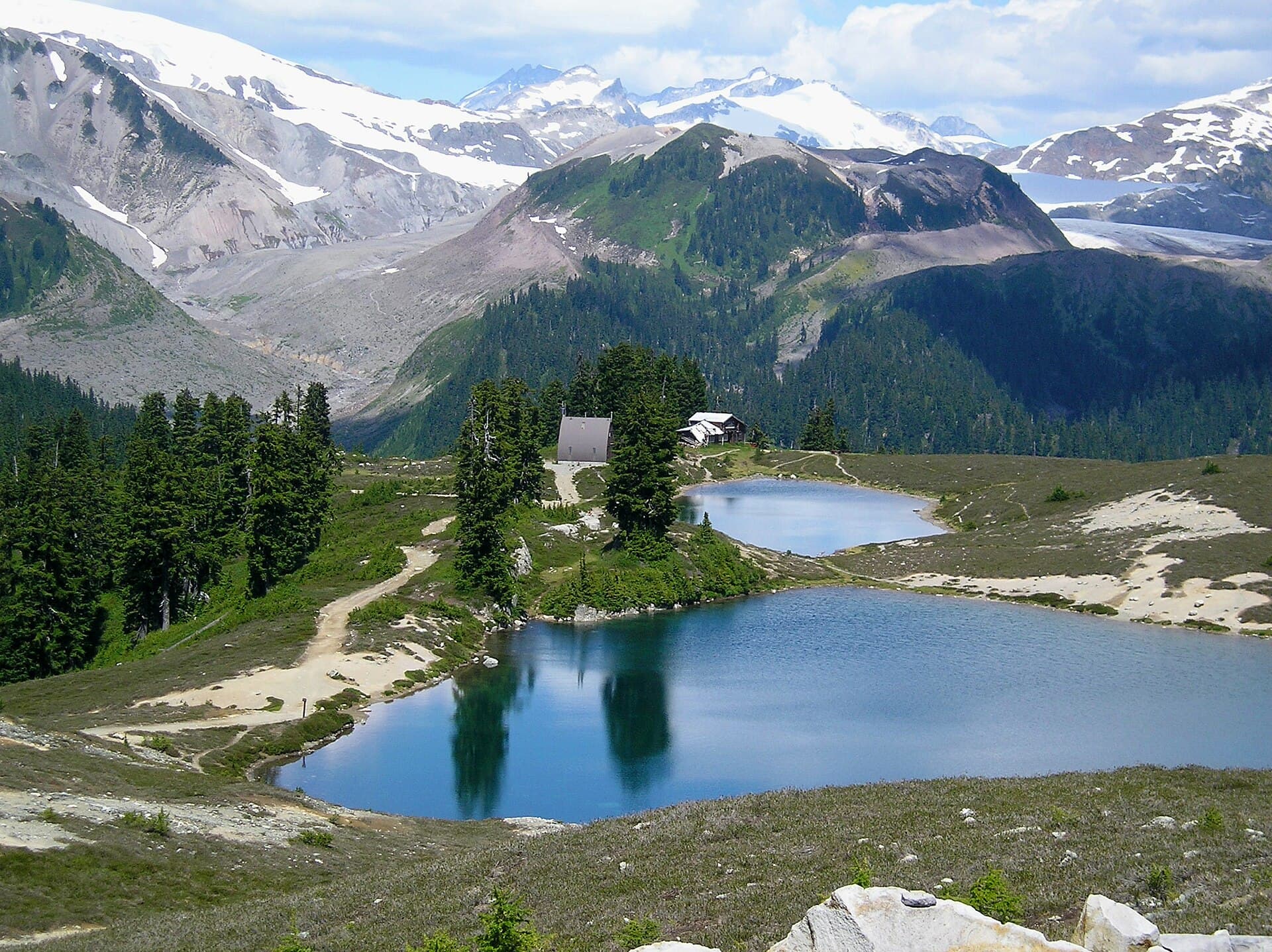
Opal Cone rises as a distinctive volcanic cinder cone within Garibaldi Provincial Park, offering hikers a tangible connection to the region’s fiery geological past. Its dark, loose slopes contrast sharply with surrounding snowfields and turquoise glacial lakes, creating a landscape that feels both remote and otherworldly. The summit delivers panoramic views of the Mamquam Icefield, Atwell Peak, and the broader Coast Mountains, making the effort worthwhile for those seeking quieter trails beyond the park’s more famous destinations.

Getting There

Access begins from the Elfin Lakes trailhead, reached by driving north from Squamish along Highway 99 then turning onto the well-signed Mamquam Forest Service Road. The final 11 kilometres are gravel and suitable for most passenger vehicles in dry conditions; high-clearance vehicles handle it more comfortably after rain. Parking fills quickly on summer weekends, so arrive early. From the trailhead, follow the wide Elfin Lakes trail for roughly 11 kilometres to the lakes themselves, then continue south on the marked Opal Cone route.

The Hike

The full round-trip distance from the trailhead measures approximately 26 kilometres with 900 metres of elevation gain. Most hikers spend the night at Elfin Lakes campground or hut before tackling the final 4-kilometre out-and-back to the cone. The trail crosses alpine meadows, skirts small tarns, and climbs steadily over volcanic rubble to the summit rim. Expect loose footing near the top; trekking poles help on the descent. Allow 8–10 hours total for fit hikers completing the journey in one long day, or split it comfortably over two days.

Best Time to Visit

July through September provides the most reliable snow-free conditions and longest daylight. Early July may still hold patchy snow on north-facing slopes, while October brings early storms. Winter travel requires avalanche awareness and ski or snowshoe experience. Always check current park conditions before departing, as weather in the Coast Mountains changes rapidly.

Nearby Attractions

Combine the trip with a visit to nearby Elfin Lakes for swimming or photography, or extend further to Garibaldi Lake and the iconic Black Tusk. The broader Squamish area offers additional hiking, mountain biking, and river rafting opportunities on either side of the park visit.

Visitor tips

  • Pack sturdy footwear and trekking poles; the final ascent over loose cinder is steep and slippery.
  • Carry more water than you think you needu2014alpine sources are limited after Elfin Lakes.
  • Reserve Elfin Lakes hut or campsite in advance during peak season to avoid carrying a full overnight pack on the longer day.

Frequently asked questions

How difficult is the hike to Opal Cone?+

The route is rated moderate to strenuous due to distance and elevation; the final section involves loose volcanic material that demands careful footing.

Do I need a permit to hike Opal Cone?+

Day hiking requires no permit, but overnight stays at Elfin Lakes need advance reservations through BC Parks.

Is Opal Cone suitable for beginners?+

Beginners with good fitness can manage it by camping at Elfin Lakes and hiking to the cone as a separate day trip, but the full distance from the trailhead is long for novices.

What wildlife might I encounter?+

Black bears, marmots, and mountain goats are possible; make noise on blind corners and store food properly at camp.

Can I mountain bike to Opal Cone?+

Biking is permitted only to Elfin Lakes; the Opal Cone trail itself is hiking-only due to steep, loose terrain.

Share
Google Maps Apple Maps Directions

Image: Andysonic777 at English Wikipedia · CC BY 3.0 · via Wikimedia Commons

Keep reading

Nearby & related

All stories
Vedder River: Salmon Fishing, Paddling and Riverside Trails in British Columbia
British Columbia

Vedder River: Salmon Fishing, Paddling and Riverside Trails in British Columbia

A clear, productive river in the Fraser Valley offering consistent chinook and coho runs, easy paddling and quiet hiking…

1 August 2026
E
British Columbia

Englishman River: Waterfalls, Forests and Salmon Runs on Vancouver Island

Hike to dramatic waterfalls, swim in clear pools, and watch salmon spawn along this Vancouver Island river.

1 August 2026
B
British Columbia

Bella Coola River: Wilderness Fishing and Grizzly Viewing in British Columbia’s Great Bear Rainforest

This remote river in the Bella Coola Valley offers world-class steelhead and salmon fishing, abundant wildlife, and…

1 August 2026


