Skip to content
Plan & Tour
DestinationsItinerariesTravel BlogAboutContact
0Sign inPlan a trip
Plan & TourPlan & Tour

Travel guides, destination inspiration and curated itineraries for Canada, the USA and beyond, plus a free tool to plan your own day-by-day trip.

Get travel inspiration

Explore

  • All Destinations
  • Curated Itineraries
  • Travel Blog
  • Plan a Trip

Topics

  • Hiking & Nature
  • Food & Drink
  • City Breaks
  • Budget Travel

Company

  • About Us
  • Contact
  • Privacy Policy
  • Terms of Service

© 2026 Plan & Tour. Built for travellers.

Discover the world, one trip at a time.

Nazko Cone: Hiking British Columbia’s Youngest Volcano
  1. Home
  2. Destinations
  3. British Columbia
  4. Nazko Cone: Hiking British Columbia’s Youngest Volcano
Mountain

Nazko Cone: Hiking British Columbia’s Youngest Volcano

Discover the remote cinder cone that marks Canada's most recent volcanic activity in the heart of the Chilcotin Plateau.

British ColumbiaUpdated 31 July 2026

Why Nazko Cone Stands Out

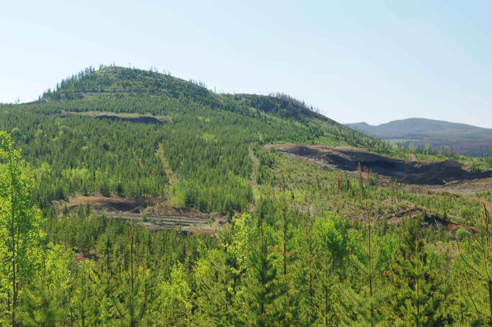
Nazko Cone rises as a classic basaltic cinder cone from the flat expanse of the Chilcotin Plateau, formed by eruptions roughly 7,200 years ago that rank it as the youngest volcanic feature in Canada. Its dark, loose scoria slopes and crater rim offer tangible evidence of relatively recent geological activity in an otherwise stable region. Visitors reach a quiet summit with panoramic views across lodgepole pine forests and distant mountain ridges, an experience shaped by the cone’s isolation rather than crowds.

Reaching the Site

Access begins from Highway 97 near Quesnel, turning west onto the Nazko Road and then following a network of maintained forestry roads for the final stretch. The last 10 to 15 kilometres require a high-clearance vehicle, especially after rain when surfaces turn muddy. No public transit serves the area, so independent travel or arranged shuttles from Williams Lake are the practical options. The trailhead sits at the base of the cone, marked by a small pullout and basic interpretive sign.

What to See and Do

The main activity is the hike to the summit, a steady climb on loose volcanic gravel that takes most people 45 to 90 minutes round-trip. The route circles the crater rim, where wind-sculpted trees and patches of alpine vegetation contrast with the dark rock. Birdwatchers may spot Clark’s nutcrackers or ravens, while the surrounding plateau offers opportunities for wildlife viewing, including mule deer and black bears at dawn or dusk. Overnight camping is possible on flat ground near the trailhead, though no facilities exist.

Best Time to Visit

Late June through early September provides the most reliable conditions, with snow-free trails and long daylight hours. Spring runoff can make access roads impassable, and autumn brings early snow at this elevation. Winter visits demand snowmobiles or skis and full winter travel preparation.

Nearby Places Worth Exploring

The broader Nazko Volcanic Field contains several smaller cones and lava flows reachable by the same forestry road network. Southward lies the community of Nazko, a small First Nations settlement with basic services. Further afield, the rolling ranchlands around Williams Lake and the extensive trails of the Cariboo Mountains provide additional day trips for those extending their stay on the plateau.

Visitor tips

  • Carry extra fuel, water, and a full-size spare tire, as cell coverage is absent beyond Quesnel and services are limited.
  • Stay on established paths to avoid damaging fragile volcanic soils and to reduce the chance of disorientation in uniform pine forest.
  • Check current forestry road conditions with the local district office before departure, especially after heavy rain or during fire season.

Frequently asked questions

How difficult is the hike to the summit of Nazko Cone?+

The ascent is moderate for fit hikers, covering loose cinder on a steady grade with no technical sections, though the footing can be tiring on descent.

Is Nazko Cone suitable for children or beginners?+

The trail is short but steep and unstable underfoot, so it suits older children and beginners who are comfortable with uneven terrain and prepared for variable weather.

Are there any facilities or water sources at Nazko Cone?+

None exist on site. Visitors must bring all water, food, and waste disposal supplies, and plan to use services in Quesnel or Williams Lake.

Can I drive to the top of Nazko Cone?+

No vehicle access reaches the summit. The final approach is on foot via the hiking trail from the forestry road pullout at the base.

What wildlife might I encounter around Nazko Cone?+

Mule deer, black bears, and various birds are common on the plateau. Carry bear spray, make noise on the trail, and secure food at camp.

Share
Google Maps Apple Maps Directions

Image: nass5518 · CC BY 2.0 · via Wikimedia Commons

Keep reading

Nearby & related

All stories
Wedgemount Lake: Hiking to a Turquoise Alpine Gem Near Whistler
British Columbia

Wedgemount Lake: Hiking to a Turquoise Alpine Gem Near Whistler

A rewarding backcountry trek leads to glacial waters and sweeping mountain views in British Columbia’s Coast Range.

8 August 2026
Yellowhead Lake: Turquoise Waters and Mountain Backdrops in Mount Robson Provincial Park
British Columbia

Yellowhead Lake: Turquoise Waters and Mountain Backdrops in Mount Robson Provincial Park

This serene lake in British Columbia’s Rockies delivers quiet paddling, trout fishing, and easy access to dramatic peaks…

8 August 2026
Swindle Island: Remote Wilderness on British Columbia’s Central Coast
British Columbia

Swindle Island: Remote Wilderness on British Columbia’s Central Coast

Discover pristine rainforest, marine wildlife, and quiet anchorages on this secluded island in the Inside Passage.

8 August 2026


