
Skip to content
Plan & Tour
DestinationsItinerariesTravel BlogAboutContact
0Sign inPlan a trip
Plan & TourPlan & Tour

Travel guides, destination inspiration and curated itineraries for Canada, the USA and beyond, plus a free tool to plan your own day-by-day trip.

Get travel inspiration

Explore

  • All Destinations
  • Curated Itineraries
  • Travel Blog
  • Plan a Trip

Topics

  • Hiking & Nature
  • Food & Drink
  • City Breaks
  • Budget Travel

Company

  • About Us
  • Contact
  • Privacy Policy
  • Terms of Service

© 2026 Plan & Tour. Built for travellers.

Discover the world, one trip at a time.

Mount Tyrwhitt: Summit Scramble in the Canadian Rockies
  1. Home
  2. Destinations
  3. British Columbia
  4. Mount Tyrwhitt: Summit Scramble in the Canadian Rockies
Mountain

Mount Tyrwhitt: Summit Scramble in the Canadian Rockies

A rewarding hike to panoramic views across Kananaskis Country and the Alberta-British Columbia border peaks.

British ColumbiaUpdated 31 July 2026

Why Visit Mount Tyrwhitt

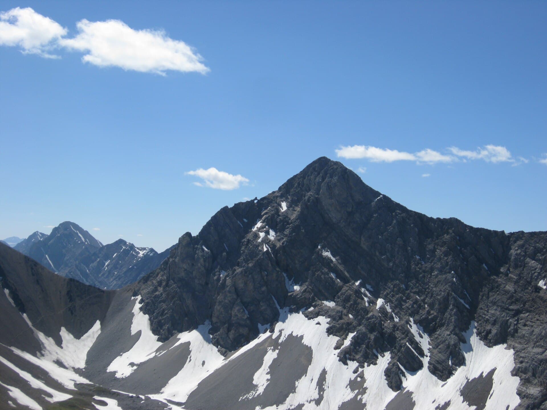
Mount Tyrwhitt rises prominently above the Spray Lakes Reservoir in the Canadian Rockies, delivering 360-degree views that stretch from the Opal Range to distant peaks in British Columbia. Its accessible scramble makes it a favorite for hikers seeking a moderate challenge without the crowds of more famous summits nearby.

The Hike to the Summit

The standard route begins near the Mount Tyrwhitt trailhead along the Smith-Dorrien Trail. Hikers follow a well-defined path through subalpine forest before emerging onto open slopes. The final push involves straightforward scrambling over loose rock and scree to the 2,881-metre summit. Expect a round-trip distance of roughly 8 kilometres with 700 metres of elevation gain. Strong hikers complete the outing in four to six hours.

What to Expect at the Top

From the summit cairn you can identify Mount Rae to the north, Mount Sparrowhawk to the south, and the distinctive profile of Mount Assiniboine on clear days. The broad summit plateau offers sheltered spots for lunch and photography.

Getting There

Drive south from Canmore on Highway 742 (Smith-Dorrien Trail) past the Spray Lakes Reservoir. Parking is available at the signed pullout for the Tyrwhitt trail. The road is gravel in sections and suitable for most passenger vehicles in summer, though winter access is limited.

Best Time to Visit

July through early September offers the most reliable snow-free conditions and long daylight hours. Wildflowers peak in late July. Shoulder seasons bring colorful larches in September and quieter trails, but expect possible morning frost. Always check avalanche and weather forecasts before heading out.

Nearby Attractions

  • Drive or hike to nearby Chester Lake for an easier alpine meadow walk.
  • Explore the interpretive trails around the Kananaskis Lakes.
  • Combine with a visit to the Mount Shark area for additional scrambling options.

Visitor tips

  • Carry plenty of water and layers; the exposed upper slopes heat quickly in summer but cool rapidly after sunset.
  • Wear sturdy boots with good traction for the loose scree near the summit.
  • Start early to avoid afternoon thunderstorms common in the Rockies.

Frequently asked questions

How difficult is the Mount Tyrwhitt hike?+

It is rated moderate to difficult due to the steep final scramble and loose rock. Good fitness and some scrambling experience are recommended.

Are dogs allowed on the trail?+

Yes, dogs are permitted but must be under control at all times; bring a leash for the summit area where other hikers congregate.

Is there cell service near Mount Tyrwhitt?+

Coverage is spotty along the Smith-Dorrien Trail and nonexistent on the upper slopes; download offline maps before departing.

Can I camp near the mountain?+

No designated camping exists at the trailhead. Backcountry camping is available at nearby sites such as Mount Shark or in Kananaskis Provincial Park with permits.

What wildlife might I encounter?+

Watch for grizzly bears, bighorn sheep, and marmots. Carry bear spray and make noise on the forested sections of the trail.

Share
Google Maps Apple Maps Directions

Image: Chwilliams · Public domain · via Wikimedia Commons

Keep reading

Nearby & related

All stories
Vedder River: Salmon Fishing, Paddling and Riverside Trails in British Columbia
British Columbia

Vedder River: Salmon Fishing, Paddling and Riverside Trails in British Columbia

A clear, productive river in the Fraser Valley offering consistent chinook and coho runs, easy paddling and quiet hiking…

1 August 2026
E
British Columbia

Englishman River: Waterfalls, Forests and Salmon Runs on Vancouver Island

Hike to dramatic waterfalls, swim in clear pools, and watch salmon spawn along this Vancouver Island river.

1 August 2026
B
British Columbia

Bella Coola River: Wilderness Fishing and Grizzly Viewing in British Columbia’s Great Bear Rainforest

This remote river in the Bella Coola Valley offers world-class steelhead and salmon fishing, abundant wildlife, and…

1 August 2026

