
Keep reading
Nearby & related

Wedgemount Lake: Hiking to a Turquoise Alpine Gem Near Whistler
A rewarding backcountry trek leads to glacial waters and sweeping mountain views in British Columbia’s Coast Range.
8 August 2026
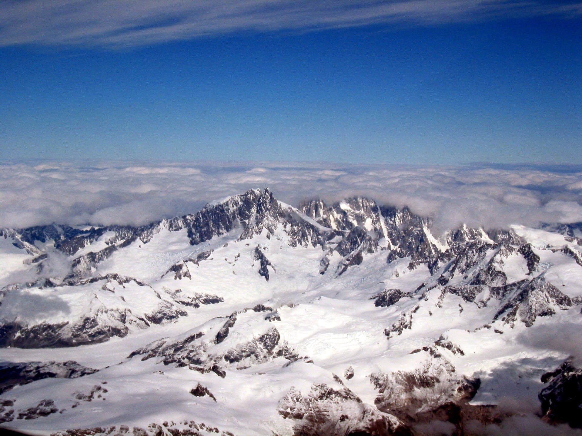
Explore the rugged granite spires, expansive glaciers, and serious climbing terrain of this iconic Coast Mountains peak.
Mount Tiedemann rises dramatically in the heart of the Waddington Range, offering one of the most remote and technically demanding alpine experiences in British Columbia. At 3,081 metres, it forms part of a vast icefield landscape that includes neighbouring giants like Mount Waddington. The peak attracts experienced mountaineers drawn to its long rock routes, serac-strewn glaciers, and near-total wilderness isolation.
Access begins with a flight to Vancouver or Campbell River, followed by a scheduled float-plane flight into the Knight or Bute Inlet region. From the landing lake, parties typically travel by helicopter or ski-plane to a base camp on the Tiedemann Glacier or nearby snowfields. No roads reach the mountain, so all visitors must arrange air charters in advance and be prepared for weather-dependent schedules.
The optimal window runs from mid-July through early September when snow bridges are firm and daytime temperatures allow multi-day climbs. Earlier season visits may encounter deeper snow and higher avalanche risk, while September brings shorter days and the possibility of early storms.
The South Face and East Ridge are the most frequented lines, involving sustained rock climbing up to 5.8–5.10 difficulty combined with glacier travel. Photographers and ski mountaineers also visit for the sweeping views across the Homathko Icefield and the chance to traverse between Tiedemann and adjacent peaks. All routes require crevasse rescue skills, glacier navigation, and self-sufficiency for several days.
Most climbers combine a Tiedemann ascent with attempts on Mount Waddington or the Serra Peaks to the north. Lower-elevation options include kayak-supported trips along Knight Inlet or wildlife viewing at the mouth of Bute Inlet, both reachable by the same air charters that service the range.
Keep reading
A rewarding backcountry trek leads to glacial waters and sweeping mountain views in British Columbia’s Coast Range.
Most parties are self-guided, but only if the group has proven glacier travel, crevasse rescue, and technical rock skills. First-time visitors often hire a certified mountain guide for safety.
Allow five to eight days round-trip from Vancouver, including weather days, travel to base camp, the climb, and return flights.
No. The peak demands advanced mountaineering experience; novices should start with guided trips on easier Coast Mountains objectives first.
No climbing permits are needed, but visitors must follow Leave No Trace principles and may need to register with Parks Canada if entering adjacent protected areas.
Overland approaches from logging roads are extremely long and bushy; nearly all successful trips rely on float-plane access.
This serene lake in British Columbia’s Rockies delivers quiet paddling, trout fishing, and easy access to dramatic peaks…

Discover pristine rainforest, marine wildlife, and quiet anchorages on this secluded island in the Inside Passage.
