Skip to content
Plan & Tour
DestinationsItinerariesTravel BlogAboutContact
0Sign inPlan a trip
Plan & TourPlan & Tour

Travel guides, destination inspiration and curated itineraries for Canada, the USA and beyond, plus a free tool to plan your own day-by-day trip.

Get travel inspiration

Explore

  • All Destinations
  • Curated Itineraries
  • Travel Blog
  • Plan a Trip

Topics

  • Hiking & Nature
  • Food & Drink
  • City Breaks
  • Budget Travel

Company

  • About Us
  • Contact
  • Privacy Policy
  • Terms of Service

© 2026 Plan & Tour. Built for travellers.

Discover the world, one trip at a time.

Mount Robie Reid: Hiking British Columbia’s Remote Coastal Summit
  1. Home
  2. Destinations
  3. British Columbia
  4. Mount Robie Reid: Hiking British Columbia’s Remote Coastal Summit
Mountain

Mount Robie Reid: Hiking British Columbia’s Remote Coastal Summit

Tackle the demanding trails to the summit of Mount Robie Reid for sweeping views over Pitt Lake and the Coast Mountains.

British ColumbiaUpdated 31 July 2026

Why Visit Mount Robie Reid

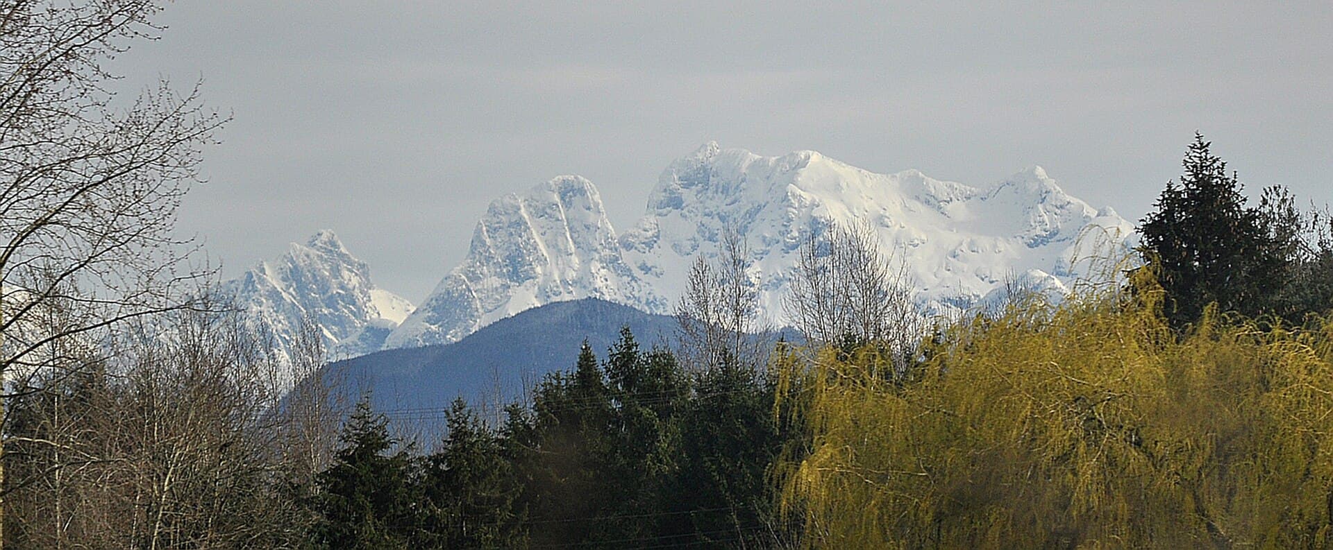
Mount Robie Reid rises steeply from the shores of Pitt Lake in British Columbia’s Coast Mountains, offering experienced hikers a true wilderness summit experience without the crowds of more accessible peaks. The mountain’s rugged granite faces and subalpine meadows deliver panoramic views of the lake, surrounding ridges, and distant Vancouver skyline on clear days. Its isolation makes it ideal for those seeking solitude and a genuine backcountry challenge.

Getting There

Access begins with a boat or float-plane journey across Pitt Lake from the community of Pitt Meadows. From the lake’s north end, unmarked trails and creek beds lead upward through dense forest toward the summit. Four-wheel-drive vehicles are required for the rough logging roads leading to launch points, and visitors should arrange water transport in advance with local operators familiar with the area. No maintained trailhead exists, so solid navigation skills using topographic maps or GPS are essential.

Trails and Activities

The primary route follows old logging roads before ascending steep, unmaintained paths through second-growth forest and boulder fields. Expect 8–10 hours round-trip for fit hikers, with significant elevation gain and route-finding required above treeline. Summit rewards include 360-degree vistas and the chance to spot mountain goats. In winter, the mountain attracts experienced ski mountaineers, though avalanche terrain demands proper training and gear.

Best Time to Visit

Late June through September offers the most reliable weather and snow-free conditions at higher elevations. Early summer can still hold snow patches, while fall brings vibrant foliage but shorter days. Always check current avalanche forecasts and weather before departure, as conditions change rapidly in the Coast Mountains.

Nearby Attractions

Combine a trip with exploration of Golden Ears Provincial Park to the west or the scenic Pitt-Addington Marsh Wildlife Management Area for birdwatching. The lower Pitt River offers calm paddling opportunities, and the historic town of Maple Ridge provides resupply and lodging options before heading into the backcountry.

Visitor tips

  • Carry a satellite communicator or personal locator beacon, as cell service is nonexistent beyond the lake.
  • Pack extra layers and rain gearu2014mountain weather can shift from clear to stormy within minutes.
  • Practice leave-no-trace principles: camp only on durable surfaces and pack out all waste.

Frequently asked questions

How difficult is the hike to Mount Robie Reid?+

It is a strenuous, off-trail adventure suitable only for very experienced hikers with strong navigation skills and good fitness.

Do I need a permit to hike Mount Robie Reid?+

No permit is required for day hiking, but backcountry camping follows standard British Columbia Crown land regulations.

Is Mount Robie Reid suitable for beginners?+

No. The route involves route-finding, steep terrain, and remote wilderness travel that demands prior backcountry experience.

What wildlife might I encounter?+

Black bears, mountain goats, and various bird species are common; carry bear spray and know how to use it.

Can I reach the summit in winter?+

Only with advanced ski-mountaineering skills, avalanche training, and proper safety equipment due to steep, avalanche-prone slopes.

Share
Google Maps Apple Maps Directions

Image: The High Fin Sperm Whale · CC BY-SA 3.0 · via Wikimedia Commons

Keep reading

Nearby & related

All stories
Vedder River: Salmon Fishing, Paddling and Riverside Trails in British Columbia
British Columbia

Vedder River: Salmon Fishing, Paddling and Riverside Trails in British Columbia

A clear, productive river in the Fraser Valley offering consistent chinook and coho runs, easy paddling and quiet hiking…

1 August 2026
E
British Columbia

Englishman River: Waterfalls, Forests and Salmon Runs on Vancouver Island

Hike to dramatic waterfalls, swim in clear pools, and watch salmon spawn along this Vancouver Island river.

1 August 2026
B
British Columbia

Bella Coola River: Wilderness Fishing and Grizzly Viewing in British Columbia’s Great Bear Rainforest

This remote river in the Bella Coola Valley offers world-class steelhead and salmon fishing, abundant wildlife, and…

1 August 2026


