
Skip to content
Plan & Tour
DestinationsItinerariesTravel BlogAboutContact
0Sign inPlan a trip
Plan & TourPlan & Tour

Travel guides, destination inspiration and curated itineraries for Canada, the USA and beyond, plus a free tool to plan your own day-by-day trip.

Get travel inspiration

Explore

  • All Destinations
  • Curated Itineraries
  • Travel Blog
  • Plan a Trip

Topics

  • Hiking & Nature
  • Food & Drink
  • City Breaks
  • Budget Travel

Company

  • About Us
  • Contact
  • Privacy Policy
  • Terms of Service

© 2026 Plan & Tour. Built for travellers.

Discover the world, one trip at a time.

Mount Orville: Remote Wilderness Peak in Alaska’s Fairweather Range
  1. Home
  2. Destinations
  3. Hoonah–Angoon Census Area
  4. Mount Orville: Remote Wilderness Peak in Alaska’s Fairweather Range
Mountain

Mount Orville: Remote Wilderness Peak in Alaska’s Fairweather Range

Experience the rugged solitude of Mount Orville, a glaciated summit deep in Alaska’s Glacier Bay wilderness.

Hoonah–Angoon Census AreaUpdated 16 August 2026

Why Mount Orville Draws Serious Adventurers

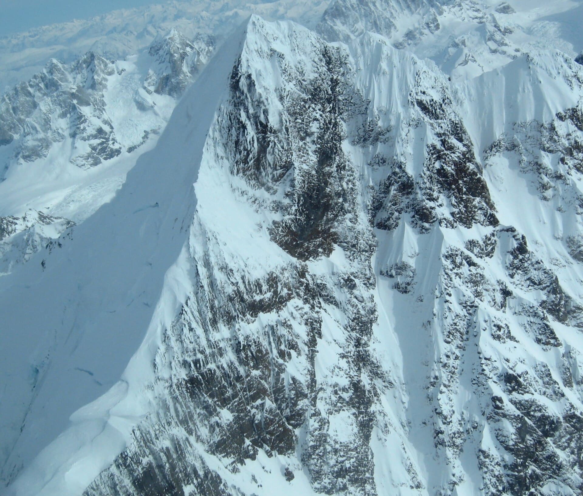
Mount Orville rises in the Fairweather Range within Glacier Bay National Park and Preserve, offering one of Alaska’s most isolated alpine environments. Its steep glaciers, knife-edge ridges, and frequent storms create a true wilderness experience far from roads or established trails. Visitors come for the challenge of untracked terrain and the chance to witness calving tidewater glaciers and abundant marine and terrestrial wildlife from high vantage points.

How to Reach the Mountain

Access begins in Gustavus or Juneau. From there, travelers arrange bush-plane flights or helicopter charters into the park’s backcountry landing zones near the mountain’s base. No maintained trails exist, so every approach requires route-finding across moraines, icefields, and dense coastal forest. Permits for overnight stays are required through the National Park Service and must be obtained in advance at park headquarters.

Best Time to Visit

July through early September provides the longest daylight and relatively stable weather windows for climbing and hiking. Snow cover remains extensive even in summer, and temperatures can drop below freezing at elevation. Shoulder months bring higher avalanche risk and more frequent storms, making them suitable only for highly experienced teams.

Activities on and Around the Peak

  • Technical mountaineering on glaciated routes with ice axes and crampons
  • Wildlife viewing of mountain goats, bears, and seabirds from high ridges
  • Photography of dramatic icefalls and the St. Elias Mountains to the north
  • Sea-kayaking extensions in nearby Glacier Bay fjords after descent

Nearby Destinations Worth Exploring

After a Mount Orville trip, many visitors continue to the tidewater glaciers of Johns Hopkins Inlet or the historic Bartlett Cove area for ranger programs and easier day hikes. The coastal waters also offer excellent opportunities for whale watching and fishing charters based out of Gustavus.

Visitor tips

  • Hire a local guide or join an expedition outfitter; solo travel here is extremely hazardous due to crevasses and weather.
  • Pack layers for rapid temperature swings, a satellite communicator, and extra food for weather delays.
  • Confirm current park backcountry regulations and bear-safety protocols before departure, as conditions change with glacial movement.

Frequently asked questions

Is Mount Orville suitable for beginners?+

No. The mountain demands advanced mountaineering skills, glacier travel experience, and self-sufficiency in remote conditions with no rescue infrastructure nearby.

Do I need a permit to climb Mount Orville?+

Yes. Overnight backcountry permits are mandatory and obtained through Glacier Bay National Park headquarters in advance of travel.

What wildlife might I encounter?+

Expect mountain goats on the ridges, black and brown bears at lower elevations, and marine mammals such as humpback whales visible from high viewpoints on clear days.

How long does a typical trip take?+

Most expeditions require 7u201314 days including flight access, acclimatization, summit attempts, and weather contingencies.

Are there any facilities near the mountain?+

There are no facilities, cabins, or maintained trails. All supplies, shelter, and waste management must be carried in and out.

Share
Google Maps Apple Maps Directions

Image: Walles39 · CC BY-SA 3.0 · via Wikimedia Commons

Keep reading

Nearby & related
All stories
Mount Wilbur: Scaling Alaska’s Remote Glacier Bay Wilderness Peak
Hoonah–Angoon Census Area

Mount Wilbur: Scaling Alaska’s Remote Glacier Bay Wilderness Peak

Experience the stark, glacier-carved majesty of Mount Wilbur, a striking summit in Alaska’s vast Hoonah–Angoon…

16 August 2026
Y
Hoonah–Angoon Census Area

Yakobi Island: Remote Wilderness in Alaska’s Tongass National Forest

Explore the rugged, wildlife-rich terrain of Yakobi Island, a secluded destination in Southeast Alaska’s Alexander…

16 August 2026
Mount Crillon: Scaling Alaska’s Remote Fairweather Giant
Hoonah–Angoon Census Area

Mount Crillon: Scaling Alaska’s Remote Fairweather Giant

An insider’s guide to planning an expedition on this dramatic, seldom-visited peak in the Fairweather Range.

15 August 2026