
Keep reading
Nearby & related

Wedgemount Lake: Hiking to a Turquoise Alpine Gem Near Whistler
A rewarding backcountry trek leads to glacial waters and sweeping mountain views in British Columbia’s Coast Range.
8 August 2026
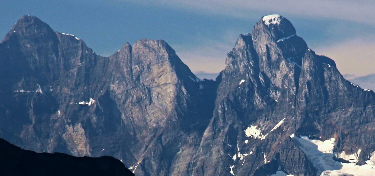
Mount Goodsir offers dramatic alpine scenery and serious backcountry adventure in British Columbia’s Yoho National Park.
Mount Goodsir rises as the tallest summit in Yoho National Park, part of the rugged Goodsir massif in the Canadian Rockies. Its twin towers and sheer rock faces create one of the most striking profiles visible from the Trans-Canada Highway corridor between Field and the Alberta border. The mountain’s isolation and elevation deliver sweeping views across the Ottertail and Kicking Horse river valleys, making it a destination for experienced hikers and climbers seeking genuine wilderness rather than crowded viewpoints.
Access begins along the Trans-Canada Highway east of Field, British Columbia. Most visitors park at the Mount Goodsir trailhead or nearby pullouts near the park’s eastern boundary. From there, trails lead into the Ottertail Valley and eventually to high camps beneath the peak. No public transit serves the immediate area, so a private vehicle or arranged shuttle from Field or Golden is required. The final approach roads are paved, but trailheads sit at the edge of maintained park infrastructure.
July through mid-September offers the most reliable snow-free conditions on lower routes and trails. Early summer can still hold deep snow on north-facing slopes, while September brings cooler temperatures and the possibility of early storms. Winter visits demand full mountaineering skills and avalanche awareness, as the mountain lies in a high-precipitation zone.
Day hikers can follow the Ottertail River trail for distant views of the Goodsir towers without technical climbing. More committed visitors tackle multi-day backpacking routes that circle the massif or ascend to alpine meadows below the south tower. The surrounding terrain features classic subalpine larch stands that turn golden in September and abundant wildflower meadows in July and August. Wildlife sightings commonly include mountain goats, hoary marmots, and grizzly bears; proper food storage is essential.
After exploring Mount Goodsir, continue to Takakkaw Falls, one of Canada’s highest waterfalls, or the turquoise waters of Emerald Lake. Both lie within a short drive and provide easier, family-friendly options. The historic town of Field offers basic services and serves as a gateway to additional Yoho trails such as the Iceline or Lake O’Hara region.
Keep reading
A rewarding backcountry trek leads to glacial waters and sweeping mountain views in British Columbia’s Coast Range.
Trails range from moderate valley walks to strenuous multi-day routes requiring route-finding, stream crossings, and good fitness. The mountain itself involves technical climbing for those attempting the summit.
Experienced hikers comfortable with backcountry travel can go independently, but first-time visitors or those planning technical ascents benefit from a certified mountain guide familiar with the area.
Grizzly bears, black bears, mountain goats, and marmots are regularly seen. Maintain proper distance and follow all food-storage regulations.
The peak itself is not suitable for beginners. However, the surrounding valley trails offer rewarding scenery for fit hikers with basic wilderness experience.
Drones are prohibited in Yoho National Park. All overnight stays require a valid backcountry permit obtained from Parks Canada.
This serene lake in British Columbia’s Rockies delivers quiet paddling, trout fishing, and easy access to dramatic peaks…

Discover pristine rainforest, marine wildlife, and quiet anchorages on this secluded island in the Inside Passage.
