Skip to content
Plan & Tour
DestinationsItinerariesTravel BlogAboutContact
0Sign inPlan a trip
Plan & TourPlan & Tour

Travel guides, destination inspiration and curated itineraries for Canada, the USA and beyond, plus a free tool to plan your own day-by-day trip.

Get travel inspiration

Explore

  • All Destinations
  • Curated Itineraries
  • Travel Blog
  • Plan a Trip

Topics

  • Hiking & Nature
  • Food & Drink
  • City Breaks
  • Budget Travel

Company

  • About Us
  • Contact
  • Privacy Policy
  • Terms of Service

© 2026 Plan & Tour. Built for travellers.

Discover the world, one trip at a time.

Lillooet River: Wilderness Adventures in British Columbia’s Coast Mountains
  1. Home
  2. Destinations
  3. British Columbia
  4. Lillooet River: Wilderness Adventures in British Columbia’s Coast Mountains
River

Lillooet River: Wilderness Adventures in British Columbia’s Coast Mountains

Flowing through dramatic mountain terrain, the Lillooet River delivers pristine waters and remote outdoor experiences near Pemberton.

British ColumbiaUpdated 1 August 2026

Why the Lillooet River Stands Out

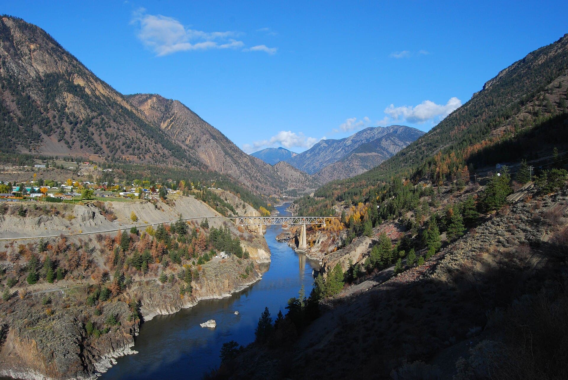
The Lillooet River carves a wide glacial valley through the Coast Mountains, creating a landscape of turquoise waters, forested slopes, and distant peaks. Its clear waters originate from high-elevation snowfields and glaciers, offering visitors a true sense of wilderness just a few hours from Vancouver.

Activities Along the River

Anglers target seasonal runs of salmon and steelhead in the lower reaches. Kayakers and rafters navigate Class II-III sections that wind past gravel bars and cottonwood stands. Hikers follow informal riverbank trails that lead to viewpoints of the valley and occasional side canyons. Wildlife viewing is rewarding; black bears, bald eagles, and mountain goats frequent the area.

Getting There

Most visitors drive the Sea-to-Sky Highway north from Vancouver to Pemberton, then continue on well-maintained gravel forestry roads that parallel the river. Four-wheel-drive vehicles are helpful but not always required in summer. Floatplane access is possible from Whistler or Vancouver for those seeking a remote put-in.

Best Time to Visit

July through September offers the most reliable weather and lowest water levels for floating and hiking. Late summer and early fall bring spawning salmon and vibrant foliage. Winter travel is possible but requires preparation for heavy snow and limited road access.

Nearby Destinations

The river lies between the resort town of Whistler and the quieter communities of Pemberton and Mount Currie. Short drives lead to hot springs, volcanic peaks of the Mount Meager complex, and the trailheads of Garibaldi Provincial Park. Many travelers combine a river visit with a day in Whistler or a ferry ride across Harrison Lake.

Visitor tips

  • Carry bear spray and know how to use it; the valley supports a healthy black bear population.
  • Check current road conditions with local forestry offices before heading onto gravel routes.
  • Pack extra fuel, water, and a satellite communicator, as cell service is absent in much of the valley.

Frequently asked questions

Is the Lillooet River suitable for beginners to kayak or raft?+

The river contains several Class II-III rapids that require solid intermediate skills. Beginners should join a guided trip or choose calmer sections near Pemberton.

What kind of fishing is available on the Lillooet River?+

Anglers pursue chinook, coho, and sockeye salmon in season, plus resident rainbow trout and winter steelhead. A valid British Columbia fishing licence is required.

Are there established campgrounds along the river?+

Recreational sites and forestry campsites exist at several pullouts. Most lack facilities beyond basic pit toilets, so visitors should be fully self-sufficient.

Can I see glaciers from the Lillooet River valley?+

Yes, several high peaks visible from the river host small glaciers, especially when looking north toward the Mount Meager area on clear days.

Is swimming safe in the Lillooet River?+

The water remains very cold year-round due to glacial melt. Strong currents and sudden depth changes make swimming risky except in a few protected side channels.

Share
Google Maps Apple Maps Directions

Image: LongitudeLatitude · CC BY 2.0 · via Wikimedia Commons

Keep reading

Nearby & related

All stories
Vedder River: Salmon Fishing, Paddling and Riverside Trails in British Columbia
British Columbia

Vedder River: Salmon Fishing, Paddling and Riverside Trails in British Columbia

A clear, productive river in the Fraser Valley offering consistent chinook and coho runs, easy paddling and quiet hiking…

1 August 2026
E
British Columbia

Englishman River: Waterfalls, Forests and Salmon Runs on Vancouver Island

Hike to dramatic waterfalls, swim in clear pools, and watch salmon spawn along this Vancouver Island river.

1 August 2026
B
British Columbia

Bella Coola River: Wilderness Fishing and Grizzly Viewing in British Columbia’s Great Bear Rainforest

This remote river in the Bella Coola Valley offers world-class steelhead and salmon fishing, abundant wildlife, and…

1 August 2026


