Skip to content
Plan & Tour
DestinationsItinerariesTravel BlogAboutContact
0Sign inPlan a trip
Plan & TourPlan & Tour

Travel guides, destination inspiration and curated itineraries for Canada, the USA and beyond, plus a free tool to plan your own day-by-day trip.

Get travel inspiration

Explore

  • All Destinations
  • Curated Itineraries
  • Travel Blog
  • Plan a Trip

Topics

  • Hiking & Nature
  • Food & Drink
  • City Breaks
  • Budget Travel

Company

  • About Us
  • Contact
  • Privacy Policy
  • Terms of Service

© 2026 Plan & Tour. Built for travellers.

Discover the world, one trip at a time.

Lauca River: Bolivia’s Remote High-Andes Waterway in Oruro
  1. Home
  2. Destinations
  3. Oruro Department
  4. Lauca River: Bolivia’s Remote High-Andes Waterway in Oruro
River

Lauca River: Bolivia’s Remote High-Andes Waterway in Oruro

A rugged Andean river cutting through the Altiplano near Sajama National Park, offering stark volcanic scenery and authentic high-altitude wilderness.

Oruro DepartmentUpdated 11 October 2026

Why the Lauca River Belongs on Your Bolivia Itinerary

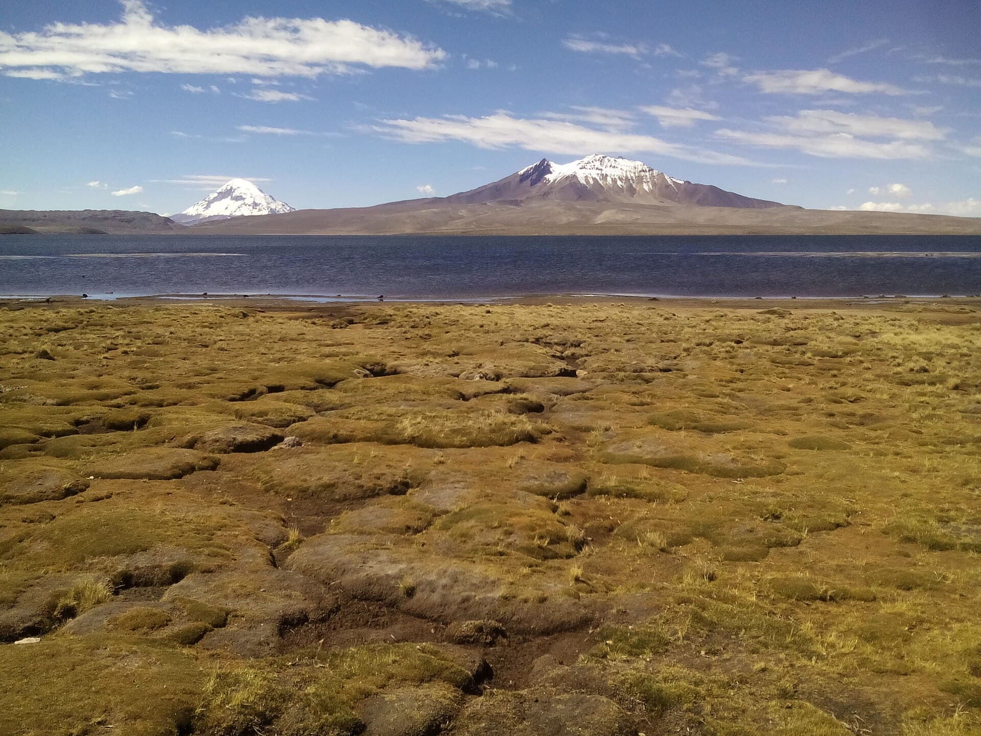
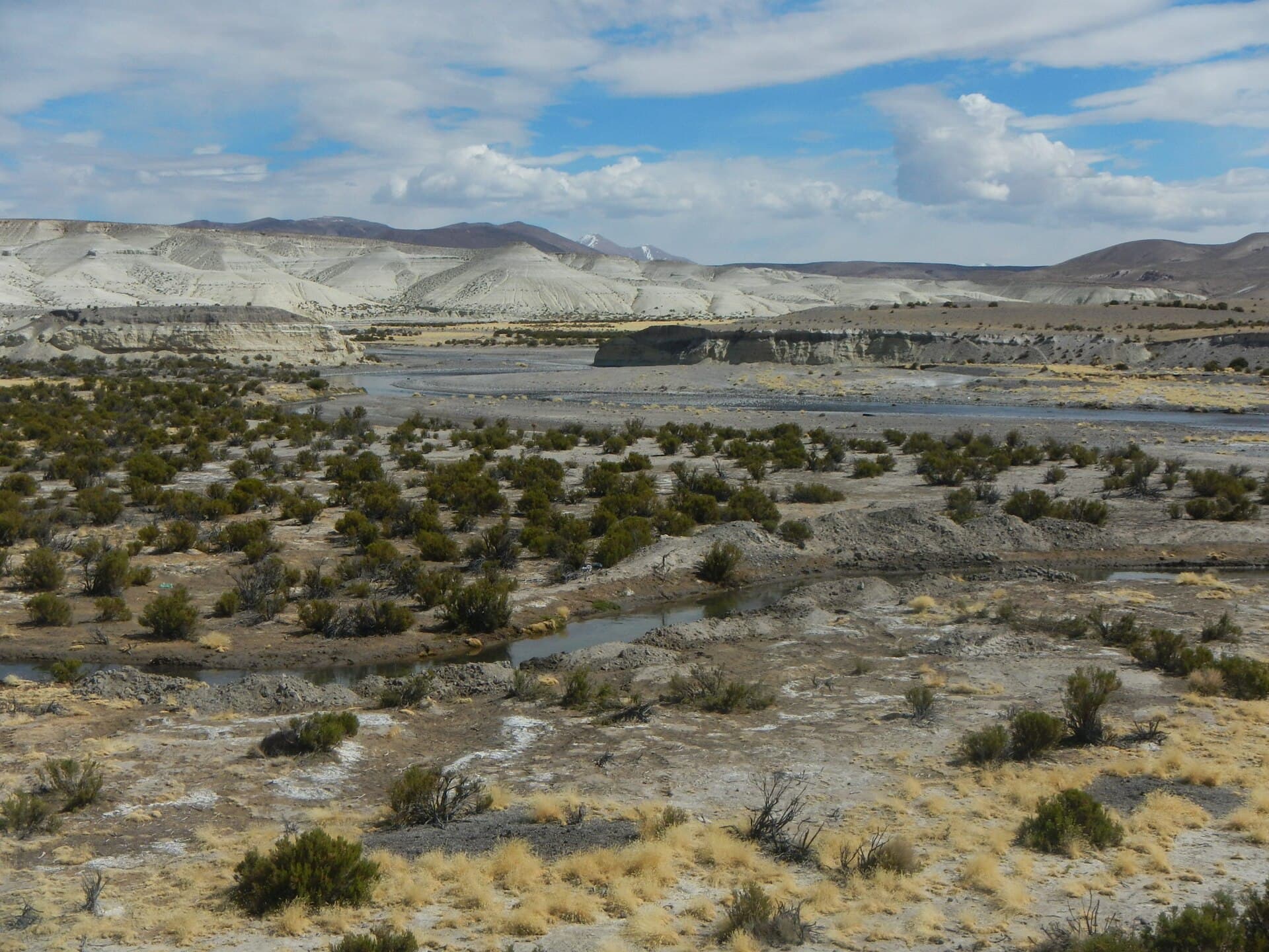
The Lauca River rises on the Bolivian Altiplano in Oruro Department and flows westward toward the Chile border. At roughly 4,000 meters elevation, it threads through a landscape of volcanic cones, bofedales wetlands, and open puna grassland. Travelers who reach this remote stretch encounter one of the least-visited corners of the Bolivian Andes, where the river itself becomes a lifeline for vicuñas, Andean geese, and seasonal flamingo flocks.

What to See and Do

Follow gravel tracks that parallel the river for short hikes or photography stops. The water carves small canyons and creates mirror-like reflections of nearby peaks such as Pomerape and Parinacota on calm mornings. Birders scan the wetlands for three species of flamingo, Andean avocets, and puna ibis. Photographers favor sunrise and late-afternoon light when the surrounding volcanoes turn rose and ochre. Because infrastructure is minimal, most visitors combine the river with a stop inside Sajama National Park, where the same river valley provides access to high-altitude hot springs and the base of Sajama Volcano.

Practical Activities

  • Drive or cycle the riverside track between the village of Sabaya and the international border area for sweeping views.
  • Stop at roadside bofedales to watch vicuñas grazing; keep a respectful distance.
  • Combine the outing with a visit to the Sajama geyser field and the colonial church at Sabaya.

Getting There

Oruro city lies roughly 200 km to the east. Shared taxis or small tour operators run as far as Sabaya; beyond that point a 4×4 or sturdy high-clearance vehicle is essential on the unpaved roads. Many travelers arrive as part of a multi-day circuit that starts in La Paz, crosses the Salar de Coipasa, and exits via the border at Tambo Quemado. Public transport is infrequent, so independent visitors usually arrange transport in Oruro or join a small-group jeep tour.

Best Time to Visit

The dry season from May to October brings stable weather, clear skies, and passable roads. Afternoon winds can be strong, so mornings are best for walking. The wet season (December–March) turns tracks to mud and raises river levels, making access unreliable. Nighttime temperatures drop below freezing year-round, so layers and a windproof jacket are essential even in the dry months.

Nearby Attractions

Sajama National Park protects the river’s upper watershed and offers the tallest peak in Bolivia. The salt flat of Coipasa lies a day’s drive south, while the Chilean Lauca National Park sits just across the border for those with the correct permits. The colonial village of Sabaya provides the nearest basic lodging and supplies.

Visitor tips

  • Acclimatize in Oruro or La Paz for at least two nights before traveling above 4,000 m to reduce altitude-sickness risk.
  • Carry extra fuel, water, and a spare tire; services along the river are nonexistent.
  • Hire a local driver familiar with the unmarked tracks if you do not have prior high-altitude 4x4 experience.

Frequently asked questions

Is the Lauca River safe to visit independently?+

The area is remote and roads are rough. Most visitors join a guided jeep tour from Oruro or La Paz for safety and logistics.

Are there facilities along the river?+

No services exist beside the river. Carry all food, water, and fuel; the nearest basic supplies are in Sabaya.

Can I cross into Chile at the river?+

The Tambo Quemado border crossing is nearby but requires valid documents and vehicle permits; the river itself is not a legal crossing point.

What wildlife might I see?+

Vicuu00f1as, Andean flamingos, geese, and foxes are common in the wetlands and puna grasslands beside the river.

How cold does it get?+

Temperatures fall below freezing every night. Daytime highs in the dry season rarely exceed 15 u00b0C with strong winds.

Share
Google Maps Apple Maps Directions

Image: Jfbustos · CC BY-SA 3.0 · via Wikimedia Commons

Keep reading

Nearby & related

All stories
C
Oruro Department

Cosapilla River: Bolivia’s Remote Andean Highland Stream

A high-altitude river valley in Oruro Department offering stark volcanic scenery and quiet access to Bolivia’s western…

12 October 2026
J
Oruro Department

Jach’a Ch’ankha: Trekking Bolivia’s Remote Andean Summit in Oruro

Experience solitude, sweeping Altiplano views, and high-altitude adventure on this lesser-known peak in Bolivia’s Oruro…

12 October 2026
K’isi K’isini: Bolivia’s Remote Andean Volcano for Adventurous Hikers
Oruro Department

K’isi K’isini: Bolivia’s Remote Andean Volcano for Adventurous Hikers

Explore the stark volcanic landscapes and high-altitude trails of this striking peak in Oruro Department.

12 October 2026