Skip to content
Plan & Tour
DestinationsItinerariesTravel BlogAboutContact
0Sign inPlan a trip
Plan & TourPlan & Tour

Travel guides, destination inspiration and curated itineraries for Canada, the USA and beyond, plus a free tool to plan your own day-by-day trip.

Get travel inspiration

Explore

  • All Destinations
  • Curated Itineraries
  • Travel Blog
  • Plan a Trip

Topics

  • Hiking & Nature
  • Food & Drink
  • City Breaks
  • Budget Travel

Company

  • About Us
  • Contact
  • Privacy Policy
  • Terms of Service

© 2026 Plan & Tour. Built for travellers.

Discover the world, one trip at a time.

Kettle River, British Columbia: Scenic Paddling and Fishing in the Boundary Country
  1. Home
  2. Destinations
  3. British Columbia
  4. Kettle River, British Columbia: Scenic Paddling and Fishing in the Boundary Country
River

Kettle River, British Columbia: Scenic Paddling and Fishing in the Boundary Country

Follow the meandering Kettle River through quiet valleys, old-growth forests, and small communities in southern British Columbia.

British ColumbiaUpdated 1 July 2026

Why the Kettle River Belongs on Your British Columbia Itinerary

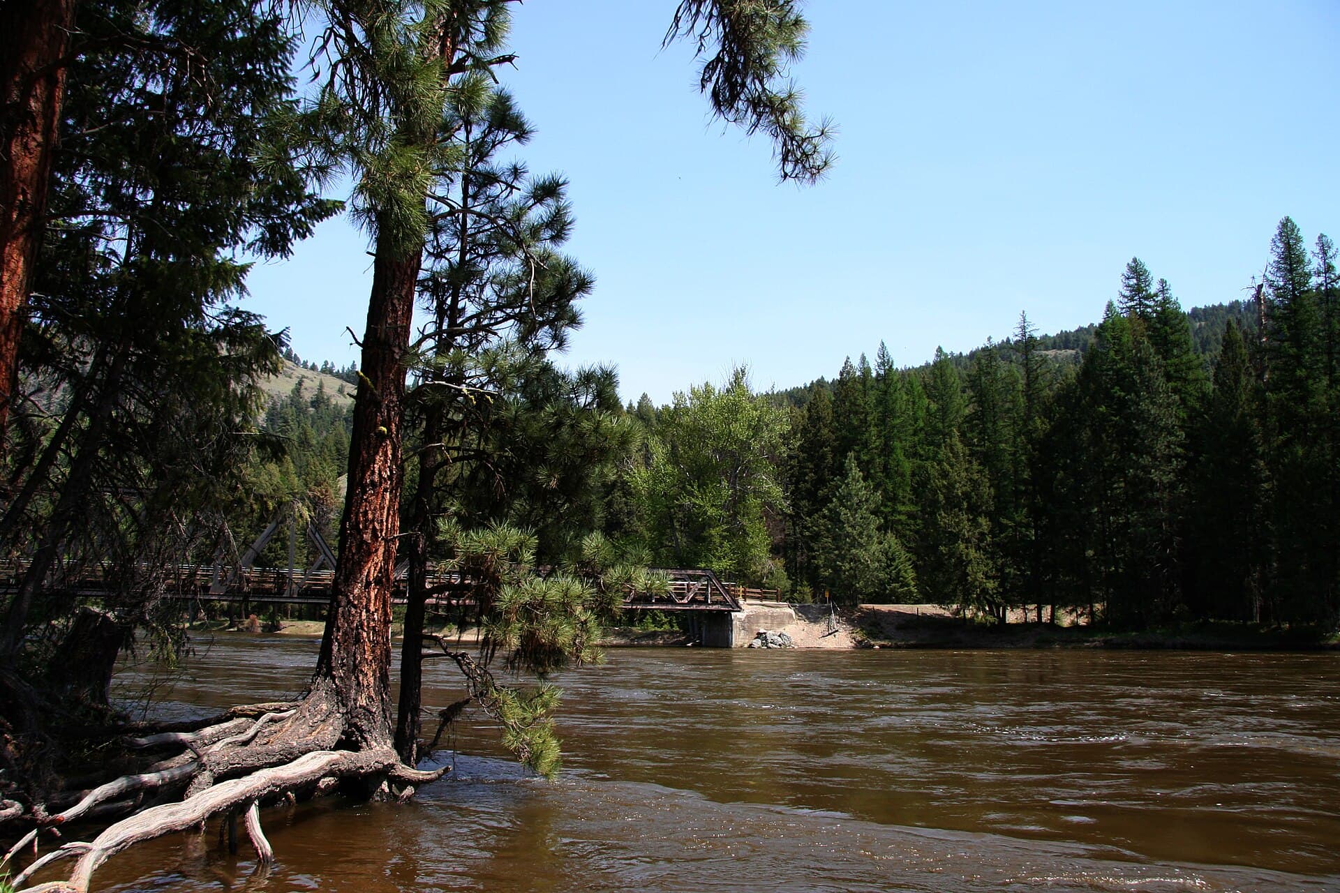
The Kettle River carves a gentle path through the Boundary Country, offering a quieter alternative to busier waterways farther west. Its clear water, gravel bars, and cottonwood-lined banks create a landscape suited to relaxed paddling, trout fishing, and riverside walks rather than high-adrenaline thrills.

Activities on and Around the River

Anglers target rainbow and brook trout in the deeper pools, especially near the mouth of tributaries. Float trips by kayak or canoe reveal changing scenery from open ranchland to narrow canyons. Riverside trails connect to short hikes that climb into mixed pine and fir forest, where deer and occasional black bears are seen. In late summer, gravel bars become natural picnic spots for watching the slow current.

Getting There

Highway 3 (Crowsnest Highway) parallels much of the river between Grand Forks and Rock Creek. Travelers coming from the Okanagan Valley turn east at Osoyoos; those arriving from the Kootenays follow the same highway west. Once in the valley, several unmarked pullouts and forestry roads provide river access, though visitors should respect private land boundaries.

Best Time to Visit

Water levels are most inviting from late May through early September, when snowmelt has receded and daytime temperatures are comfortable for water sports. Early autumn brings golden cottonwoods and fewer insects, while spring offers higher flows for experienced paddlers. Winter visits are limited to roadside viewpoints because ice and snow close many access points.

Nearby Destinations

Christina Lake lies a short drive north and offers warmer swimming. Granby Provincial Park protects old-growth cedar stands and additional hiking options. The historic town of Grand Forks provides supplies and a glimpse of Doukhobor heritage. Continuing south on Highway 3 leads to the U.S. border crossing at Danville, useful for travelers combining the river with Washington state parks.

Visitor tips

  • Carry a detailed map or GPS; many access roads are unsigned gravel tracks.
  • Check river conditions before launching; spring runoff can create strong currents near narrow sections.
  • Pack layers and insect repellent, especially near wetlands in early summer.

Frequently asked questions

Can you swim in the Kettle River?+

Yes, but the water remains cool year-round. Swimmers prefer slower sections and gravel bars near Grand Forks during July and August.

Is fishing permitted without a guide?+

Non-residents need a British Columbia fishing licence; check current regulations for the Kettle River watershed before your trip.

Are there campgrounds directly on the river?+

Several provincial recreation sites and forestry campgrounds sit along the banks, offering basic facilities and river access.

How difficult is kayaking the Kettle River?+

Most sections are Class I to II, suitable for beginners with proper equipment; experienced paddlers seek the slightly steeper reaches near the border.

What wildlife might visitors see?+

Common sightings include deer, osprey, and kingfishers; black bears occasionally appear along the forested banks in late summer.

Share
Google Maps Apple Maps Directions

Image: Iwona Erskine-Kellie from Vancouver, Canada · CC BY 2.0 · via Wikimedia Commons

Keep reading

Nearby & related

All stories
Chilkat River: Bald Eagle Capital Along the BC-Alaska Border
British Columbia

Chilkat River: Bald Eagle Capital Along the BC-Alaska Border

Float through salmon-rich waters teeming with eagles and bears in one of North America’s premier wildlife corridors.

1 July 2026
Similkameen River: A Scenic Waterway Through British Columbia’s Southern Valleys
British Columbia

Similkameen River: A Scenic Waterway Through British Columbia’s Southern Valleys

Follow the Similkameen River through dramatic canyons, fertile orchards, and quiet parks in the heart of the Similkameen…

1 July 2026
Adams River: Witnessing British Columbia’s Legendary Sockeye Salmon Migration
British Columbia

Adams River: Witnessing British Columbia’s Legendary Sockeye Salmon Migration

Discover the dramatic sockeye salmon runs, clear waters, and surrounding forests of Adams River in British Columbia’s…

1 July 2026


