Skip to content
Plan & Tour
DestinationsItinerariesTravel BlogAboutContact
0Sign inPlan a trip
Plan & TourPlan & Tour

Travel guides, destination inspiration and curated itineraries for Canada, the USA and beyond, plus a free tool to plan your own day-by-day trip.

Get travel inspiration

Explore

  • All Destinations
  • Curated Itineraries
  • Travel Blog
  • Plan a Trip

Topics

  • Hiking & Nature
  • Food & Drink
  • City Breaks
  • Budget Travel

Company

  • About Us
  • Contact
  • Privacy Policy
  • Terms of Service

© 2026 Plan & Tour. Built for travellers.

Discover the world, one trip at a time.

Christina Lake: Warm-Water Adventures in British Columbia’s Boundary Country
  1. Home
  2. Destinations
  3. British Columbia
  4. Christina Lake: Warm-Water Adventures in British Columbia’s Boundary Country
Lake

Christina Lake: Warm-Water Adventures in British Columbia’s Boundary Country

Swim, boat, and hike at one of Canada’s warmest lakes, tucked into the forested valleys of southern British Columbia.

British ColumbiaUpdated 1 July 2026

Why Christina Lake Stands Out

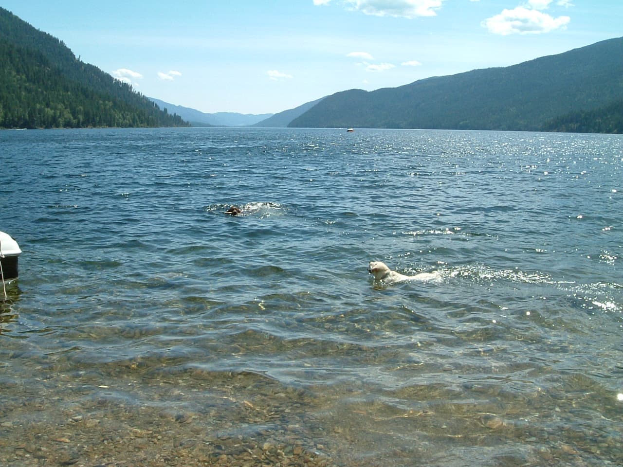
Christina Lake sits in the Boundary Country, a region of rolling hills and ponderosa pine where the lake’s shallow basin absorbs sunlight, producing water temperatures that regularly exceed those of most Canadian lakes. The result is a long swimming season and clear water that draws families and paddlers year after year.

Water Activities

The public beach at Christina Lake Provincial Park offers a sandy entry and roped swimming area ideal for children. Motorboats, kayaks, and stand-up paddleboards can be rented near the government wharf; the 11-kilometre length of the lake allows full-day paddling routes with stops at sheltered coves. Anglers target smallmouth bass and rainbow trout from rented boats or the public fishing pier.

Hiking and Shoreline Trails

The Christina Lake Trail climbs from the lakeside to viewpoints overlooking the valley and the Monashee Mountains. Shorter walks follow the shoreline past private cottages and public picnic sites. In autumn the surrounding slopes turn gold with larch and aspen, creating easy photography walks.

How to Get There

From the Trans-Canada Highway, exit at Grand Forks and follow Highway 3 east for 20 minutes; the lake lies directly beside the road. Visitors arriving from the United States cross at the Carson border crossing and continue north on Highway 395 to the same junction. The nearest commercial airport is in Kelowna, roughly two hours northwest.

Best Time to Visit

July and August bring the warmest water and busiest beaches. Late May through June offers fewer crowds and good fishing before peak summer heat. September remains pleasant for hiking and paddling while daytime temperatures stay comfortable.

Nearby Attractions

Grand Forks, 20 minutes west, features historic Doukhobor villages and a lively farmers’ market. The Kettle River offers additional paddling and fly-fishing. East of the lake, the historic mining town of Greenwood preserves turn-of-the-century buildings and a small museum.

Visitor tips

  • Bring reef-safe sunscreen and water shoes; the lake bottom is sandy near shore but can contain sharp rocks farther out.
  • Reserve waterfront accommodation early for July and August weekends; options include provincial-park camping, cabin rentals, and small resorts.
  • Fill the vehicle fuel tank in Grand Forks; services directly at the lake are limited outside peak season.

Frequently asked questions

Is Christina Lake good for swimming?+

Yes. The lake is one of the warmest in Canada, with summer surface temperatures often reaching the low 20s Celsius and a long shallow shelf that makes entry comfortable for all ages.

Are there boat rentals at Christina Lake?+

Several marinas and resorts along the east side of the lake rent kayaks, paddleboards, and small motorboats by the hour or day.

Can I camp at Christina Lake?+

Christina Lake Provincial Park maintains a campground with vehicle sites and a day-use beach area; reservations are recommended in summer.

What fish can I catch in Christina Lake?+

Rainbow trout, smallmouth bass, and yellow perch are the primary species; a valid British Columbia fishing licence is required.

Is there cell service around the lake?+

Major Canadian carriers provide coverage along the highway and near the provincial park, though signals weaken on some back roads and hiking trails.

Share
Google Maps Apple Maps Directions

Image: Public domain · via Wikimedia Commons

Keep reading

Nearby & related

All stories
Chilkat River: Bald Eagle Capital Along the BC-Alaska Border
British Columbia

Chilkat River: Bald Eagle Capital Along the BC-Alaska Border

Float through salmon-rich waters teeming with eagles and bears in one of North America’s premier wildlife corridors.

1 July 2026
Similkameen River: A Scenic Waterway Through British Columbia’s Southern Valleys
British Columbia

Similkameen River: A Scenic Waterway Through British Columbia’s Southern Valleys

Follow the Similkameen River through dramatic canyons, fertile orchards, and quiet parks in the heart of the Similkameen…

1 July 2026
Adams River: Witnessing British Columbia’s Legendary Sockeye Salmon Migration
British Columbia

Adams River: Witnessing British Columbia’s Legendary Sockeye Salmon Migration

Discover the dramatic sockeye salmon runs, clear waters, and surrounding forests of Adams River in British Columbia’s…

1 July 2026


