Skip to content
Plan & Tour
DestinationsItinerariesTravel BlogAboutContact
0Sign inPlan a trip
Plan & TourPlan & Tour

Travel guides, destination inspiration and curated itineraries for Canada, the USA and beyond, plus a free tool to plan your own day-by-day trip.

Get travel inspiration

Explore

  • All Destinations
  • Curated Itineraries
  • Travel Blog
  • Plan a Trip

Topics

  • Hiking & Nature
  • Food & Drink
  • City Breaks
  • Budget Travel

Company

  • About Us
  • Contact
  • Privacy Policy
  • Terms of Service

© 2026 Plan & Tour. Built for travellers.

Discover the world, one trip at a time.

C
  1. Home
  2. Destinations
  3. Oruro Department
  4. Cerro Columa: Hiking Bolivia’s Remote Andean Peak
Mountain

Cerro Columa: Hiking Bolivia’s Remote Andean Peak

Climb the windswept slopes of Cerro Columa for sweeping Altiplano views and a taste of Bolivia’s highland solitude.

Oruro DepartmentUpdated 12 October 2026

Why Cerro Columa Stands Out

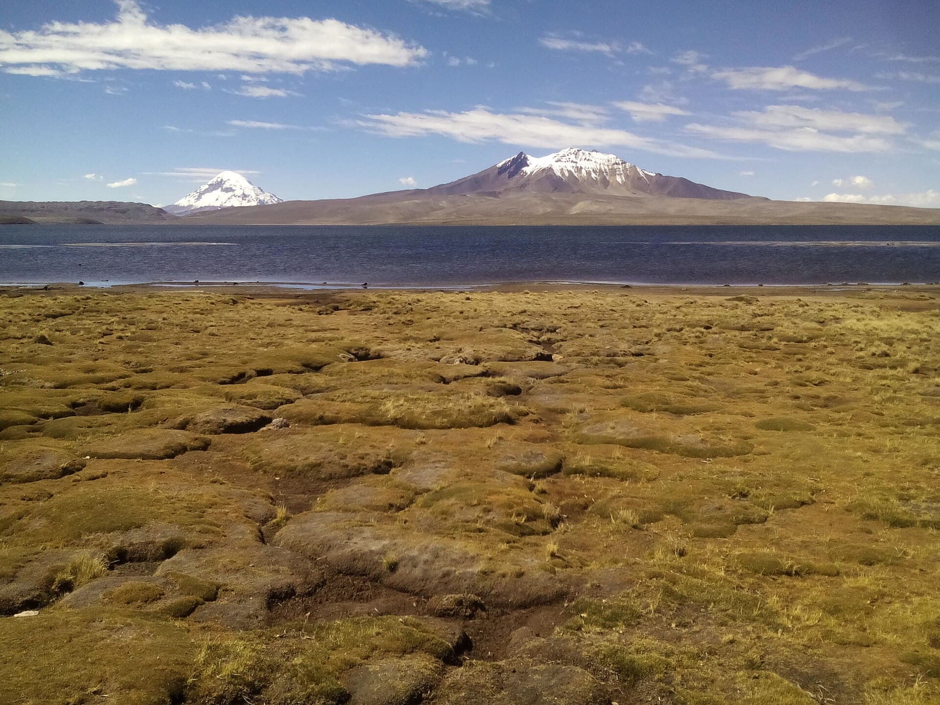
Rising from the dry puna grasslands of Oruro Department, Cerro Columa offers hikers a genuine high-Andes experience without the crowds of more famous Bolivian peaks. Its broad, rocky summit delivers 360-degree panoramas of neighboring volcanoes, salt flats shimmering on the horizon, and the endless brown-and-white expanse of the Altiplano. Because the mountain sits at high elevation, the air is thin and the light intense, creating dramatic cloud formations and sharp shadows that change hourly.

Reaching the Mountain

Most visitors start from the city of Oruro, roughly 150 km to the northeast. Regular buses run south toward the Chilean border; travelers usually disembark at the small settlement of Sajama or nearby hamlets and arrange a 4×4 transfer the final stretch. The last kilometers cross unpaved tracks that become impassable after heavy rain, so checking road conditions with local drivers is essential. Those with their own rugged vehicle can follow the main highway toward the Sajama National Park entrance and branch west on a signed dirt road that leads to the base.

Best Time to Visit

The dry season from May through October brings stable weather and clearer skies, making it the most reliable window for summit attempts. Afternoon winds can still be fierce, so early starts are advisable. The wet months of December to March transform the lower slopes into muddy bogs and increase rockfall risk on steeper sections.

Activities and What to Expect

The standard route follows a broad ridge that begins at around 4,200 m and climbs steadily through tussock grass and scattered queñua trees. No technical climbing gear is required, but the altitude demands a slow pace and frequent rest stops. On clear days the summit reveals distant views of Nevado Sajama and the Uyuni salt flat’s white edge. Birders often spot Andean flamingos in seasonal wetlands at the mountain’s foot, while vicuñas graze the higher slopes. Photographers prize the golden-hour light that turns the surrounding volcanoes pink and orange.

Practical Considerations on the Ground

  • Carry at least three liters of water per person; streams are scarce above the lower valleys.
  • Acclimatize for at least two nights in Oruro or Sajama before attempting the summit.
  • Strong sun and sudden temperature drops mean layering with windproof shell and warm fleece is mandatory.

Nearby Attractions Worth Combining

Many travelers pair Cerro Columa with a visit to Sajama National Park’s geysers and hot springs, or continue south to the Uyuni salt flats for multi-day tours. The colonial churches and Carnaval celebrations of Oruro itself provide cultural contrast after days on the mountain.

Visitor tips

  • Hire a local driver familiar with the final dirt tracks; GPS signals are unreliable near the mountain.
  • Bring a basic altitude-medicine kit and descend immediately if headaches or nausea worsen.
  • Pack out all waste; there are no facilities and the fragile puna ecosystem recovers slowly.

Frequently asked questions

How high is Cerro Columa?+

The summit reaches approximately 5,200 m, typical for peaks in this section of the Bolivian Altiplano.

Do I need a guide to climb Cerro Columa?+

A local driver or guide is strongly recommended for navigation and safety, especially if you are not acclimatized or traveling solo.

Is Cerro Columa suitable for beginners?+

The hike is non-technical but the altitude makes it strenuous; previous high-elevation experience is helpful.

Are there any facilities on the mountain?+

No services exist above the base; bring all food, water, and shelter.

Can I combine a visit with the Uyuni salt flats?+

Yes, many travelers continue south after Cerro Columa to join Uyuni tours, roughly a full dayu2019s drive away.

Share
Google Maps Apple Maps Directions

Keep reading

Nearby & related

All stories
C
Oruro Department

Cosapilla River: Bolivia’s Remote Andean Highland Stream

A high-altitude river valley in Oruro Department offering stark volcanic scenery and quiet access to Bolivia’s western…

12 October 2026
J
Oruro Department

Jach’a Ch’ankha: Trekking Bolivia’s Remote Andean Summit in Oruro

Experience solitude, sweeping Altiplano views, and high-altitude adventure on this lesser-known peak in Bolivia’s Oruro…

12 October 2026
K’isi K’isini: Bolivia’s Remote Andean Volcano for Adventurous Hikers
Oruro Department

K’isi K’isini: Bolivia’s Remote Andean Volcano for Adventurous Hikers

Explore the stark volcanic landscapes and high-altitude trails of this striking peak in Oruro Department.

12 October 2026