Skip to content
Plan & Tour
DestinationsItinerariesTravel BlogAboutContact
0Sign inPlan a trip
Plan & TourPlan & Tour

Travel guides, destination inspiration and curated itineraries for Canada, the USA and beyond, plus a free tool to plan your own day-by-day trip.

Get travel inspiration

Explore

  • All Destinations
  • Curated Itineraries
  • Travel Blog
  • Plan a Trip

Topics

  • Hiking & Nature
  • Food & Drink
  • City Breaks
  • Budget Travel

Company

  • About Us
  • Contact
  • Privacy Policy
  • Terms of Service

© 2026 Plan & Tour. Built for travellers.

Discover the world, one trip at a time.

Choqueyapu River: La Paz’s Urban Artery Through the Andes
  1. Home
  2. Destinations
  3. La Paz
  4. Choqueyapu River: La Paz’s Urban Artery Through the Andes
River

Choqueyapu River: La Paz’s Urban Artery Through the Andes

Follow the river that carved La Paz’s dramatic valley and still anchors daily life in the Bolivian capital.

La PazUpdated 12 October 2026

The River That Shapes La Paz

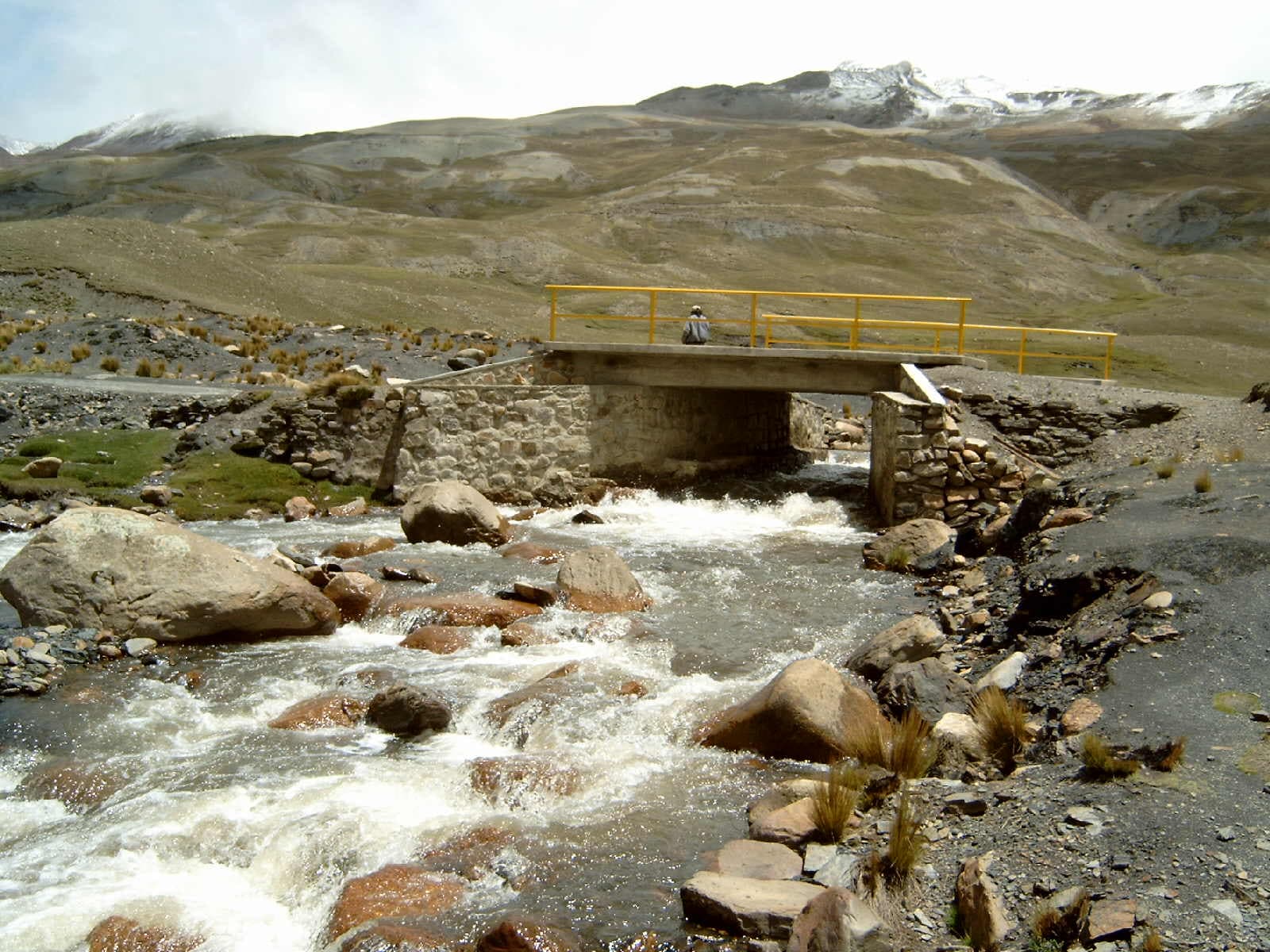
The Choqueyapu River descends from the high Andes and slices directly through the center of La Paz, creating the steep valley walls that give the city its famous topography. Unlike pristine mountain streams, this is an intensely urban waterway that locals cross daily on footbridges, market stalls hug its banks, and neighborhoods rise in layers above it.

What to See and Do

Start at the upper reaches near the Plaza España area and walk downstream. The river passes under multiple bridges that offer changing perspectives of the canyon walls and the snow-capped peak of Illimani in the distance. Continue toward the historic center where the waterway runs close to the Witches’ Market; the contrast between colorful stalls selling ritual items and the channeled river below is quintessentially La Paz. Further along, small parks and pedestrian paths appear where residents exercise or simply rest beside the water.

Practical Exploration Tips

  • Wear sturdy shoes—the sidewalks and staircases alongside the river are steep and uneven.
  • Carry a light jacket; temperatures drop quickly once you descend into the canyon even on sunny days.
  • Combine your walk with a visit to nearby markets for lunch rather than expecting riverside cafés.

Getting There

From central La Paz, the river is reached on foot from the main plaza or by taking any micro or minibus heading toward the Sopocachi or Miraflores districts and alighting at one of the many bridges. Taxis are inexpensive for short hops between viewpoints if you prefer not to walk the full length.

Best Time to Visit

The dry season from May to October offers clearer skies and safer footing along paths that can become slippery during the November-to-March rains. Early morning visits provide the best light for photographs and fewer crowds before market activity peaks.

Nearby Attractions

After following the river, continue to Plaza San Pedro, the historic cemetery, or climb toward the higher neighborhoods of Sopocachi for panoramic views back down the valley. The river ultimately flows toward the Yungas road, making it a natural starting point for day trips into lower elevations if you have extra time.

Visitor tips

  • Walk downstream from higher neighborhoods to avoid steep uphill climbs at altitude.
  • Stay on marked paths and bridges; the river channel is fast-moving and not suitable for recreation.
  • Combine the visit with the Witchesu2019 Market for an authentic local experience rather than treating the river as a standalone attraction.

Frequently asked questions

Can I swim or raft on the Choqueyapu River?+

No. The river flows through a densely populated city and is channeled in concrete sections; swimming or rafting is neither safe nor permitted.

How long should I allow to walk along the river?+

Two to four hours covers the most interesting central stretch from Plaza Espau00f1a to the historic center at a relaxed pace with stops.

Is the area safe for solo visitors?+

Daytime walking is generally fine in the busier sections near markets and bridges. Avoid isolated stretches after dark and keep valuables secure.

Are there restrooms or facilities along the river?+

Public facilities are limited. Use restrooms in nearby cafu00e9s, markets, or hotels before descending into the canyon.

Does the river have any cultural significance?+

Yes. Its Aymara name reflects pre-Hispanic roots, and it continues to mark neighborhood boundaries and daily routes for residents.

Share
Google Maps Apple Maps Directions

Image: Meister · CC BY-SA 3.0 · via Wikimedia Commons

Keep reading

Nearby & related

All stories
Basilica of San Francisco: La Paz’s Colonial Heart in the Andes
La Paz

Basilica of San Francisco: La Paz’s Colonial Heart in the Andes

Step into centuries of history at this ornate 16th-century church anchoring La Paz’s vibrant old town.

12 October 2026
Parinacota: Scaling Bolivia’s Perfect Andean Volcano
La Paz

Parinacota: Scaling Bolivia’s Perfect Andean Volcano

Explore the striking symmetry of Parinacota, an accessible high-altitude climb offering sweeping views across the…

11 October 2026