Skip to content
Plan & Tour
DestinationsItinerariesTravel BlogAboutContact
0Sign inPlan a trip
Plan & TourPlan & Tour

Travel guides, destination inspiration and curated itineraries for Canada, the USA and beyond, plus a free tool to plan your own day-by-day trip.

Get travel inspiration

Explore

  • All Destinations
  • Curated Itineraries
  • Travel Blog
  • Plan a Trip

Topics

  • Hiking & Nature
  • Food & Drink
  • City Breaks
  • Budget Travel

Company

  • About Us
  • Contact
  • Privacy Policy
  • Terms of Service

© 2026 Plan & Tour. Built for travellers.

Discover the world, one trip at a time.

Barranco de Guayadeque: Prehistoric Caves and Ravine Trails in Gran Canaria
  1. Home
  2. Destinations
  3. Las Palmas
  4. Barranco de Guayadeque: Prehistoric Caves and Ravine Trails in Gran Canaria
Archaeological site

Barranco de Guayadeque: Prehistoric Caves and Ravine Trails in Gran Canaria

Explore ancient Guanche cave dwellings, dramatic cliffs, and quiet hiking paths in this archaeological treasure of eastern Gran Canaria.

Las PalmasUpdated 11 November 2026

Why Barranco de Guayadeque Stands Out

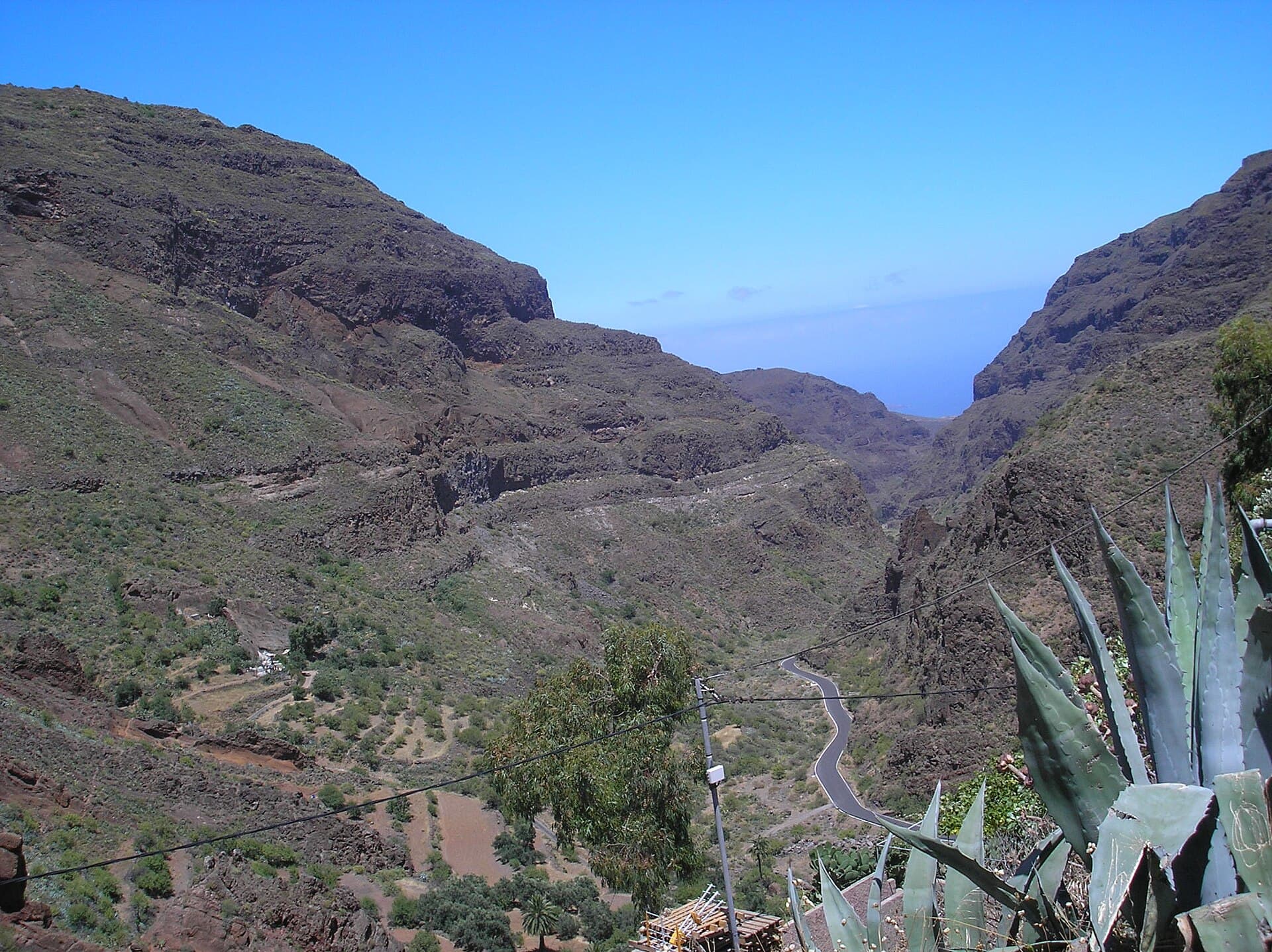
This deep ravine on the eastern side of Gran Canaria preserves one of the island’s richest concentrations of Guanche archaeological remains. Rock-cut houses, granaries, and burial caves line the steep slopes, offering visitors a direct connection to the island’s pre-Hispanic past. The dramatic landscape of terraced cliffs and palm groves adds natural beauty to the cultural heritage.

History and Archaeological Highlights

The Guanche people carved homes and storage spaces directly into the soft volcanic rock of the barranco walls. Many sites remain visible today as rectangular openings and interconnected chambers. Excavations have revealed pottery, tools, and mummified remains that illustrate daily life and burial customs before European contact. A small interpretive center near the lower entrance displays replicas and finds to help visitors understand the context without disturbing the original locations.

What to See and Do

Begin at the lower valley entrance and follow the paved path that gradually climbs beside the seasonal stream. Short side trails lead to accessible cave clusters where you can peer into ancient living spaces. Longer hikes continue upward toward the head of the ravine, passing abandoned terraces and offering wide views across the east coast. Birdwatchers often spot kestrels and laurel pigeons along the route. Photographers find the best light in the morning when the sun illuminates the ochre cliffs.

How to Get There

The barranco lies between the towns of Agüimes and Ingenio. Most visitors arrive by rental car via the GC-103 road, which descends into the valley from the main highway. Limited bus service runs from Las Palmas and nearby coastal resorts to the entrance area. Once inside, the main path is walkable; sturdy shoes help on steeper sections that continue beyond the paved area.

Best Time to Visit

Spring and autumn provide the most comfortable temperatures for walking. Winter months remain mild but can bring occasional rain that makes upper trails slippery. Summer visits are possible early in the day before heat builds in the enclosed valley. Avoid peak midday hours in any season to enjoy quieter conditions and softer light on the rock faces.

Nearby Places Worth Combining

After exploring the ravine, continue to the historic centers of Agüimes and Ingenio, both featuring traditional Canarian architecture and small museums. The coastal dunes of Maspalomas lie about 30 minutes south by road, while the central highlands around Tejeda offer a contrasting mountain landscape for a full-day itinerary.

Visitor tips

  • Wear shoes with good grip; many paths involve uneven rock and occasional loose gravel.
  • Carry water and a light snack, as facilities inside the ravine are limited beyond the lower entrance.
  • Visit early in the morning or late afternoon to avoid larger groups and enjoy cooler temperatures.

Frequently asked questions

Is Barranco de Guayadeque suitable for children?+

The lower paved section works well for families with older children. Steeper trails higher up require more caution and sturdy footwear.

Are the caves open to enter?+

Most cave entrances are visible but not open for interior access to protect the archaeological sites. A few lower chambers allow viewing from the path.

How long does a visit typically take?+

Allow two to three hours to explore the main lower path and several cave viewpoints. Add another two hours for a longer hike toward the head of the ravine.

Is there parking available?+

A small parking area exists near the entrance. Arrive early on weekends and holidays when spaces fill quickly.

Can I combine the visit with other archaeological sites?+

Yes. The nearby Four Doors cave site and the archaeological museum in Agu00fcimes make logical additions on the same day.

Share
Google Maps Apple Maps Directions

Image: Álvaro Ávila · Public domain · via Wikimedia Commons

Keep reading

Nearby & related

All stories
Inagua Natural Reserve: Gran Canaria’s Rugged Protected Wilderness
Las Palmas

Inagua Natural Reserve: Gran Canaria’s Rugged Protected Wilderness

Discover volcanic ridges, endemic pine forests, and rare birdlife in this quiet corner of the Canary Islands.

12 November 2026
Malpaís de la Arena: Hiking Fuerteventura’s Ancient Lava Badlands
Las Palmas

Malpaís de la Arena: Hiking Fuerteventura’s Ancient Lava Badlands

Discover the stark volcanic beauty and quiet trails of this protected lava field on Fuerteventura’s northern coast.

12 November 2026
Montaña Tamia: Hiking Lanzarote’s Underrated Volcanic Summit
Las Palmas

Montaña Tamia: Hiking Lanzarote’s Underrated Volcanic Summit

A serene hike up Montaña Tamia delivers sweeping views across Lanzarote’s volcanic landscape without the crowds.

12 November 2026