Skip to content
Plan & Tour
DestinationsItinerariesTravel BlogAboutContact
0Sign inPlan a trip
Plan & TourPlan & Tour

Travel guides, destination inspiration and curated itineraries for Canada, the USA and beyond, plus a free tool to plan your own day-by-day trip.

Get travel inspiration

Explore

  • All Destinations
  • Curated Itineraries
  • Travel Blog
  • Plan a Trip

Topics

  • Hiking & Nature
  • Food & Drink
  • City Breaks
  • Budget Travel

Company

  • About Us
  • Contact
  • Privacy Policy
  • Terms of Service

© 2026 Plan & Tour. Built for travellers.

Discover the world, one trip at a time.

Wapiti River: Paddling and Wilderness Exploration in British Columbia
  1. Home
  2. Destinations
  3. British Columbia
  4. Wapiti River: Paddling and Wilderness Exploration in British Columbia
River

Wapiti River: Paddling and Wilderness Exploration in British Columbia

The Wapiti River carves through remote northeastern British Columbia, offering paddlers and anglers access to untouched boreal forest and abundant wildlife.

British ColumbiaUpdated 1 July 2026

Discovering the Wapiti River

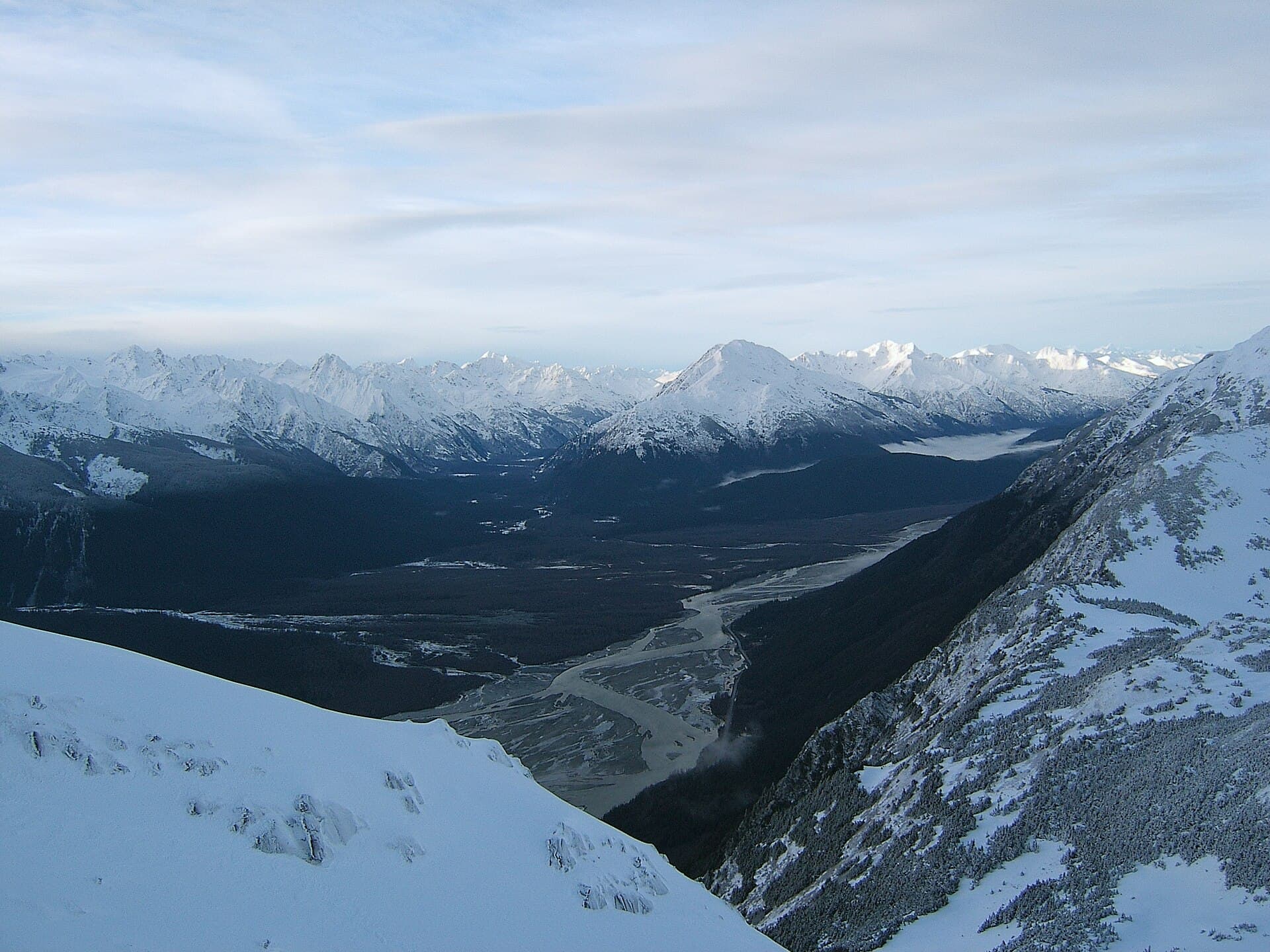
The Wapiti River rises in the foothills of the Rocky Mountains in British Columbia and flows eastward for roughly 200 kilometres before joining the Peace River near the Alberta border. Its clear waters and forested valley provide a quiet alternative to busier northern rivers, with long stretches of Class I and II water ideal for canoeists and kayakers seeking multi-day trips.

What to See and Do

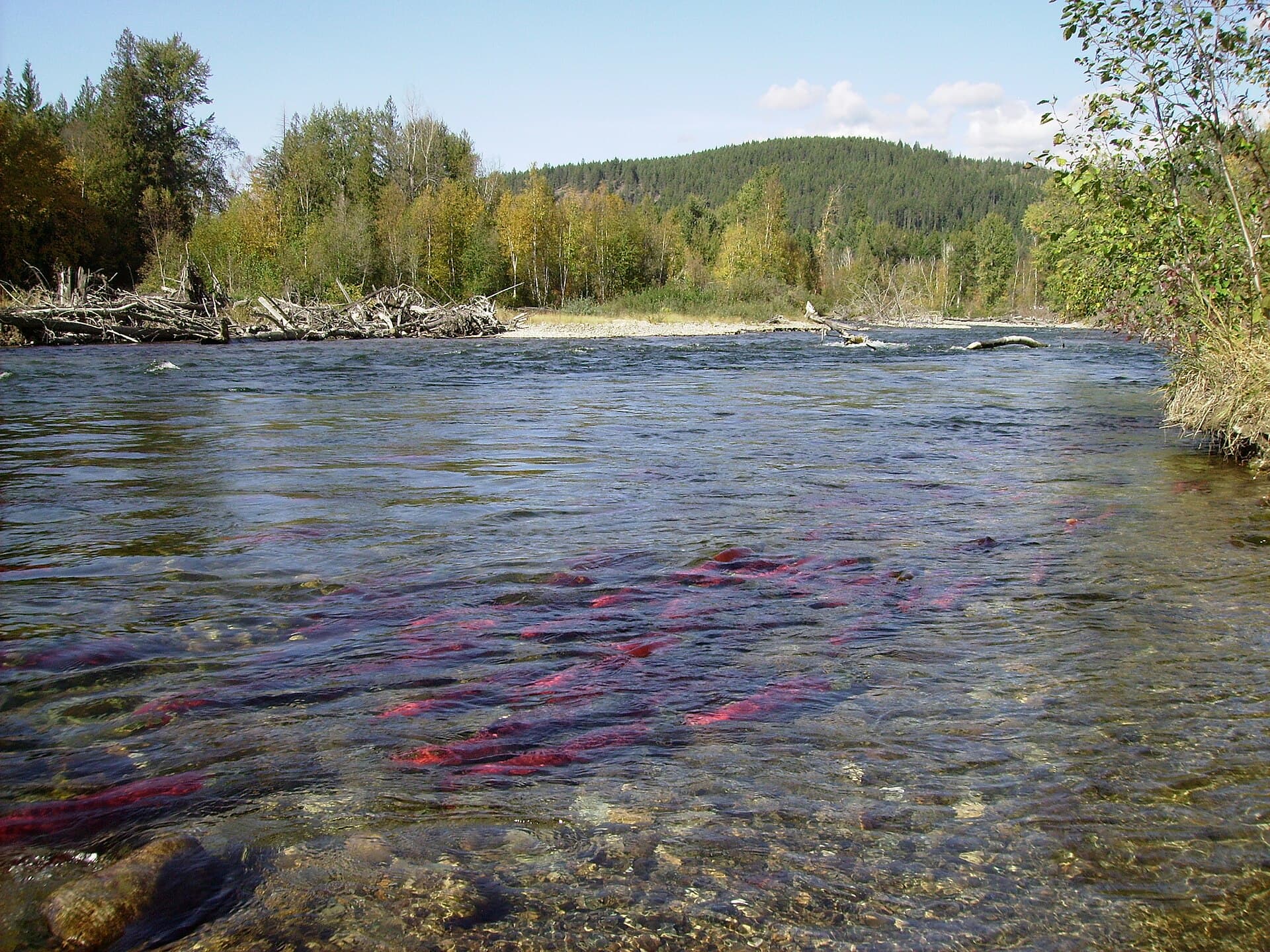
Anglers target bull trout, Arctic grayling, and mountain whitefish in the deeper pools, especially in late summer when water levels stabilize. Wildlife viewing is excellent: moose frequent the wetlands, black bears forage along the banks, and bald eagles nest in mature cottonwoods. Birders may spot sandhill cranes during migration. Short hikes from gravel bars lead to viewpoints overlooking the valley or to small side canyons with seasonal waterfalls.

Paddling Routes

Popular put-ins lie near the Highway 52 crossing west of Tumbler Ridge. A common three- to five-day trip runs from the upper reaches downstream to the Peace River confluence, with campsites on gravel bars. The river remains runnable from late May through September in most years, though spring runoff can create strong currents.

How to Get There

Access begins in Tumbler Ridge, reached by driving Highway 52 from Dawson Creek or Chetwynd. From town, forestry roads lead to river put-ins; high-clearance vehicles are recommended for the final stretches. Float planes occasionally service remote upper sections, but most visitors drive and shuttle vehicles between put-in and take-out.

Best Time to Visit

July and August offer the most reliable water levels and longest daylight for paddling. Early September brings quieter conditions and fall colors, while June can still have high water. Winter travel is limited to snowmobiling or ice fishing on frozen sections.

Nearby Attractions

Combine a river trip with visits to the Tumbler Ridge UNESCO Global Geopark, where dinosaur trackways and waterfalls such as Kinuseo Falls are easily reached by short drives or hikes. The Peace River itself offers larger-scale boating downstream, and the historic Alaska Highway lies within a half-day’s drive.

Visitor tips

  • Pack bear spray and store food in odor-proof containers; the valley supports a healthy black bear population.
  • Monitor water levels and weather via local forestry offices, as sudden rain can raise the river quickly.
  • Shuttle logistics require two vehicles or pre-arranged pickup; cell service is absent along most of the river.

Frequently asked questions

Is the Wapiti River suitable for beginners?+

Yes on the lower sections where the gradient is gentle, but paddlers should have basic river-reading skills and be prepared for remote conditions with no rescue services nearby.

Are there established campgrounds along the river?+

No formal campgrounds exist; visitors camp on gravel bars or forested terraces, following Leave No Trace principles and watching for rising water overnight.

What fish species can I expect to catch?+

Bull trout are the primary target, with good numbers of Arctic grayling and mountain whitefish; a valid BC fishing licence is required.

How remote is the Wapiti River experience?+

Very remote: there are no towns, stores, or cell coverage once you launch, so travelers must be fully self-sufficient for the duration of their trip.

Can I combine a Wapiti trip with visits to dinosaur sites?+

Yes; Tumbler Ridgeu2019s dinosaur trackways and the UNESCO Geopark are only a short drive from common put-ins, making it easy to add a day or two of land-based exploration.

Share
Google Maps Apple Maps Directions

Image: Qyd (talk · contribs) · CC BY 2.5 · via Wikimedia Commons

Keep reading

Nearby & related

All stories
Chilkat River: Bald Eagle Capital Along the BC-Alaska Border
British Columbia

Chilkat River: Bald Eagle Capital Along the BC-Alaska Border

Float through salmon-rich waters teeming with eagles and bears in one of North America’s premier wildlife corridors.

1 July 2026
Similkameen River: A Scenic Waterway Through British Columbia’s Southern Valleys
British Columbia

Similkameen River: A Scenic Waterway Through British Columbia’s Southern Valleys

Follow the Similkameen River through dramatic canyons, fertile orchards, and quiet parks in the heart of the Similkameen…

1 July 2026
Adams River: Witnessing British Columbia’s Legendary Sockeye Salmon Migration
British Columbia

Adams River: Witnessing British Columbia’s Legendary Sockeye Salmon Migration

Discover the dramatic sockeye salmon runs, clear waters, and surrounding forests of Adams River in British Columbia’s…

1 July 2026